
A deep learning technique could reduce the error in 10-day weather forecasts by more than 90%, allowing communities to better prepare for extreme events such as heat waves.
machine learning & AI
Posted inEditors' Highlights
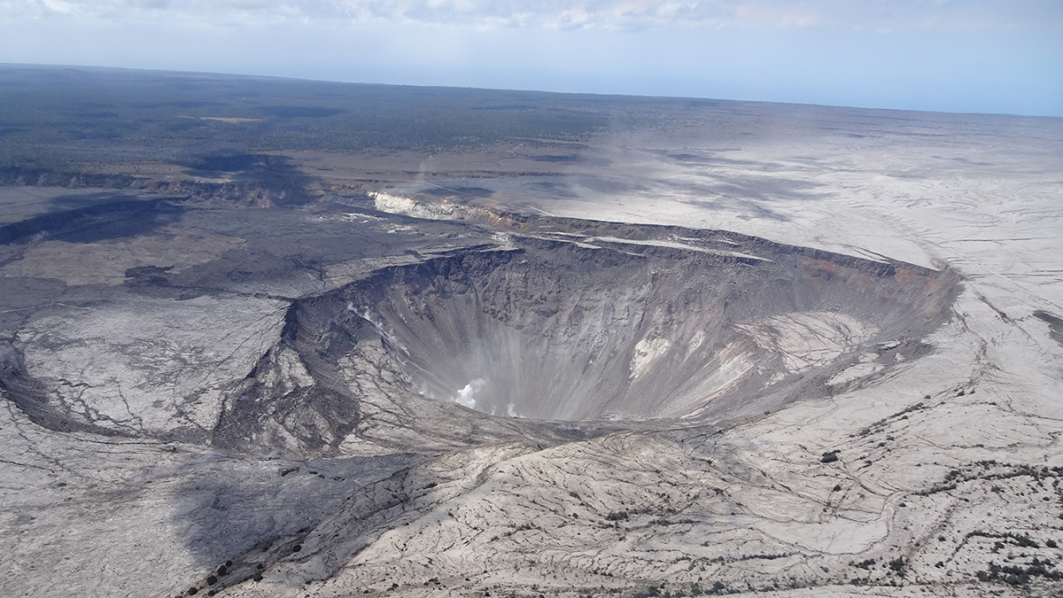
Forecasting Caldera Collapse Using Deep Learning
A deep learning model trained with geophysical data recorded during the well-documented 2018 Kilauea volcano eruption, Hawaii, predicts recurrent caldera collapse events.

Posted inOpinions
Cultivating Trust in AI for Disaster Management
Artificial intelligence applied in disaster management must be reliable, accurate, and, above all, transparent. But what does transparency in AI mean, why do we need it, and how is it achieved?

Posted inResearch Spotlights
Physics Meets Machine Learning for Better Cyclone Predictions
A new hybrid modeling approach combines physics-based and machine learning models to extend—and improve—path and intensity predictions of tropical cyclones.

Posted inEditors' Highlights
Equation Discovery for Subgrid-Scale Closures
Machine learning can discover closure equations for fluid simulations. A new study finds that common algorithms rediscover known, unstable closures, which can be stabilized with higher-order terms.

Posted inNews
New Model Can Better Predict Areas Vulnerable to Forest Fires in India
Researchers incorporated local atmospheric parameters and terrain data to more accurately estimate the probability of fire in a specific area.

Posted inEditors' Vox
Introducing the New Editor-in-Chief of the ESS Open Archive
Learn about the person taking the helm of the Earth and Space Science Open Archive and their vision for the coming years.
Posted inEditors' Highlights
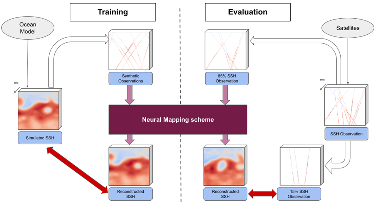
Physics + Machine Learning Provide a Better Map of Ocean Measurements
A new study offers a compelling example where the merger of dynamical modeling, machine learning, and ocean measurements enhances oceanographic understanding, monitoring, and mapping.

Posted inEditors' Highlights
Machine Learning Masters Weather Prediction
Community datasets and evaluation standards are needed to further advance machine learning for weather prediction.
Posted inEditors' Highlights
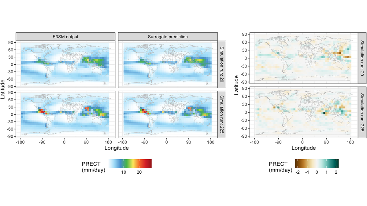
Autocalibration of the E3SM Atmosphere Model Improves Model Fidelity
A surrogate model was trained to predict E3SM atmosphere model spatial fields as a function of uncertain physical parameters and used to optimize the parameters for present-day climate.