
Machine learning technology helps scientists recognize severe weather patterns.
machine learning & AI

Posted inNews
Artificial Intelligence Can Spot Plankton from Space
Training an algorithm with satellite images of ocean color reveals the blooms and busts of phytoplankton communities.
Posted inOpinions
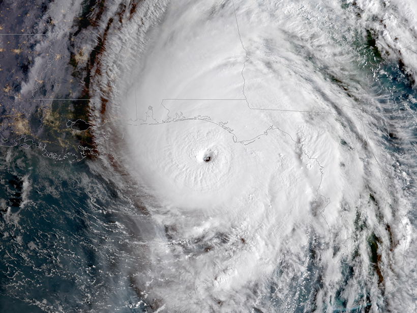
Artificial Intelligence May Be Key to Better Weather Forecasts
Recent advances in machine learning hold great potential for converting a deluge of data into weather forecasts that are fast, accurate, and detailed.

Posted inNews
Algorithm Spots Climate-Altering Ship Tracks in Satellite Data
Tens of thousands of ship tracks—cloud structures created when ships’ exhaust plumes interact with the atmosphere—are pinpointed automatically, furthering study of these climate-altering features.

Posted inScience Updates
Machine Learning in Geoscience: Riding a Wave of Progress
2nd Annual Machine Learning in Solid Earth Geoscience Conference; Santa Fe, New Mexico, 18–22 March 2019
Posted inNews
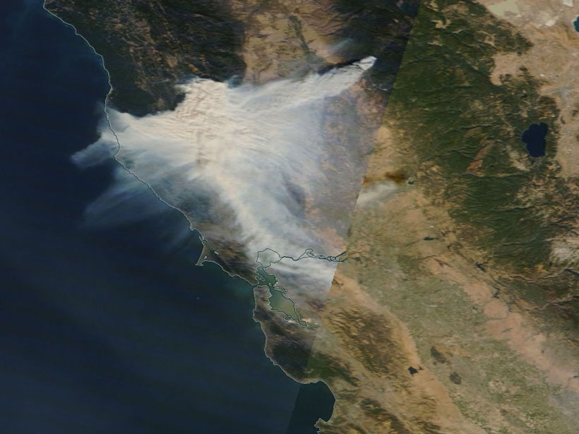
New Eyes on Wildfires
Onboard machine learning and compact thermal imaging could turn satellites into real-time fire management tools to help officials on the ground.
Posted inEditors' Highlights
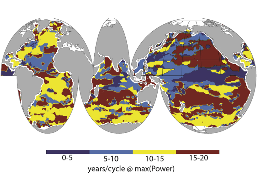
Sea-Surface Carbon Patterns Linked to Large-scale Climate Modes
A new 34-year global time series of observed sea surface partial pressure of CO2 links regional variation to major climate modes.

Posted inNews
Coral Reef Video Game Will Help Create Global Database
Players dive off a research boat, identify and classify coral reefs using satellite and drone images, and bring marine life back to reefs. In doing so, they help scientists teach a machine to learn.
Posted inEditors' Highlights
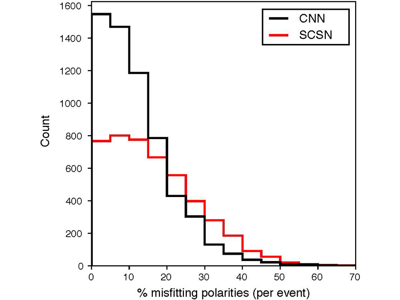
Removing the Drudgery from Earthquake Seismology
New methods of machine learning are bringing the phase arrival time and polarity picking used for automatic determination of earthquake fault planes to accuracies better than human analysists.

Posted inScience Updates
Space Weather in the Machine Learning Era
Space Weather: A Multi-disciplinary Approach; Leiden, Netherlands, 25–29 September 2017