
The ocean is a pretty loud place, and anthropogenic noise is adding another layer to the soundscape.
mapping

Posted inNews
Satellites Map Environmental Vulnerabilities in U.S. Prisons
Geoscientists are using remote sensing to gather data on risks including increased exposure to air and soil pollution, excessive heat, wildfire, and flooding.

Posted inENGAGE, News
Local Fishers Help Uncover Coral Clinging to Underwater Cliffs
Their knowledge led to more accurate seafloor maps and a hidden trove of biodiversity in the Labrador Sea.

Posted inResearch Spotlights
Seafloor Shapes on the Flanks of Mid-Ocean Ridges Linked to Magma Supply
New research suggests the source of morphologic variation on mid-ocean ridges might be deeper than scientists thought.

Posted inNews
Thunderquakes Map the Subsurface
Researchers have figured out how rumbling thunder turns to seismic waves and how this shaking could be used to reveal subsurface geology.
Posted inResearch Spotlights
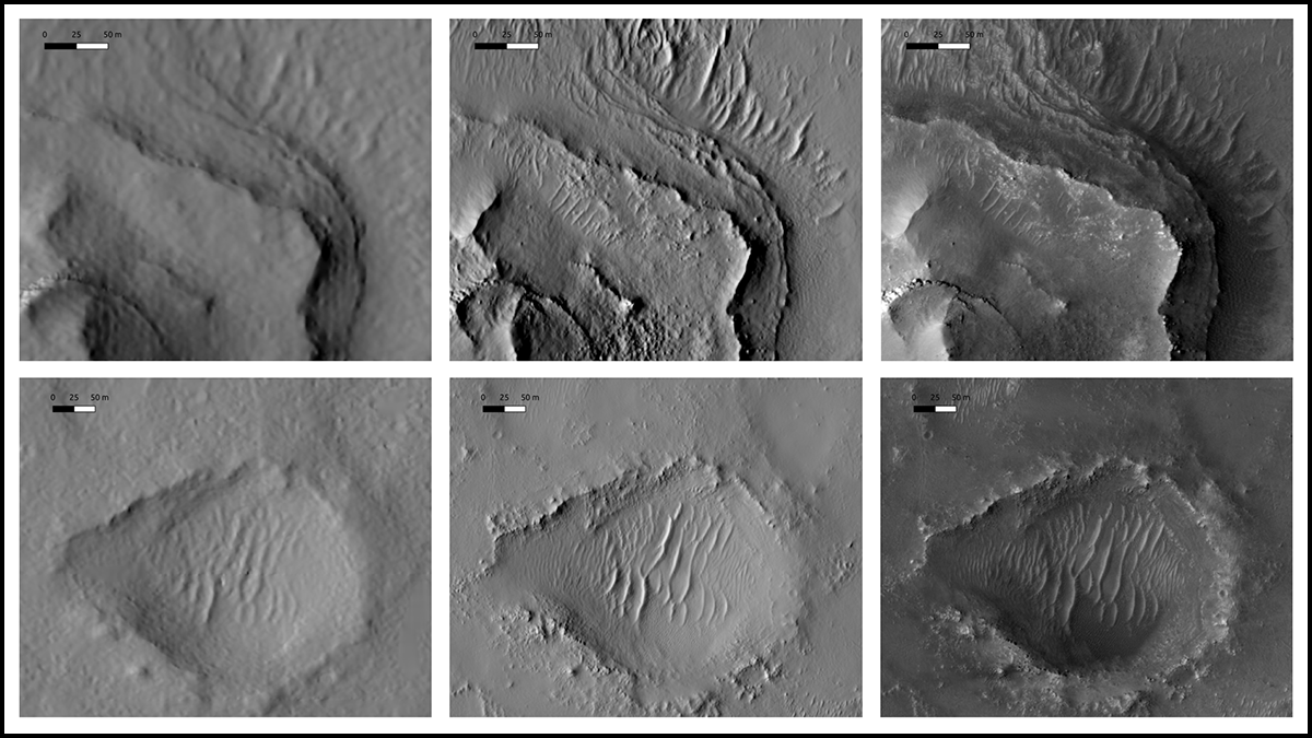
Mapping Mars: Deep Learning Could Help Identify Jezero Crater Landing Site
Researchers used new techniques to more precisely estimate ground elevations on Mars, producing a refined resolution map for rover landings.
Posted inNews
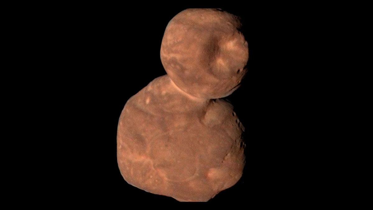
Arrokoth’s Mounds Hint at How Planetesimals Form
The most remote world ever seen up close is a mash-up of smaller pieces.

Posted inFeatures
Critical Minerals for a Carbon-Neutral Future
The Earth Mapping Resources Initiative is filling data gaps and fostering more holistic understanding of critical mineral resources in the United States using a novel mineral systems framework.

Posted inENGAGE, News
Bird Biodiversity Reports Reflect Cities’ Redlined Past
The lack of bird records in formerly redlined areas creates an inaccurate picture of urban biodiversity, leading to gaps in conservation efforts.

Posted inENGAGE, News
A Lunar Mission Spots Its Failed Brethren
Data from NASA’s Lunar Reconnaissance Orbiter have been instrumental in pinpointing where other Moon-bound spacecraft have crashed.