
If increasingly globalized societies are to make better land management decisions, the geosciences must globally evaluate how humans are reshaping Earth's surface
mapping
Posted inNews
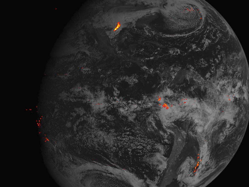
GOES-16 Satellite Lights Up Lightning Flashes in New Video
The satellite's lightning mapper instrument will help scientists forecast extreme weather.

Posted inScience Updates
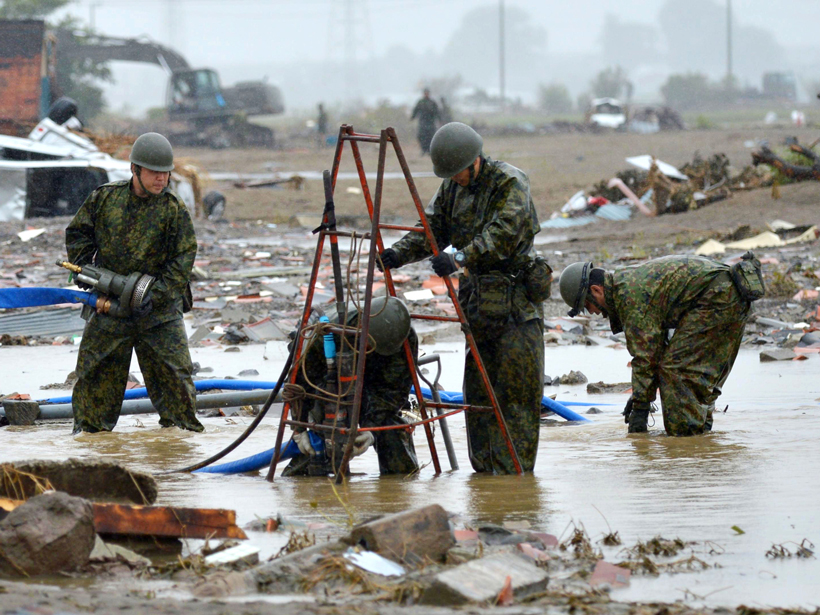
Geological Insights from Malaysia Airlines Flight MH370 Search
A rich trove of marine geophysical data acquired in the search for missing flight MH370 is yielding knowledge of ocean floor processes at a level of detail rare in the deep ocean.

Posted inNews
Kilimanjaro's Iconic Snows Mapped in Three Dimensions
New ground-penetrating radar measurements reveal the thickness and total ice volume of the mountain's Northern Ice Field.
Posted inNews
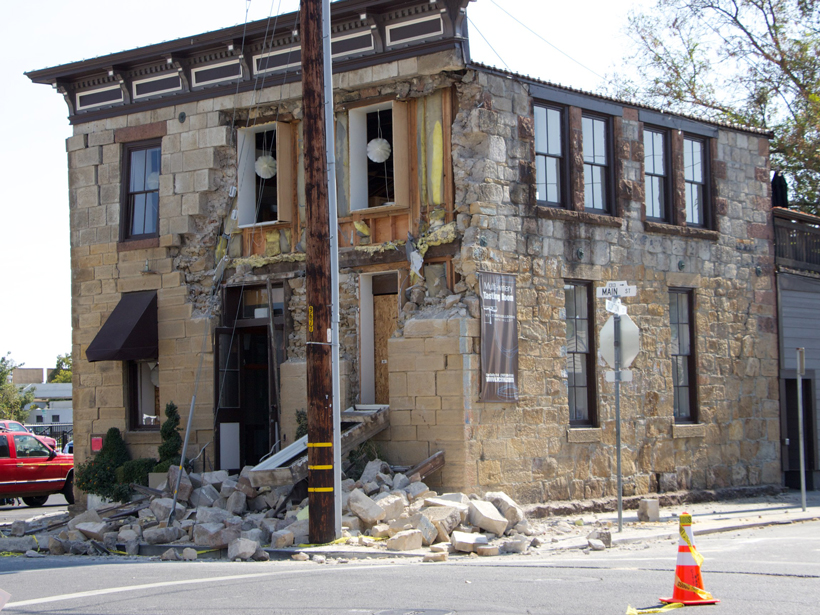
Overlooked Data Source Improves Quake Intensity Maps
A new approach may fine-tune estimates of the range of shaking from earthquakes and help define areas of potential damage.
Posted inScience Updates
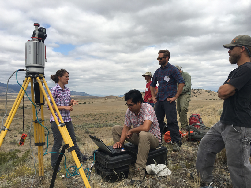
Integrating Topographic Imaging into Geoscience Field Courses
Using TLS and Structure from Motion (SfM) Photogrammetry in Undergraduate Field Education; Cardwell, Montana, 16–19 August 2016
Posted inScience Updates
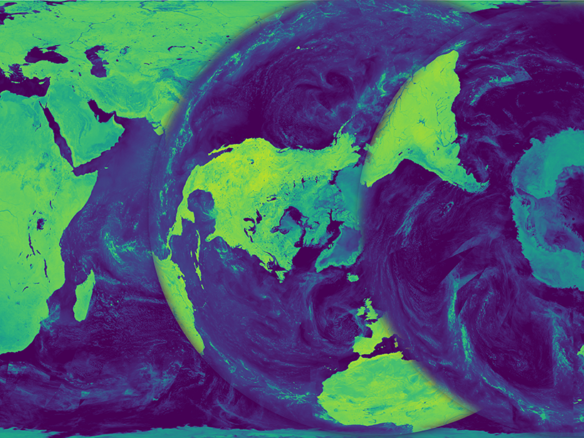
Bringing Earth's Microwave Maps into Sharper Focus
New processing capabilities improve the spatial resolution of satellite microwave data, enabling scientists to analyze trends in coastal regions and marginal ice zones.
Posted inNews
Can Data Extracted from Twitter Help Map Flood Hazards?
Tweets, if scrutinized closely, may allow scientists to map hazards in real time, helping to guide emergency response.

Posted inNews
A Quest to Put Sea Level Rise Data in Your Pocket
A new climate change app uses interactive data maps to engage users and prompt the exploration of questions related to changing sea levels and climate vulnerability.
Posted inNews
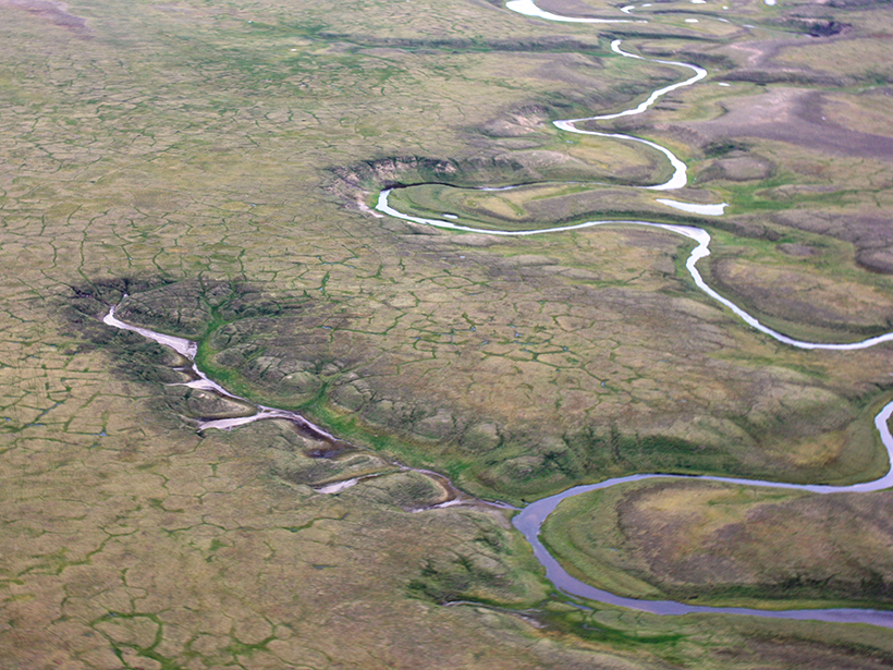
Map Reveals Hot Spots for Arctic Greenhouse Gas Emissions
By bringing together data on permafrost stability, soils, and other Arctic conditions, scientists have plotted where permafrost is vulnerable to collapse, which could release long-stored carbon.