
一个仅考虑降水和地表净辐射的简化模型似乎可以解决长期存在的问题。
Modeling
Posted inEditors' Vox
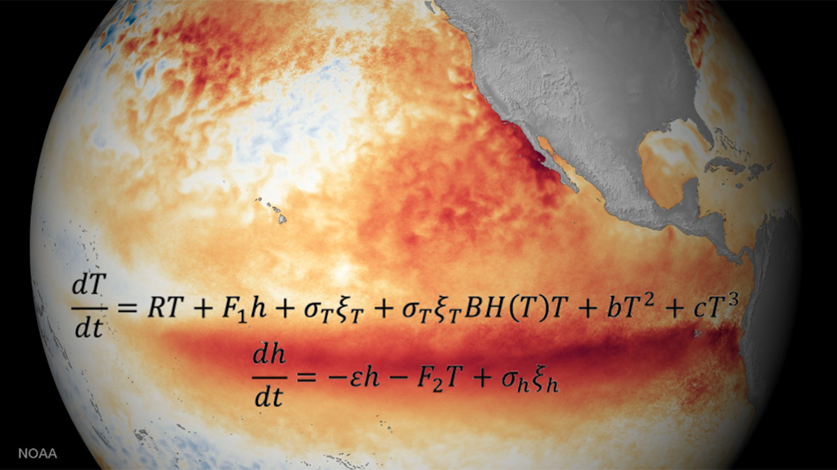
Two Equations that Unlock El Niño
Despite the El Niño–Southern Oscillation’s global reach and complex ocean–atmosphere interactions across timescales, two simple, elegant equations capture its key dynamics and defining properties.
Posted inEditors' Highlights
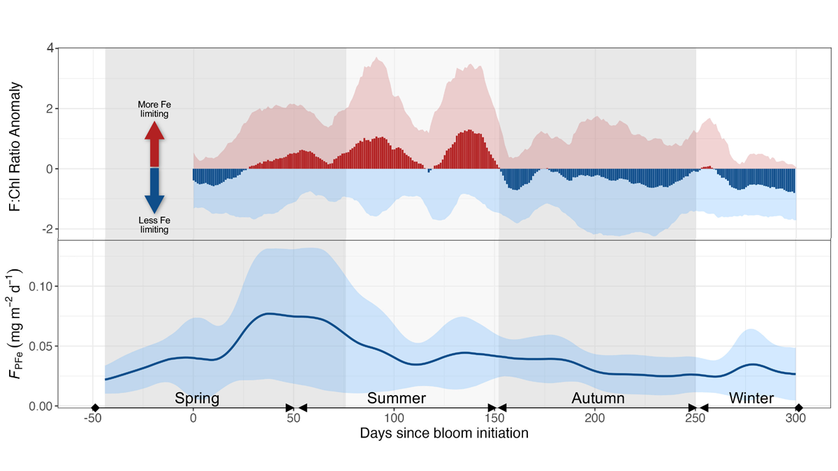
Seasonal Iron Cycle and Production in the Subantarctic Southern Ocean
Long-term monitoring at a site in the subantarctic region south of Australia combined with ship-based observations reveals three distinct phases between cycles of phytoplankton productivity and dissolved iron.
Posted inEditors' Vox
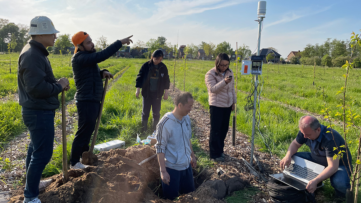
Keeping Soil Healthy: Why It Matters and How Science Can Help
Healthy soil is the foundation of our food, clean water, and a stable climate, and cutting-edge science helps us to protect it.
Posted inResearch Spotlights
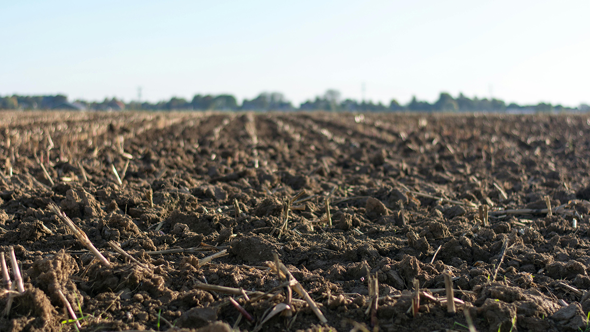
Simplicity May Be the Key to Understanding Soil Moisture
A pared-down model that considers only precipitation and net surface radiation seems to solve long-standing problems.

Posted inEditors' Highlights
Bringing Storms into Focus
A new study evaluates the performance of kilometer-scale models in predicting large tropical storms, which are key drivers of extreme rainfall and severe weather.
Posted inEditors' Highlights
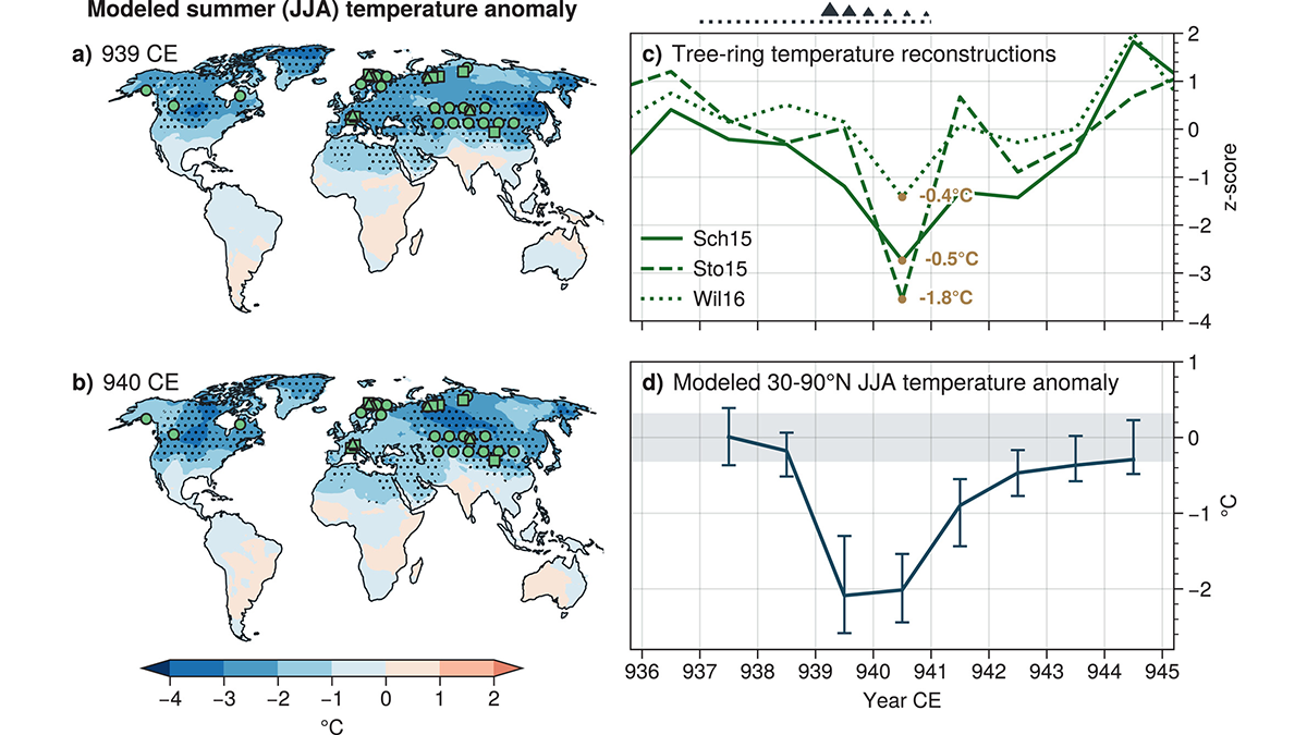
Revised Emissions Show Higher Cooling in 10th Century Eruption
The associated cooling from the Eldgjá eruption is larger than previously predicted and better matches tree-ring temperature reconstructions based on updated estimated emissions.
Posted inResearch Spotlights
An Ancient Warming Event May Have Lasted Longer Than We Thought
New research on the Paleocene-Eocene Thermal Maximum used probabilistic analysis to learn more about its duration and how long modern warming could affect the carbon cycle.
Posted inEditors' Highlights
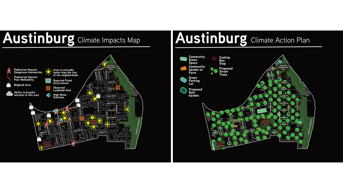
Resilient Solutions Involve Input and Data from the Community
Data dashboards assist in understanding a community’s vulnerability to climate impacts, but input from the communities themselves helps identify and support actionable solutions.
Posted inNews
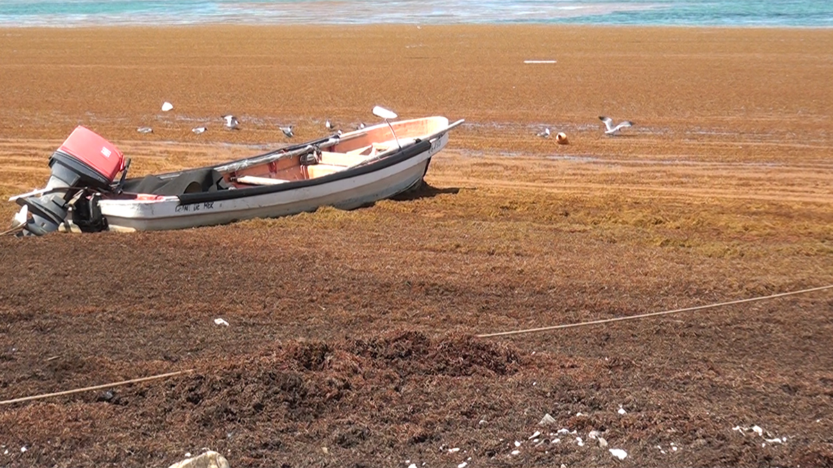
Have We Finally Found the Source of the “Sargassum Surge”?
The complexity of modeling the tropical Atlantic makes identifying the source of the ongoing seaweed blooms difficult.