
A new analysis of flood exposure shows many residential buildings at risk as sea levels rise.
Modeling

Posted inResearch Spotlights
How Tiny Cracks Lead to Large-Scale Faults
Researchers could soon gain new insights into fault development in Earth’s brittle crust, thanks to a computational approach that harnesses experimental observations of microscale rock damage.

Posted inEditors' Highlights
A Fast and Accurate Open-Source Atmospheric Transport Model
A new zonally-averaged atmospheric transport model will be useful for estimating emissions of ozone-depleting substances and greenhouse gases.

Posted inScience Updates
An Air Quality Model That Is Evolving with the Times
The pioneering Sulfur Transport and Deposition Model, initially designed to simulate atmospheric sulfur, continues to find new applications and value in environmental science and policymaking.

Posted inResearch Spotlights
Jupiter’s Magnetosphere Has a Semi-Open Relationship with the Solar Wind
Computer simulations and data from NASA’s Juno mission reveal information about the relationship between solar wind and Jupiter’s massive magnetosphere.

Posted inNews
Climate Change Is Likely to Slash Global Income
A new study estimates that climate change could cost $38 trillion per year, but emissions mitigation and adaptation strategies could limit future damages.

Posted inResearch Spotlights
The Secret to Mimicking Natural Faults? Plexiglass and Teflon
Researchers found an effective way to produce natural fault behavior in the laboratory.
Posted inEditors' Highlights
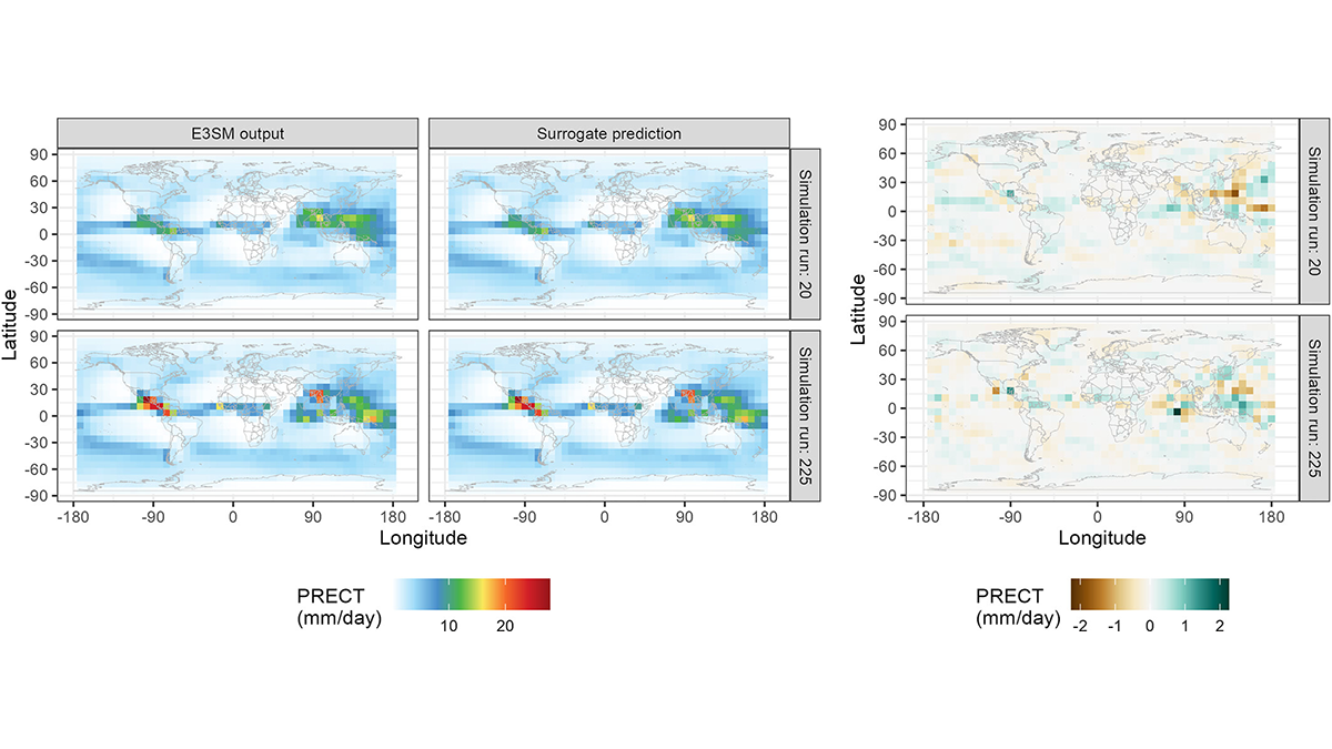
Autocalibration of the E3SM Atmosphere Model Improves Model Fidelity
A surrogate model was trained to predict E3SM atmosphere model spatial fields as a function of uncertain physical parameters and used to optimize the parameters for present-day climate.

Posted inNews
The Moon’s Mantle Did a Flip—and Scientists May Now Have Evidence
For decades, a lunar whodunit has puzzled scientists: Did the Moon’s internal layers flip during its formation? Old data might hold the evidence to solve this cold case.
Posted inEditors' Highlights
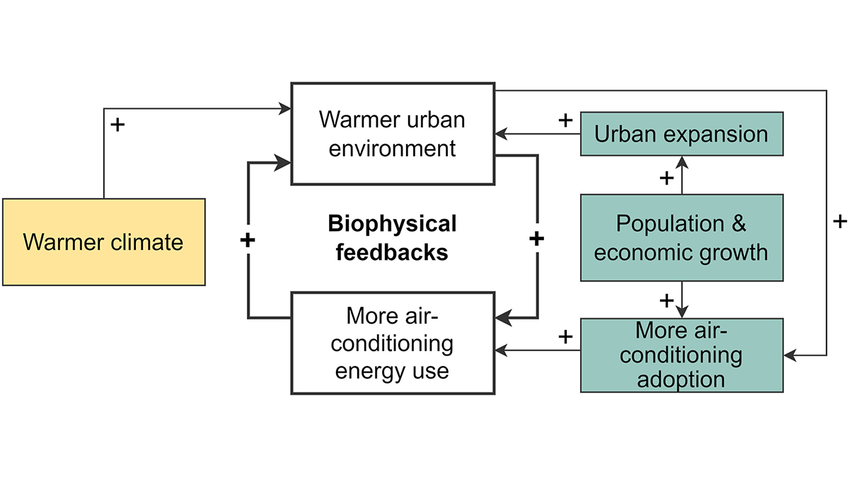
A New Scheme to Empower Global Air-Conditioning Energy Modeling
An explicit air-conditioning adoption scheme and a global dataset improve urban energy demand modeling and unlock exciting capabilities in Earth system models.