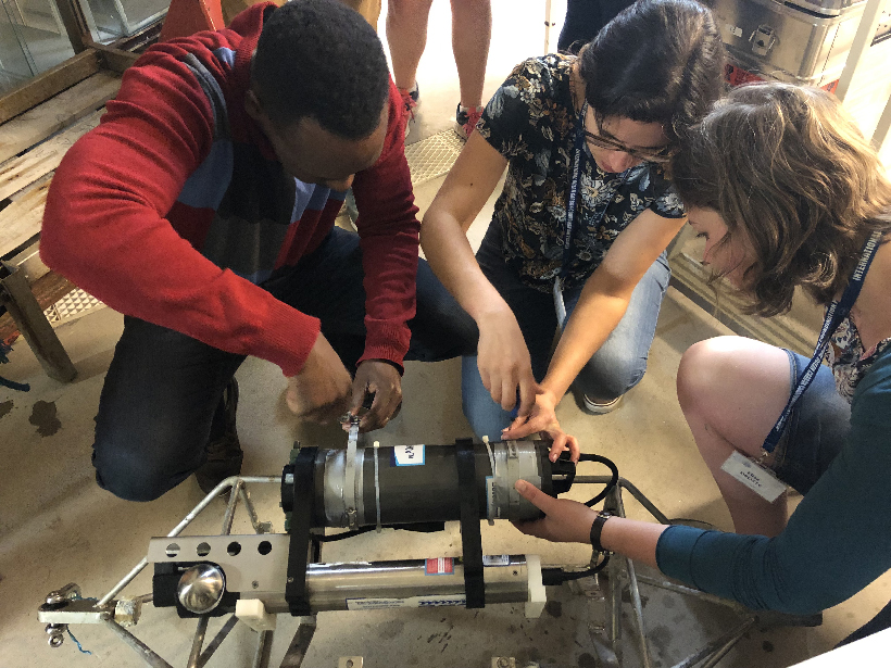
Early-career scientists came together recently to learn to use a suite of ocean biogeochemical sensors, with the goal of closing the knowledge gap between ocean technology and potential end users.
monitoring networks
Posted inScience Updates
Is the Northern Permafrost Zone a Source or a Sink for Carbon?
Thawing permafrost could release large amounts of carbon into the atmosphere, but finding out how much requires better collection and curation of data.

Posted inNews
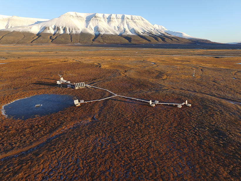
The Permafrost Listeners
Geophysicists have discovered a way to monitor permafrost thaw by measuring seismic waves so gentle they don’t shake a thing.
Posted inNews
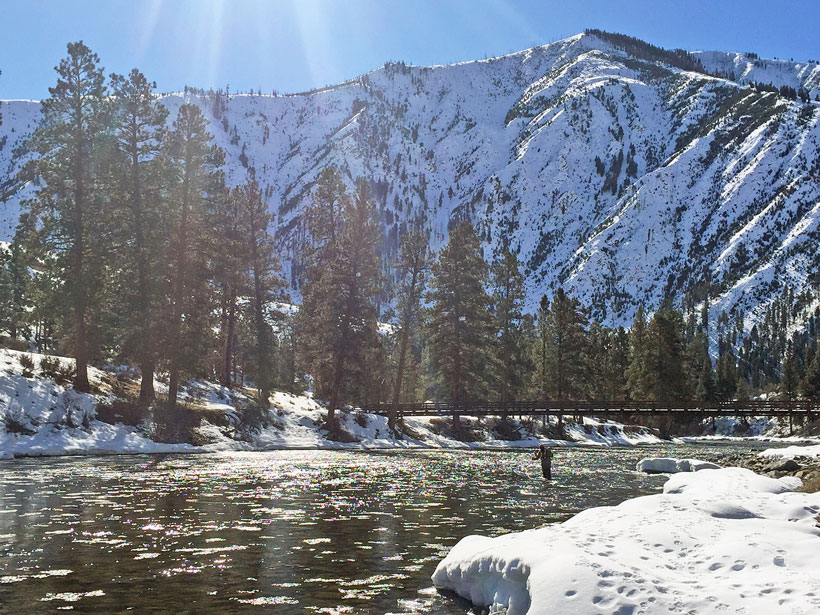
Bringing Climate Projections Down to Size for Water Managers
Hydrologists are creating watershed-scale projections for water resources managers and tools that managers can use to plan for the effects of climate change.
Posted inEditors' Highlights
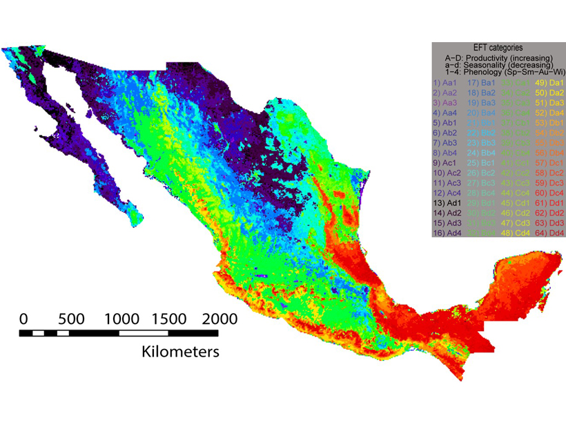
Stocking a Proper Buffet for a Megadiverse Smorgasbord
Mexico’s megadiverse biota challenge observation network design for efficient sampling, but novel methods can provide guidance and tests of representativeness.
Posted inScience Updates
Progress and Planning in Understanding Ocean Acidification
The 4th Global Ocean Acidification Observing Network (GOA-ON) International Workshop; Hangzhou, China, 14–17 April 2019
Posted inScience Updates
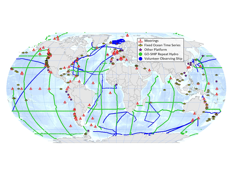
Designing the Global Observing System for Marine Life
Identifying the Backbone of a Global Observing System for Marine Life and Planning Its Implementation for the Next Decade; Santa Barbara, California, 5–7 March 2019

Posted inScience Updates
Deciphering the Fate of Plunging Tectonic Plates in Borneo
What happens when subduction stops? A team of scientists installed a dense seismic network in Borneo to investigate causes and consequences of subduction termination.

Posted inScience Updates
Monitoring Haiti’s Quakes with Raspberry Shake
A network of “personal seismometers” is intended to complement Haiti’s national seismic network to engage and inform residents about earthquake hazards and preparation.
Posted inFeatures
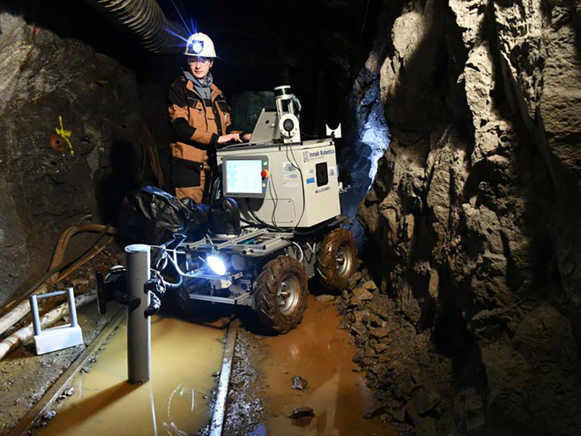
Underground Robots: How Robotics Is Changing the Mining Industry
From exploring flooded sites to providing alerts, use of robotics aims to “increase the arsenal of tools that can help miners work more safely and efficiently.”