Timely action shows the impact of urban fires on freshwater and marine ecosystems.
Pacific Ocean
Posted inEditors' Highlights
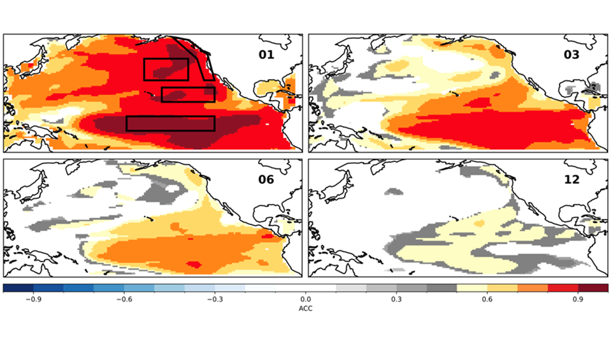
Decadal Forecasts with a SMYLE
Scientists use a large suite of simulations with an established climate model to predict the Pacific Decadal Oscillation up to one year in advance, but El Niño can still get in the way.
Posted inNews
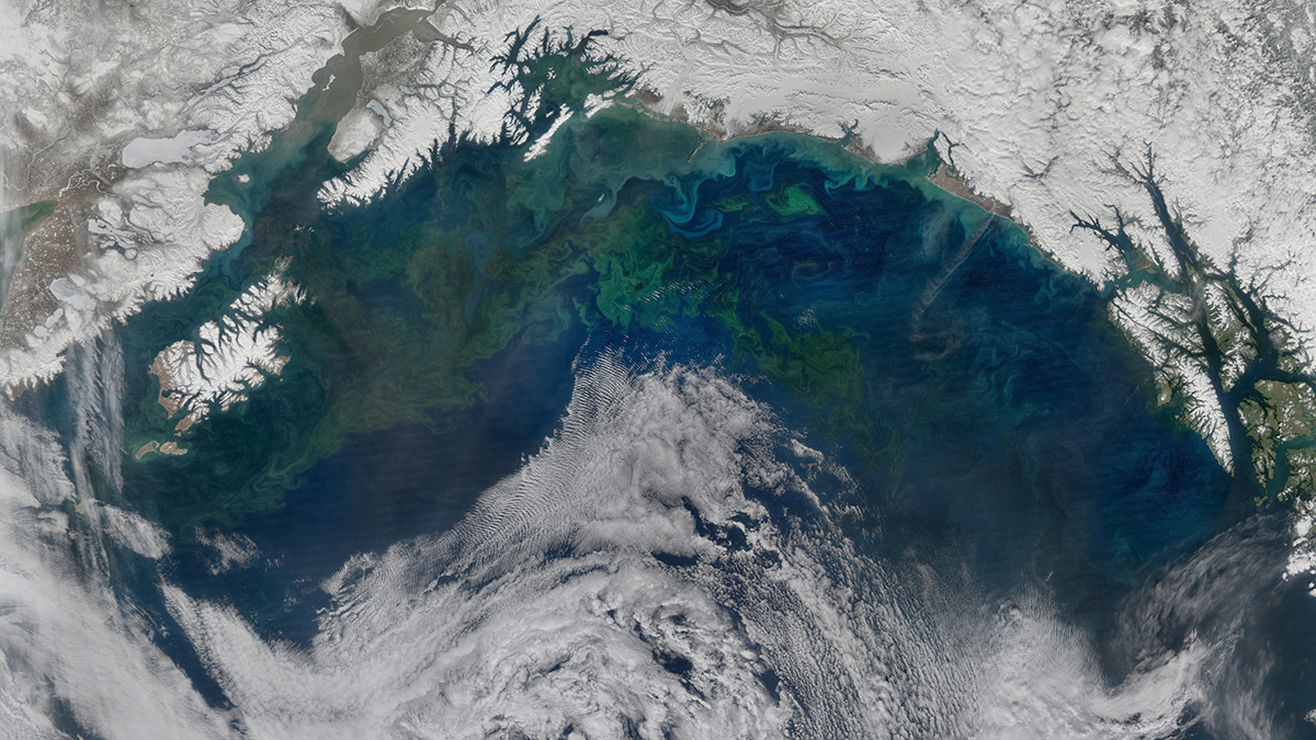
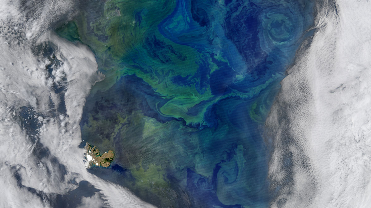
Iron Emissions Are Shifting a North Pacific Plankton Bloom
Some of the iron emitted by industrial activity in East Asia is carried by winds into the North Pacific, where it nourishes iron-hungry phytoplankton.
Posted inResearch & Developments
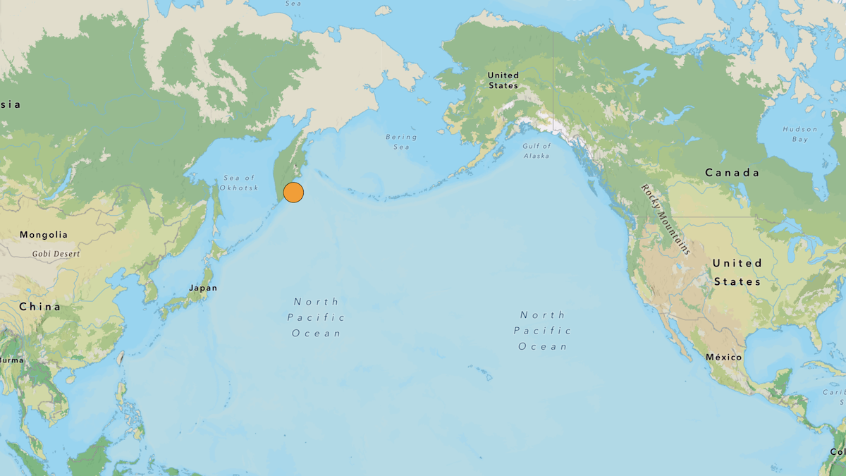
Magnitude-8.8 Earthquake Strikes Western Pacific
One of the strongest earthquakes ever recorded struck off the eastern coast of Russia’s Kamchatka Peninsula Wednesday morning local time. Initially pegged at a magnitude-8.0, the quake was eventually upgraded to a magnitude-8.8. Adjusted magnitude estimates are not unusual for large earthquakes as more data become available.
Posted inEditors' Vox
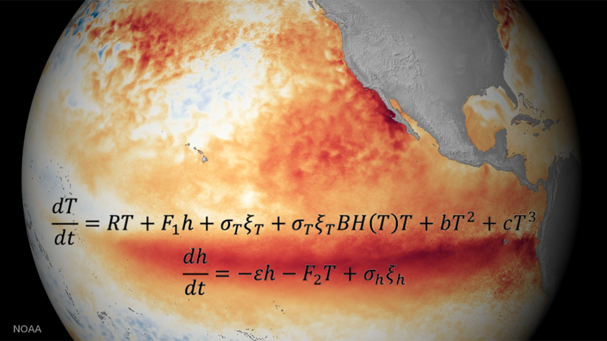
Two Equations that Unlock El Niño
Despite the El Niño–Southern Oscillation’s global reach and complex ocean–atmosphere interactions across timescales, two simple, elegant equations capture its key dynamics and defining properties.
Posted inResearch Spotlights
On the Origins of Subantarctic Mode Waters
A modeling study shows how warm subtropical waters and cold Antarctic waters combine to form an Indo-Pacific water mass that plays a key role in Earth’s climate.
Posted inEditors' Highlights
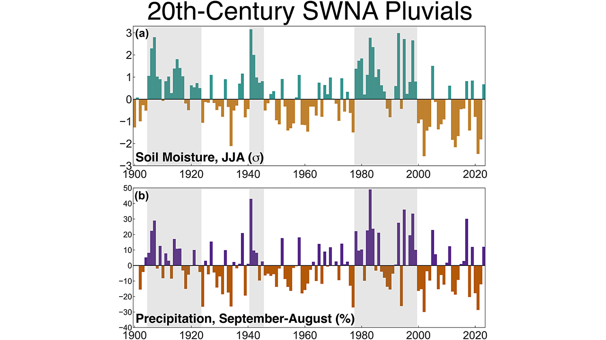
Investigating Rainfall-Rich Periods in North America
A record of soil moisture that extends over one thousand years allows for the investigation of occurrence and causes of modern and historical rainfall-rich periods.

Posted inEditors' Highlights
Characterizing the Space Between Clouds and Clear Sky
The area near clouds is often classified as ‘clear sky’, but a new study demonstrates the potential biases of misclassifying these transition zones and their significance for Earth’s energy budget.
Posted inEditors' Highlights
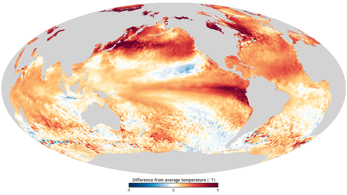
Three Studies Point to El Niño as Key to 2023 Record Global Heat
Three recent studies reveal how the interplay between El Niño and long-term global warming drove the record-breaking global temperatures of 2023.

Posted inEditors' Highlights
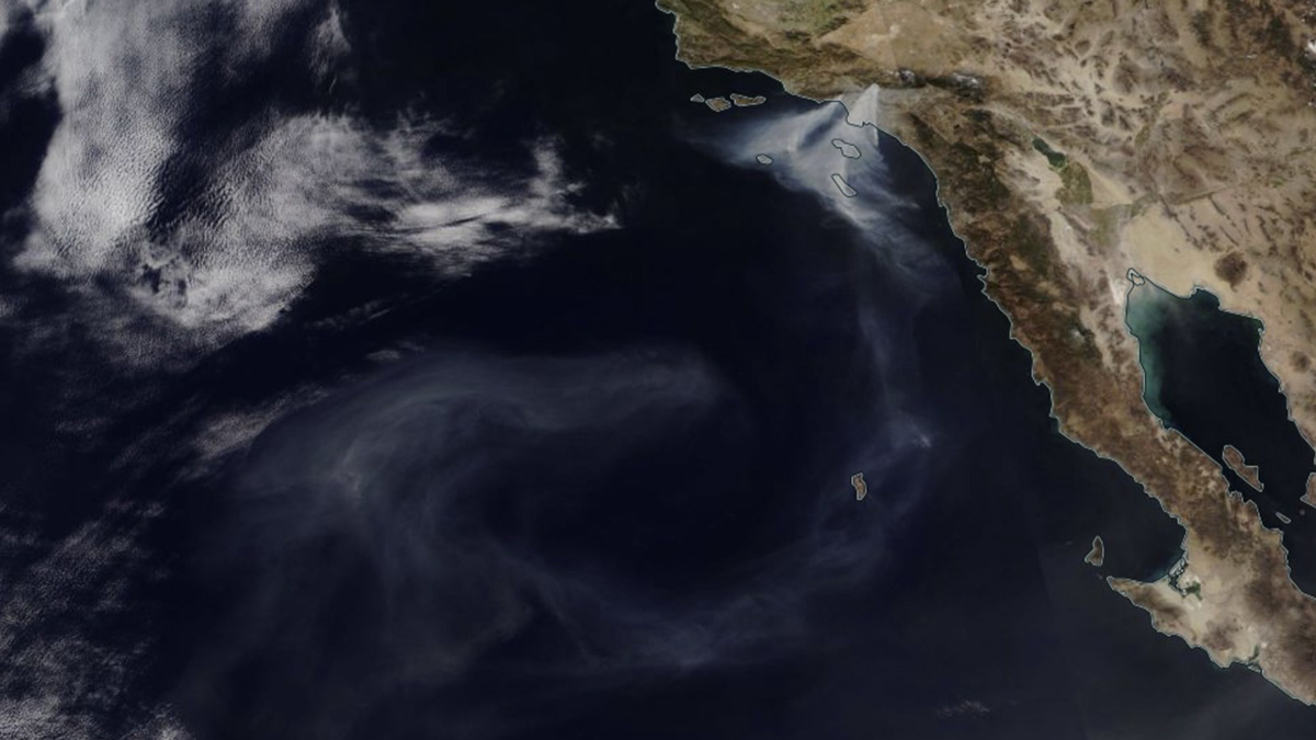
An Atmospheric Pattern Over the Pacific Influences Western U.S. Wildfire Risk
The West Pacific pattern correlates with high pressure, increased temperature, decreased precipitation, and higher burned area during autumn in the western United States.