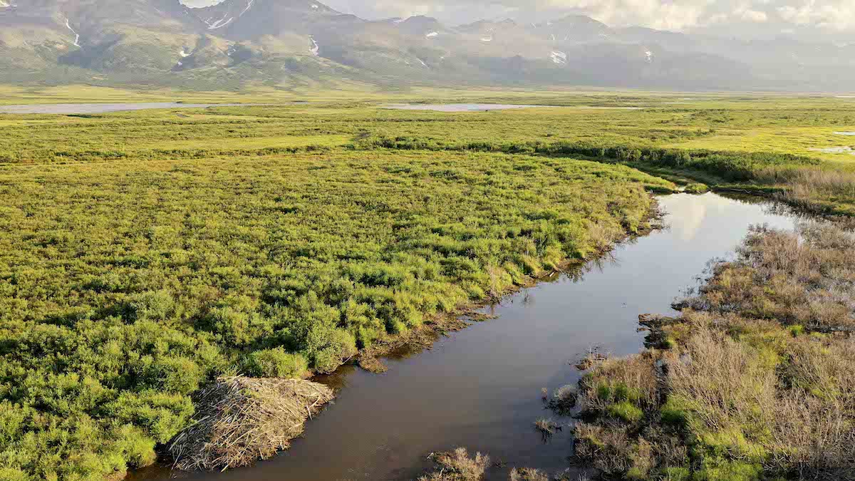
As beavers build dams in new areas, they impound water, warming permafrost adjacent to their ponds.
permafrost
Posted inResearch Spotlights
Thawing Permafrost Is Affecting Climate, but It’s Unclear by How Much
Models produce widely varying estimates of how ecosystems in the northern permafrost region are currently affecting the global greenhouse gas budget.
Posted inResearch Spotlights
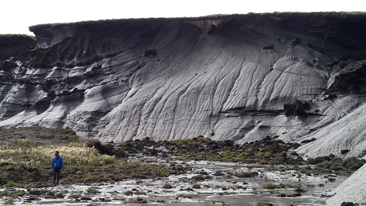
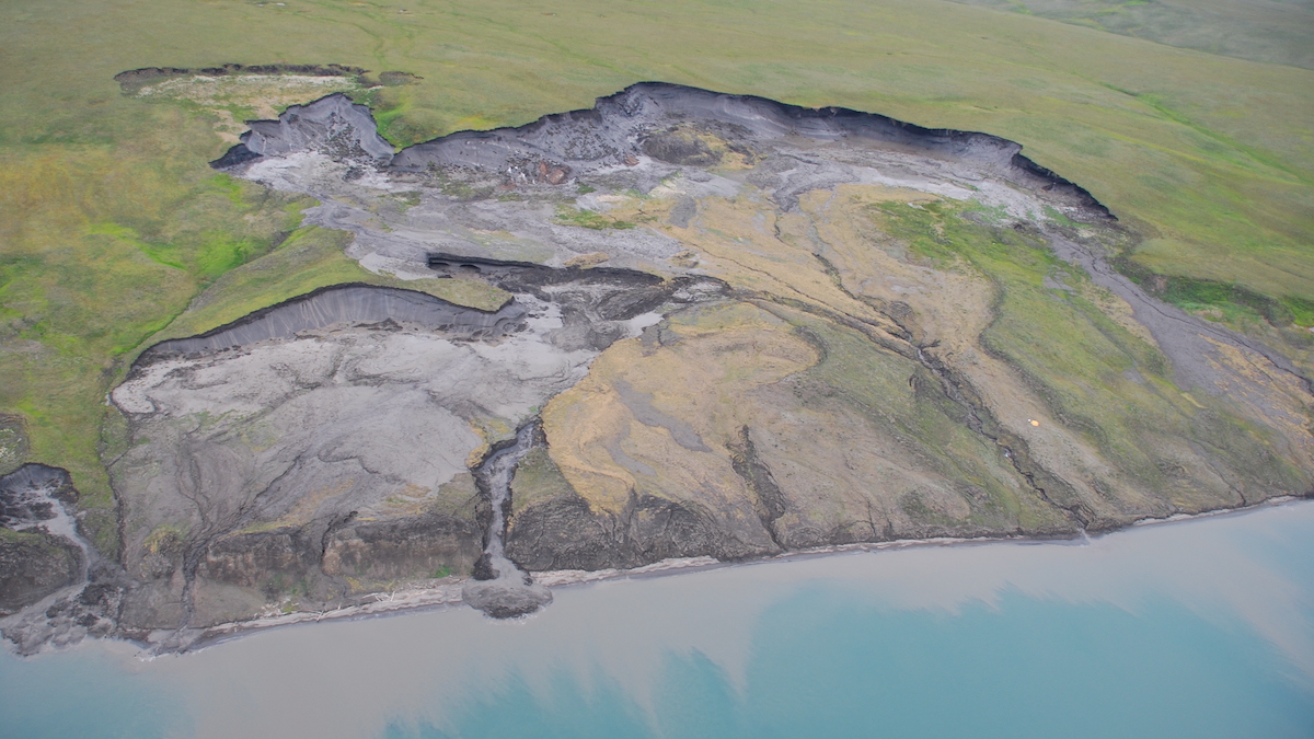
Down in the Slumps: Tracing Erosion Cycles in Arctic Permafrost
Climate change is altering permafrost thaw cycles and leading to unique Arctic erosional problems.

Posted inEditors' Highlights
The Delicate Balance of Permafrost in Arctic River Floodplains
To evaluate the vulnerability of permafrost in Arctic floodplain landscapes to warming, scientists explore dynamics of its loss and reformation.

Posted inScience Updates
Simulating Arctic Carbon Emissions in a Warming World
Not all climate models include carbon from thawing permafrost, and those that do often disagree. Scientists are working to better inform models and assess how these crucial materials are simulated.

Posted inThe Landslide Blog
Landslides in the Sedongpu gully on the Tibetan Plateau
The Landslide Blog is written by Dave Petley, who is widely recognized as a world leader in the study and management of landslides. One of the most landslide-prone locations on the planet is the catchment known as the Sedongpu gully, which is located on the Tibetan Plateau. Located at [29.8009, 94.92014], this is an area […]

Posted inResearch Spotlights
Seismologie: Ein vielversprechender Weg zur Überwachung von Permafrost
Passive seismische Daten von einer Messstation auf der Zugspitze zeichneten im Lauf der letzten 15 Jahre den Schwund von Permafrost auf. Somit eignet sich dieses Verfahren vermutlich auch für die langfristige Überwachung der Umwelt.

Posted inThe Landslide Blog
On the low frequency of rock avalanches in NE Baffin Island
The Landslide Blog is written by Dave Petley, who is widely recognized as a world leader in the study and management of landslides. Rock avalanches are an important hazard in areas with fjord topography, potentially impacting humans directly but also having the capability to generate large tsunamis that can cause damage over quite large distances. […]

Posted inNews
Rain Comes to the Arctic, With a Cascade of Troubling Changes
Rain used to be rare in the Arctic, but as the region warms, so-called rain-on-snow events are becoming more common. The rains accelerate ice loss, trigger flooding, landslides, and avalanches, and create problems for wildlife and the Indigenous people who depend on them.

Posted inResearch Spotlights
A Better Way to Predict Arctic Riverbank Erosion
Permafrost thaw might cause Arctic riverbanks to erode more quickly. But a new study shows why these erosion rates aren’t as dramatic as some scientists feared.