Using thermokinematics, researchers have found that crustal accretion along the megathrust at mid-lower crustal depths shapes plateau growth and regional drainage development.
plate tectonics

Posted inNews
Earth’s Lower Mantle Is Drier Than Previously Thought
Scientists have long known that the two layers of Earth’s mantle have different chemical compositions. Now, modeling shows that different water concentrations may keep them from mixing.
Posted inNews
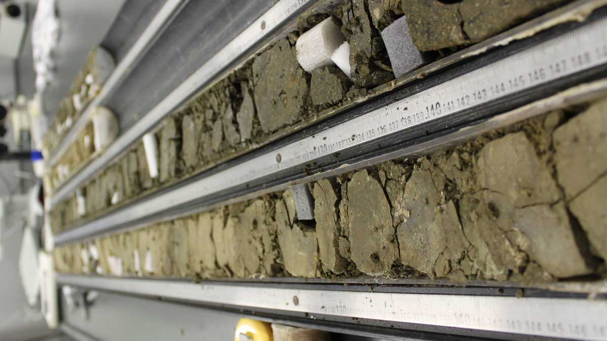
Stretching Crust Explains Earth’s 170,000-Year-Long Heat Wave
During a brief period in Earth’s past, a massive emission of carbon abruptly raised global temperatures, acidified oceans, and stamped out species. New data may help explain how it happened.

Posted inFeatures
Vashan Wright: A Champion for DEI in the Geosciences
While studying tectonic plates and sand, Wright works on a program to make the geosciences more equitable.

Posted inEditors' Highlights
Zircons and Plate Tectonics
New data on ancient zircons points to a transition from stagnant lid to subduction style tectonics at 3.6 Ga ago.
Posted inEditors' Highlights
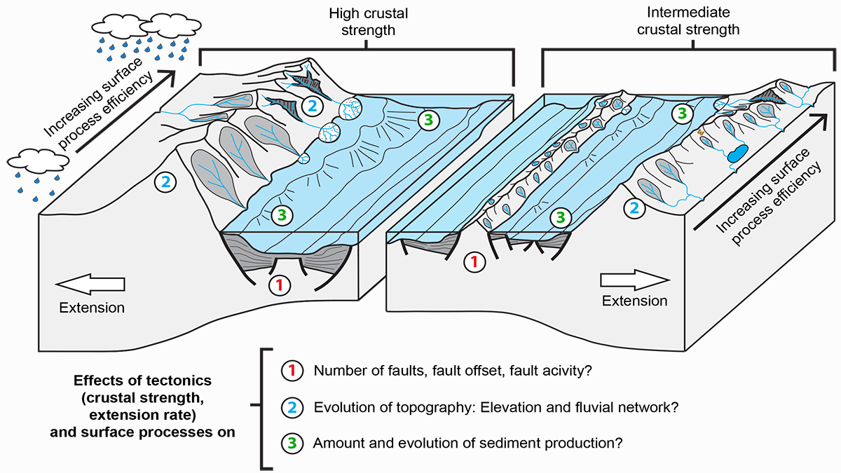
The Lost Topography Around Continental Rifts
Numerical models provide quantitative constraints on topography lost to erosion, showing how the sediment influx in a sedimentary basin reflects its tectonic and topographic evolution.
Posted inNews
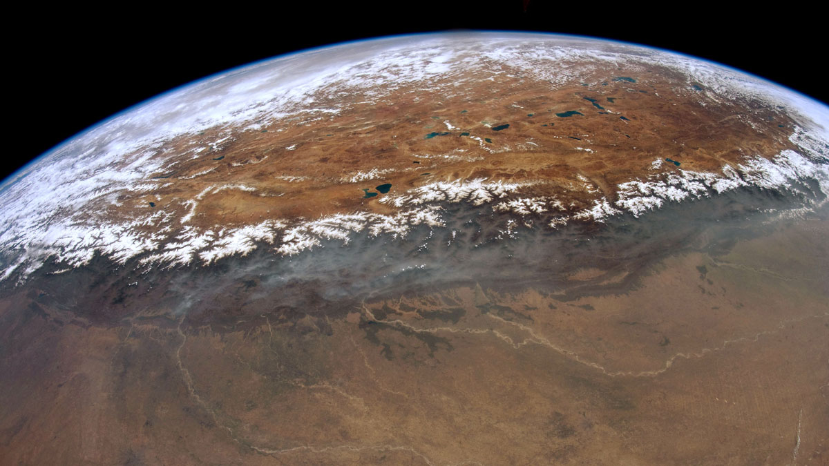
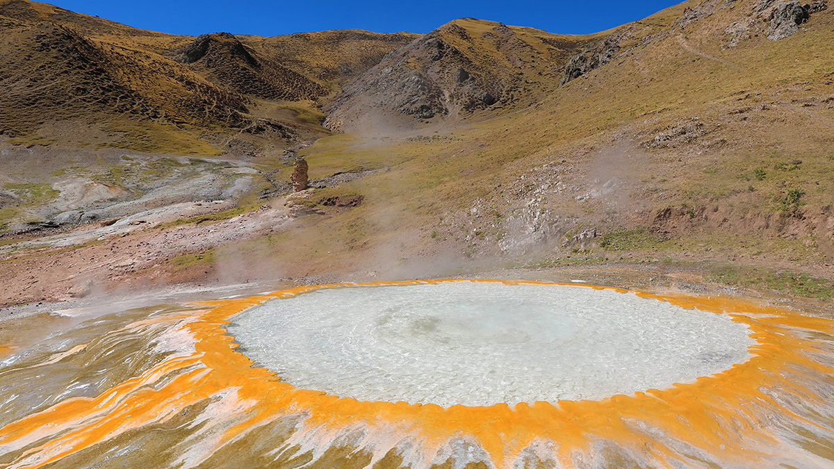
Hot Springs Suggest How the Tibetan Plateau Became the Roof of the World
Helium isotopes found in water samples provide a snapshot of what lies beneath the plateau and stimulate debate within the geosciences community.
Posted inNews
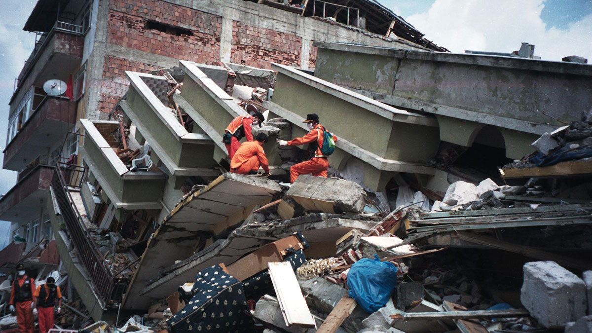
Do Earthquakes and Tectonic Plates Have a Two-Way Relationship?
A catastrophic earthquake in Turkey in 1999 changed the motion of the Anatolian plate, according to a study that could change the fundamentals of quake models.
Posted inFeatures
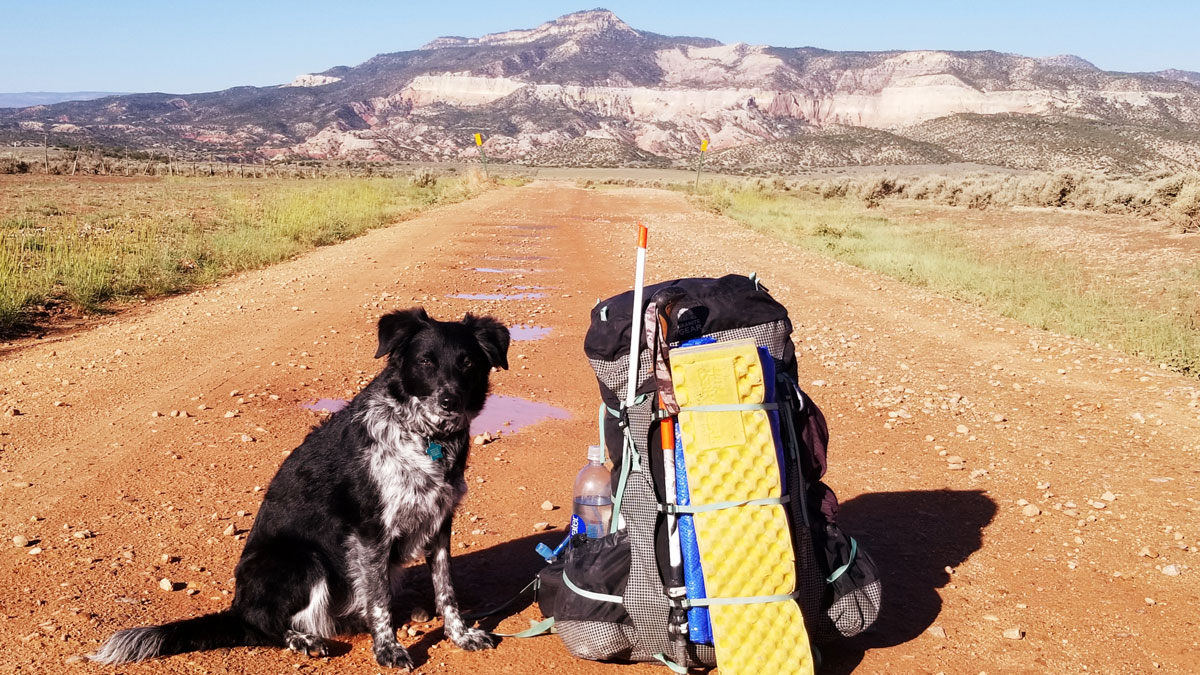
Incredible Journeys on the Crown of the Continent
Living in Geologic Time: The making, breaking, and backpacking of North America’s Continental Divide.
Posted inScience Updates
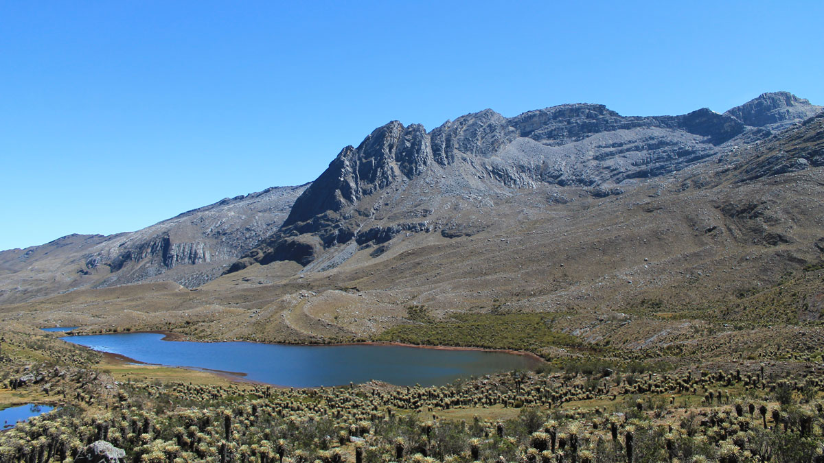
A Puzzle Mat for Assembling Colombia’s Geologic History
A new database compiles all the available pieces of information about Colombia’s geochronology, offering scientists a consistent framework in which to view and study the data in a broader context.