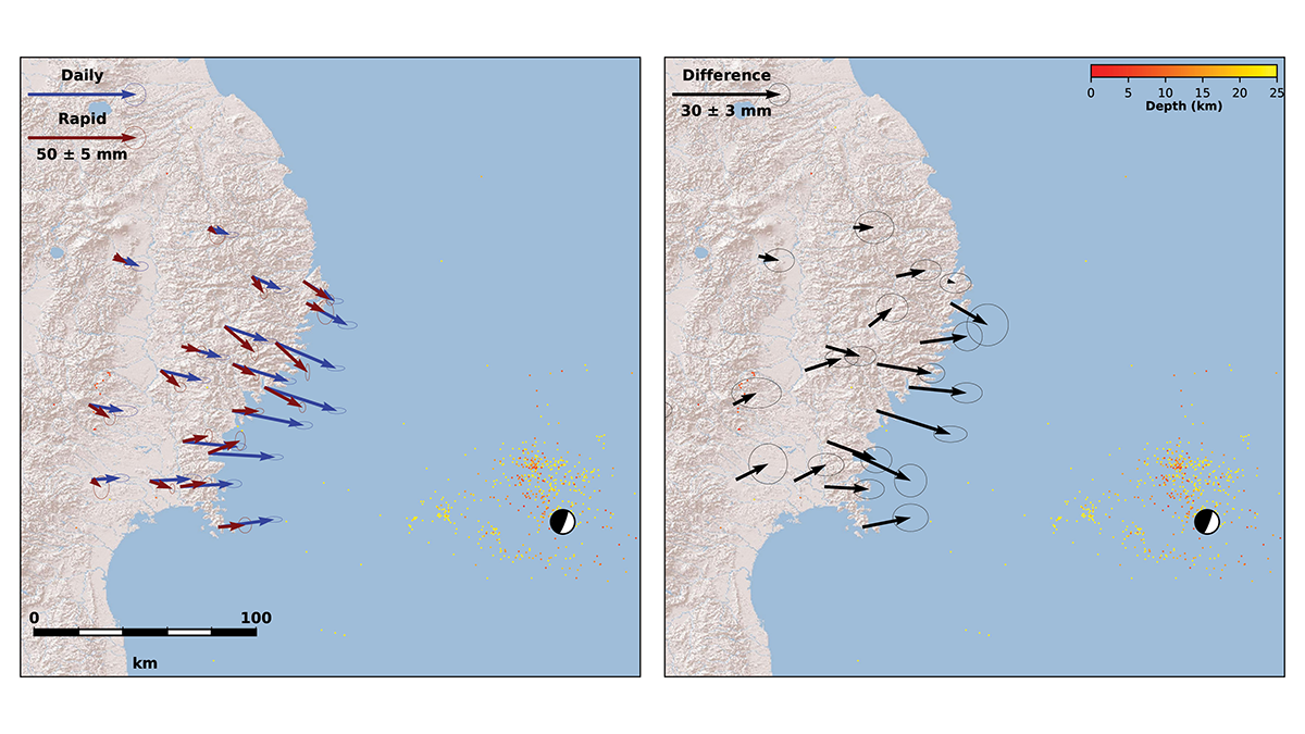
A physics-based method estimates the duration of earthquakes’ coseismic phase and can help improve the precision of coseismic slip models and magnitude estimates.
plate tectonics
Posted inResearch Spotlights
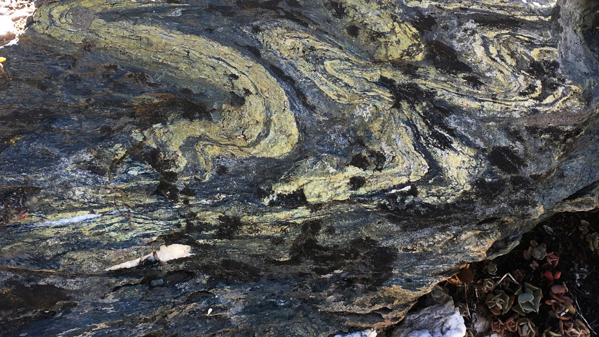
Unearthing the Cause of Slow Seismic Waves in Subduction Zones
Researchers look to the fossil rock record to unearth the driving forces for variable seismic speed through subduction zones.
Posted inEditors' Vox
The Birth, Growth, and Death of Continents
There are various explanations for how the Earth’s continents form, develop, and change but challenges remain in fully understanding the driving forces behind plate tectonics on our planet.

Posted inResearch Spotlights
Measuring Sea Level Rise Along the Coast
Scientists created a global map of vertical land motion to show how the solid ground is moving relative to the planet’s rising seas.

Posted inResearch Spotlights
Extinct Style of Plate Tectonics Explains Early Earth’s Flat Mountains
The geologic record suggests that despite Earth’s hot, thin crust during the Proterozoic, mountains were still able to form thanks to an extinct style of crustal deformation.

Posted inEditors' Highlights
A Novel Thermobarometer to Infer Mantle Melting Conditions
The algorithm RevPET automatically reverses the complex multi-phase fractional crystallization path of oceanic basalts and offers new perspectives for advancing mantle thermobarometry.
Posted inEditors' Highlights
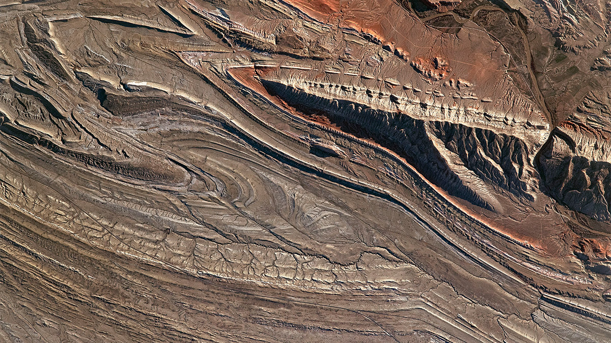
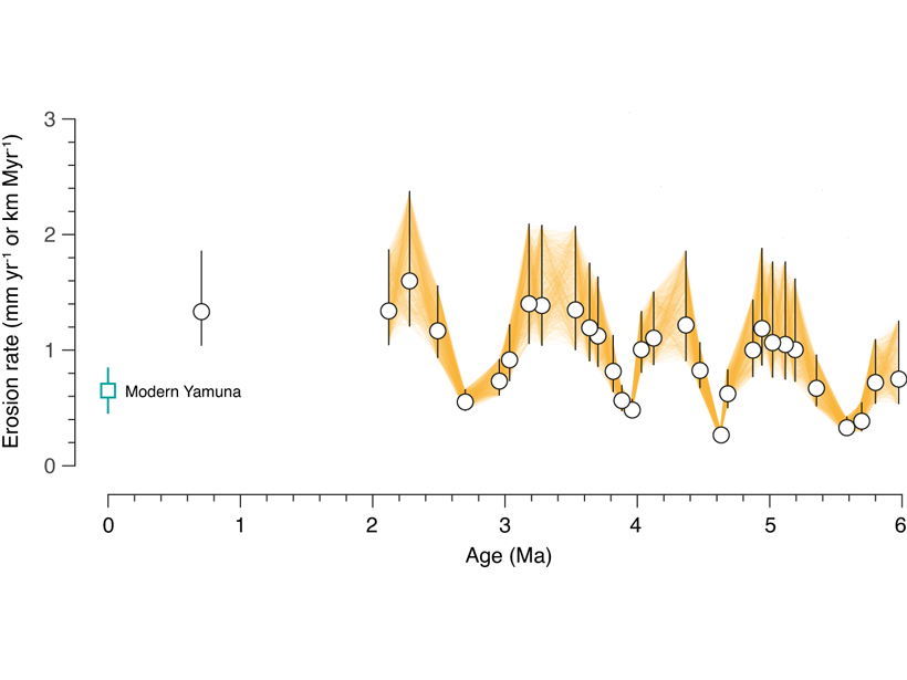
Himalayan Tectonics in the Driver’s Seat, Not Climate?
Earth’s oscillating climate is a natural guess to explain cyclic patterns in erosion, but new sediment data suggests that cyclicity may emerge from tectonic processes adding material to the Himalaya.

Posted inEditors' Highlights
Subduction Zone Earthquakes: Fast and Slow, Weak and Strong
What causes slow earthquakes in subduction zones? New insights from numerical models suggest that a mixture of strong and weak rocks might be the cause.

Posted inScience Updates
Earth’s Continents Share an Ancient Crustal Ancestor
How did today’s continents come to be? Geological sleuths found clues in grains of sand.

Posted inScience Updates
Swipe Left on the “Big One”: Better Dates for Cascadia Quakes
Improving our understanding of hazards posed by future large earthquakes on the Cascadia Subduction Zone requires advancements in the methods and sampling used to date and characterize past events.