
Production of the weak, water-bearing mineral at the interface between the Cocos and North American Plates could contribute to the occurrence of poorly understood episodic tremor and slow slip.
plate tectonics
Posted inEditors' Vox
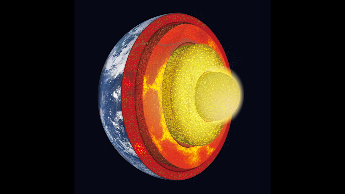
Digging Deep into Interactions Between the Core and Mantle
A new book presents major advances in our understanding of core-mantle interaction and co-evolution, and showcases technological developments improving our insights into deep Earth processes.
Posted inNews
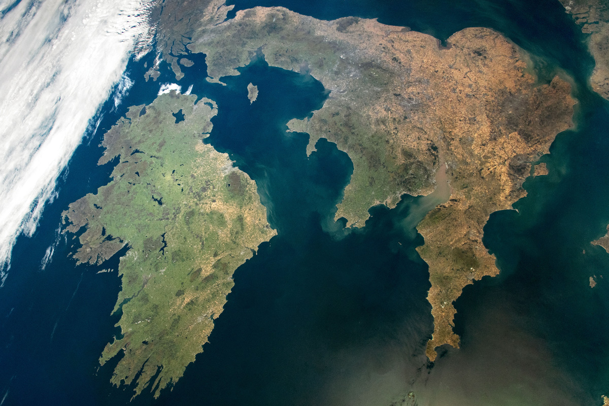
The Mysterious Case of Ireland’s Missing Earthquakes
The Emerald Isle has far fewer earthquakes than neighboring Britain. Now scientists think they know why.
Posted inEditors' Highlights
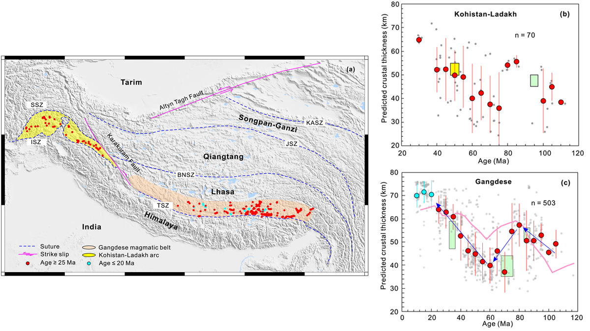
Machine Learning Helps Constrain the Thickness of Ancient Crust
A machine learning model trained using data on the chemical composition of magmatic rocks yields comparable, if not better, results to previously developed geochemical proxies.
Posted inEditors' Highlights
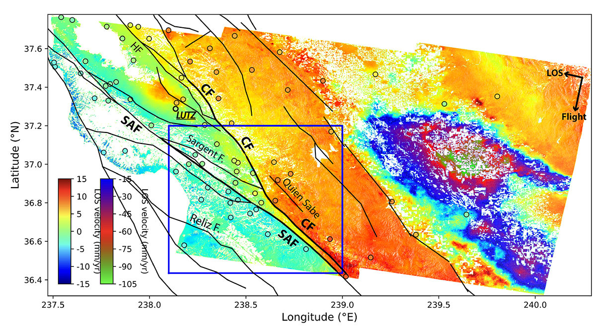
Radar Satellites Capture Subtle Slip Evolution on Faults
A five-year time series from radar satellite imagery tracks surface slip on major faults in the San Francisco Bay Area, capturing subtle velocity variations and controlling factors.

Posted inEditors' Highlights
Topography Along the Apennines Reflects Subduction Dynamics
Topography and exhumation vary strongly along the Apennines, reflecting the geometry of the Moho and different geodynamic mechanisms.

Posted inEditors' Vox
The Seven-Ages of Earth as Seen Through the Continental Lens
The 4.5-billion-year record contained in Earth’s continental crust reveals a seven-phase evolution, from an initial magma ocean to the present-day environment in which we live.

Posted inResearch Spotlights
Scientists Decipher the Seismic Dance of the Southern Alps
Most of the Alps are considered tectonically dead, but according to new research, the southeastern region—home to prosecco wine—is very much alive.


Posted inResearch Spotlights
New Tectonic Plate Model Could Improve Earthquake Risk Assessment
A new model of tectonic plates in New Zealand may identify areas of increased earthquake likelihood.