
Instead of waiting for earthquake waves to tell scientists about the structure of Earth’s interior, scientists can now use ambient noise from humans to “see” underground.
seismology

Posted inFeatures
Distributed Sensing and Machine Learning Hone Seismic Listening
Fiber-optic cables can provide a wealth of detailed data on subsurface vibrations from a wide range of sources. Machine learning offers a means to make sense of it all.
Posted inResearch Spotlights
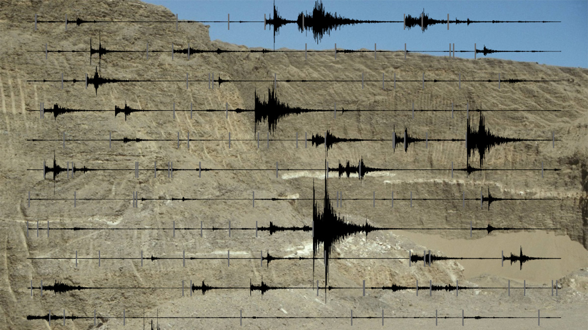
Comparing Machine Learning Models for Earthquake Detection
A new study evaluated the performance of emerging deep learning models for earthquake detection, phase identification, and phase picking.

Posted inNews
Layered Zone Beneath Coral Sea Suggests Ancient Magma Ocean
Scientists studying South Pacific earthquakes suggest that an ultralow-velocity zone at the core-mantle boundary may be a remnant of a molten early Earth.
Posted inResearch Spotlights
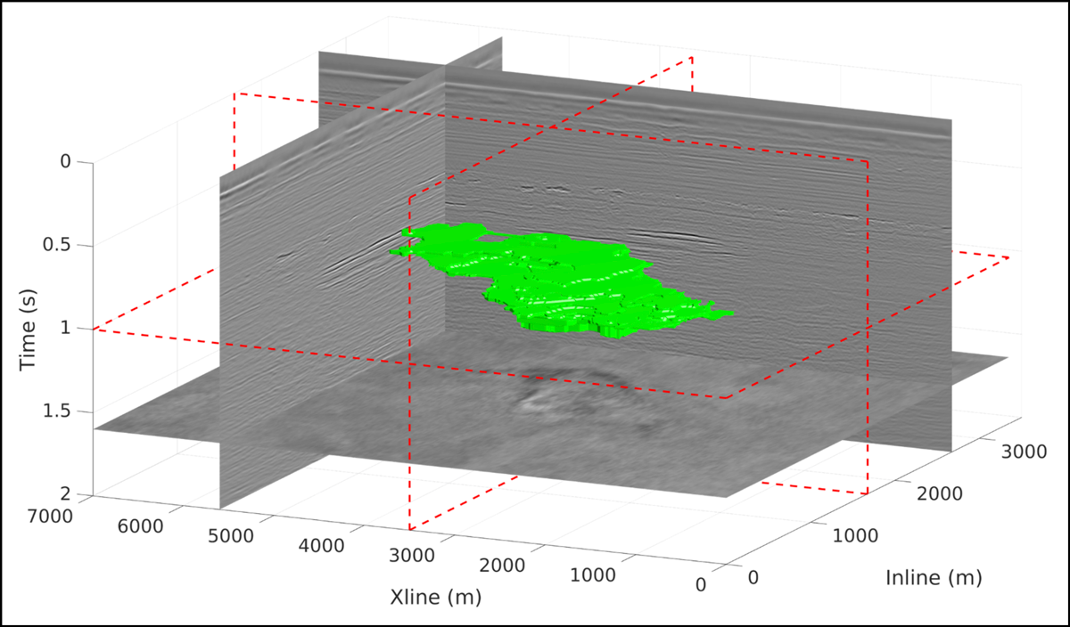
Neural Networks Can Identify Carbon Dioxide in Seismic Observations
By establishing a machine-driven approach to interpreting seismic observations of carbon dioxide injection, researchers hope to improve tracking of carbon capture and sequestration projects.
![Figure 2 from Wang and Tkalčić [2021]](https://eos.org/wp-content/uploads/2022/01/2021GL094784-Figure-2-sized-1200x675-1.png)
Posted inEditors' Highlights
Observation of Shear Wave Anisotropy in the Earth’s Inner Core
Coda-correlation wavefields reveal direction-dependent inner-core shear-wave speed, ~5 s faster in directions oblique to the Earth’s rotation axis than directions parallel to the equatorial plane.

Posted inScience Updates
Sensing Iceland’s Most Active Volcano with a “Buried Hair”
Distributed acoustic sensing offered researchers a means to measure ground deformation from atop ice-clad Grímsvötn volcano with unprecedented spatial and temporal resolutions.

Posted inResearch Spotlights
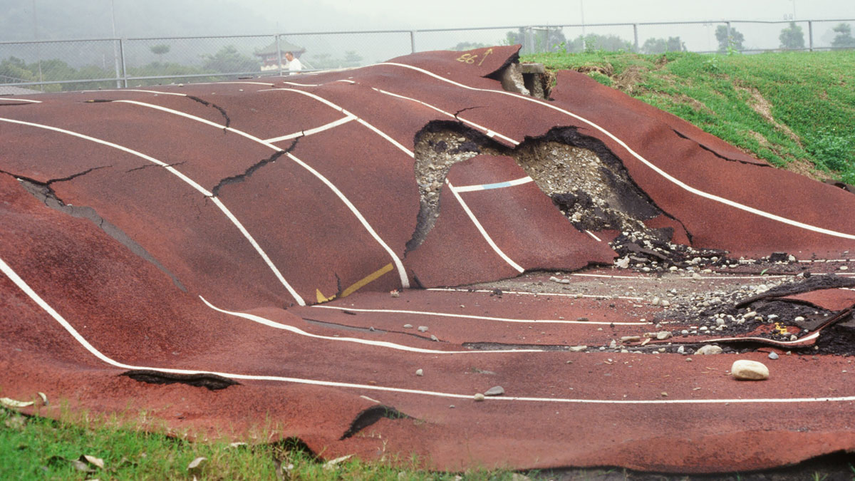
How Fault Surface Features Can Tell Us About Future Earthquakes
A new study suggests ways to quantify fault maturity, a property that affects earthquake characteristics.

Posted inNews
Can Uranus’s Rings Reveal the Planet’s Deepest Secrets?
Planetary rings can act as seismometers that respond to changes deep within a planet.