
Seismologists made an accidental discovery on the Northeast Greenland Ice Stream, changing the way glaciologists understand how ice moves.
seismology
Posted inEditors' Highlights
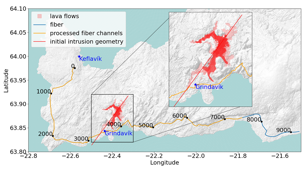
Observing Magma-Induced Seismic Velocity Changes with Fiber-Optics
A new high-resolution method for tracking volcanic activity utilizes fiber-optic sensing to detect magma intrusion by measuring seismic velocity changes.

Posted inThe Landslide Blog
The 16 October 2022 Cilan Landslide in Taiwan
The Landslide Blog is written by Dave Petley, who is widely recognized as a world leader in the study and management of landslides. In a paper just published in the journal Natural Hazards and Earth System Sciences, Chang et al. (2025) describe the 16 October 2022 Cilan Landslide in Taiwan. The research is fascinating, using […]
Posted inEditors' Highlights
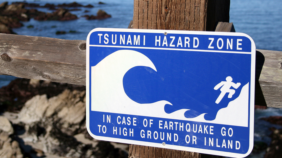
T-waves May Improve Tsunami Early Warning Systems
A unique acoustic wave related to the generation of tsunamis could be used to enhance early warning systems.

Posted inResearch Spotlights
Deep Beneath California’s Sierra Nevada, Earth’s Lithosphere May Be Peeling Away
Evidence for lithospheric foundering, or the process of denser material sinking into the mantle, is emerging.
Posted inEditors' Vox
Listening to Earth’s Subsurface with Distributed Acoustic Sensing
A new book examines how fiber-optic cables installed in boreholes can monitor seismic activity, fluid flow, subsurface temperatures, and more.
Posted inEditors' Vox
Guidelines for Managing Induced Seismicity Risks
Consolidating state-of-the-art science into guidelines provides a path forward for managing induced seismicity risks and highlights avenues for future research.
Posted inEditors' Highlights
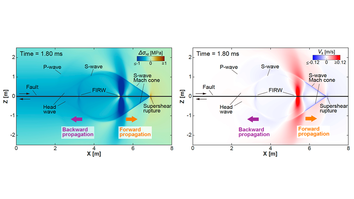
Rewinding the Fault: Stress Perturbations Promote Back-Propagating Ruptures
Free surface reflection and fault geometric asperities can excite backward propagation in the form of an interface wave or high-order re-rupture.
Posted inEditors' Highlights
Diverse Seismic Response in Hectometer-Scale Fracture System
An underground experiment with multi-stage stimulations reveals diverse seismic responses within a complex hectometer-scale fracture network, shedding light on induced seismicity behaviors at field scale.

Posted inENGAGE, News
Seismometers Track Atmospheric Shock Waves from Incoming Space Debris
A Chinese spacecraft that burned up high over Los Angeles created a sonic trail detected by ground-based sensors.