
A tsunami struck a fjord in East Greenland in 2023, ringing seismometers for nine straight days. A new satellite study provides the first observational evidence of the waves.
seismology
Posted inEditors' Highlights
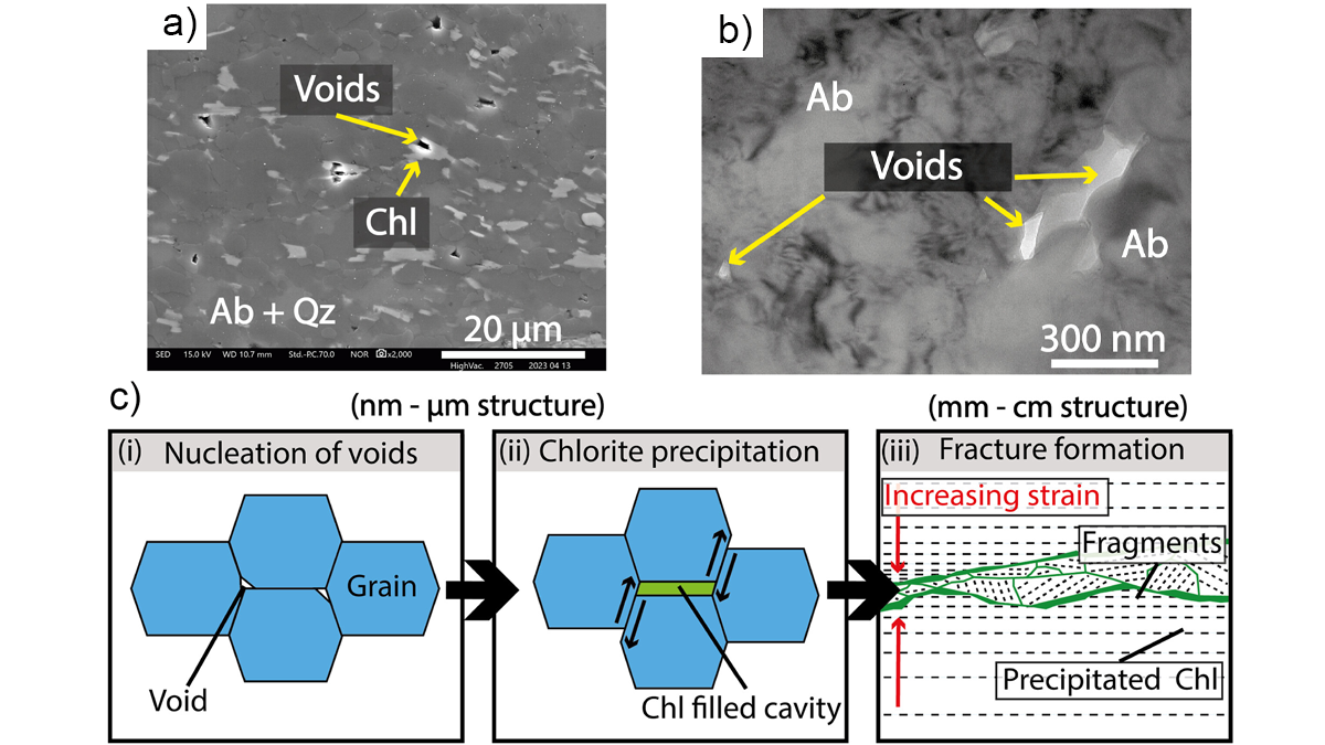
Creep Cavitation May Lead to Earthquake Nucleation
Ultramylonites, rocks of ultrafine grainsize, bring records of nanometer-scale cavities generated at the base of seismogenic crust along Japan’s largest on‐land fault.
Posted inThe Landslide Blog
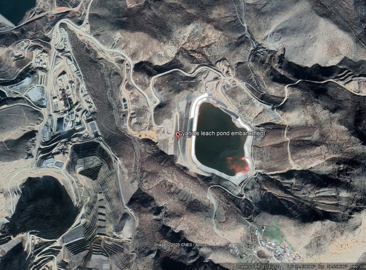
Seismic analysis to understand the 13 February 2024 Çöpler Gold Mine Landslide, Erzincan, Türkiye
The Landslide Blog is written by Dave Petley, who is widely recognized as a world leader in the study and management of landslides. On 13 February 2024, the enormous Çöpler Gold Mine Landslide occurred in Erzincan, Türkiye (Turkey), killing nine miners. This was the first of two massive and immensely damaging heap leach mine failures […]
Posted inResearch Spotlights
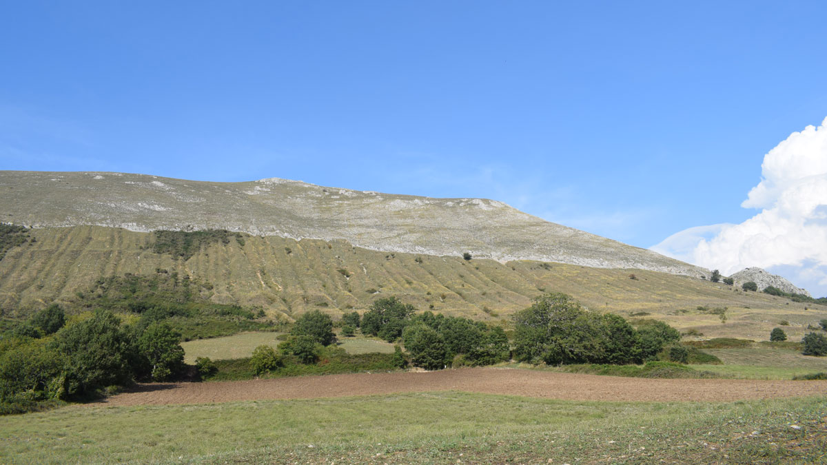
Isotopes Unearth History of Earthquakes in the Apennines
Dating of cosmogenic chlorine isotopes yields long-term estimates of fault activity in Italy, showing that periods of earthquakes and quiescence alternate over millennia.
Posted inEditors' Highlights
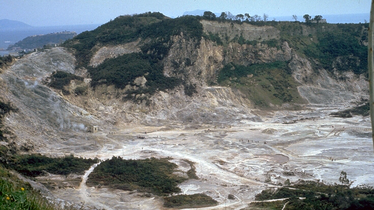
Deflected Dikes Perturb the Plumbing System
A multidisciplinary synthesis of the Campi Flegrei, Italy volcanic setting highlights the importance of sub-caldera layering for magma dynamics.
Posted inEditors' Highlights
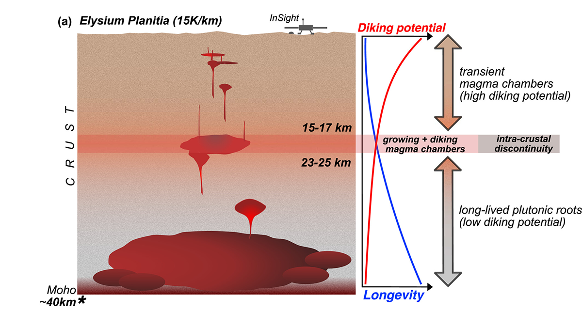
Martian Magmas Live Long and Prosper
The depths, longevity, and potential to generate silicic compositions of magma chambers are linked to crustal temperature, which varies across Mars and over its geological history.
Posted inEditors' Highlights
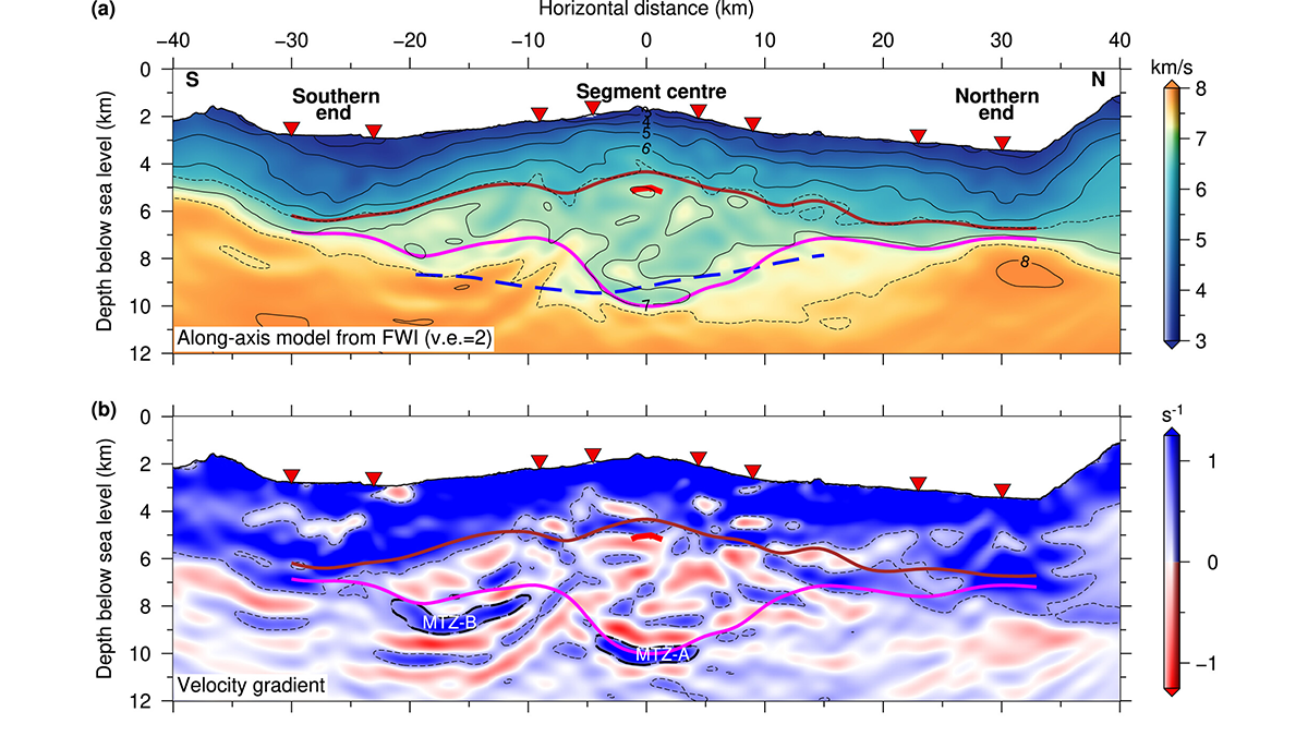
Seismic Images Show Major Change Along the Mid-Atlantic Ridge
New seismic images of the Lucky Strike slow-spreading segment of the Mid-Atlantic Ridge show thick lower crust at the center that thins in both along-ridge directions.

Posted inEditors' Highlights
Come on Feel the Noise: Machine Learning for Seismic-Wind Mapping on Mars
Wind vibrations measured by NASA’s InSight mission seismometer are mapped into wind speed and direction to detect major annual weather patterns and open new possibilities for planetary instrumentation.


Posted inNews
Seismometers Provide Fuller Picture of Los Angeles Groundwater
A new method to evaluate deep aquifers shows even torrential rains haven’t fully replenished groundwater beneath Los Angeles.