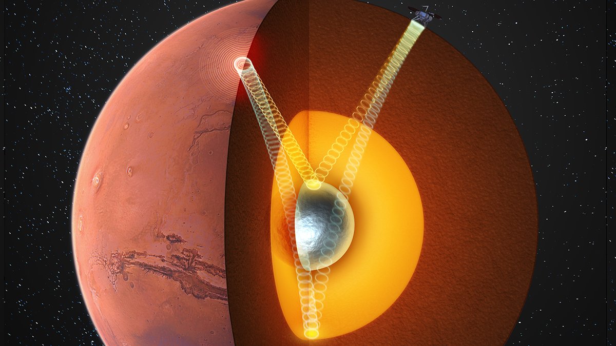
Seismic clues from NASA’s InSight mission suggest that Mars hides a solid inner core, and raise new questions about why the planet’s magnetic field disappeared.
seismology
Posted inEditors' Highlights
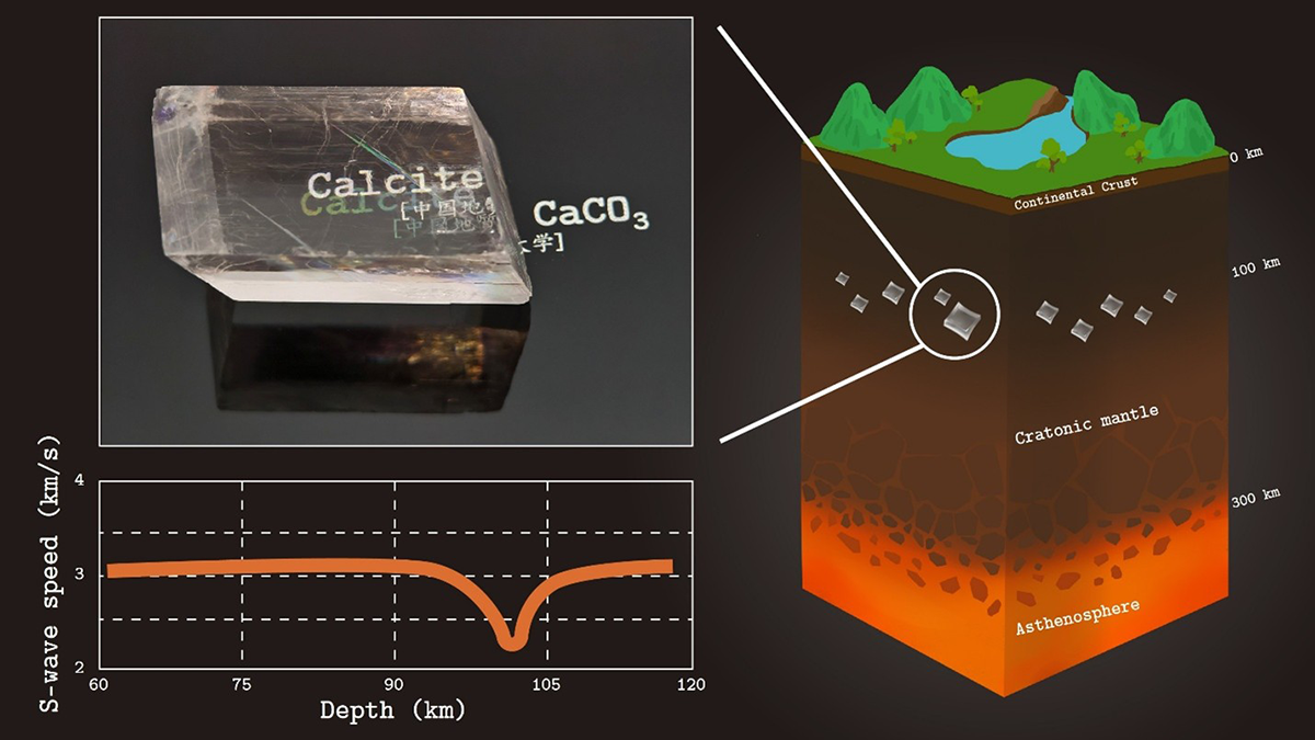
Unexpected Carbonate Phase Revealed by Advanced Simulations
Advanced simulations reveal a new calcium carbonate phase whose unusual elastic behavior may explain puzzling seismic and electrical anomalies beneath ancient continents.
Posted inEditors' Highlights
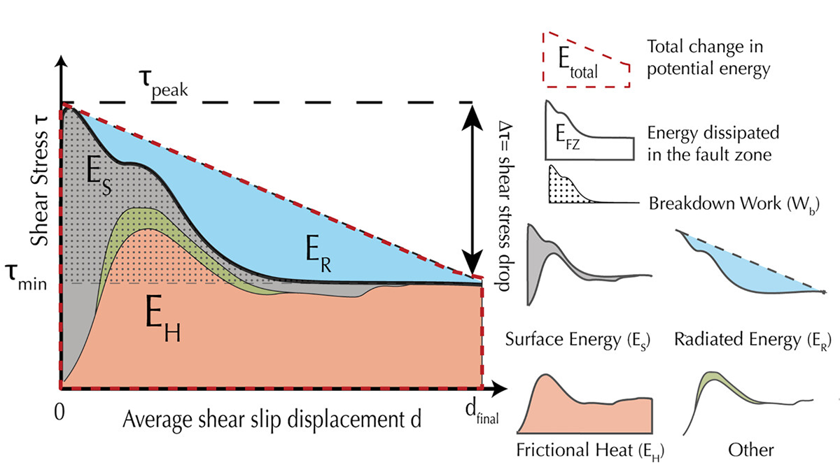
New Perspectives on Energy Sinks During Seismic Events
Laboratory earthquakes shed new light on energy partitioning during earthquakes, which is allocated to seismic radiation, creation of new surfaces, and heat dissipation.
Posted inNews
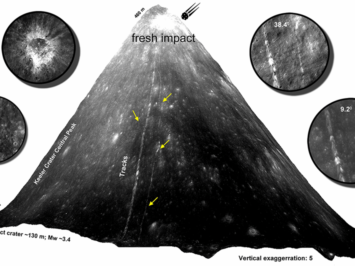
Scientists Track Down Fresh Boulder Falls on the Moon
By poring over thousands of satellite images, researchers geolocated 245 fresh boulder tracks, revealing signs of seismic activity or impact events within the last half-million years.
Posted inEditors' Highlights
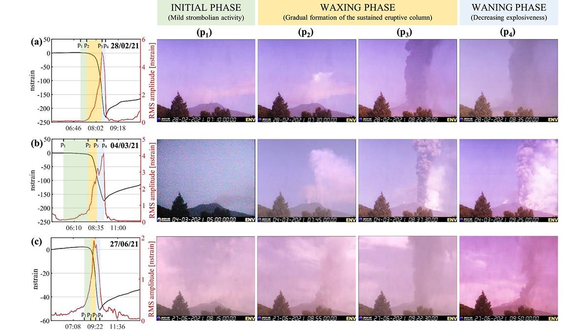
Long-Term Strain Record of Mount Etna Captures 84 Fountaining Eruptions
Scientists use over a decade of high-resolution data to demonstrate that strain signals provide a better match to eruptive style than seismic tremors.
Posted inNews
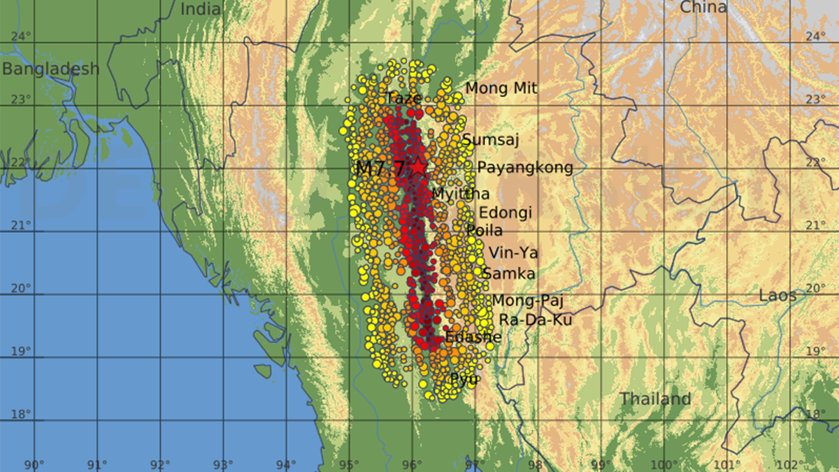
Video Shows Pulsing and Curving Fault Behavior
A chance video captured a fault rupture during March’s devastating Myanmar earthquake, delivering real-time evidence of how major seismic tremors propagate.
Posted inEditors' Highlights
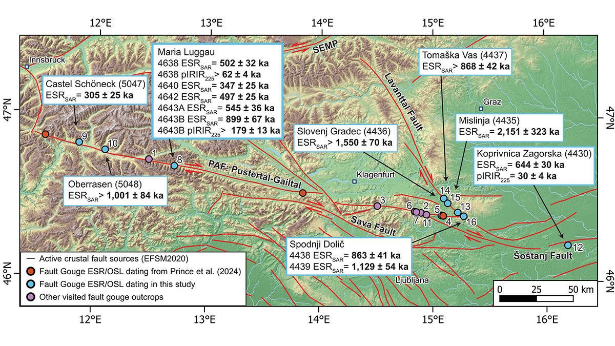
Trapped Charge Techniques Pinpoint Past Fault Slip
Scientists combine two novel dating techniques on fault gouge to better pinpoint the timing and nature of past fault activity in the Eastern Alps.
Posted inResearch Spotlights
Finding the Gap: Seismology Offers Slab Window Insights
Studying slow tremors has helped researchers home in on the youngest part of the Chile Triple Junction’s gap between subducting plates, which offers a window to the mantle.
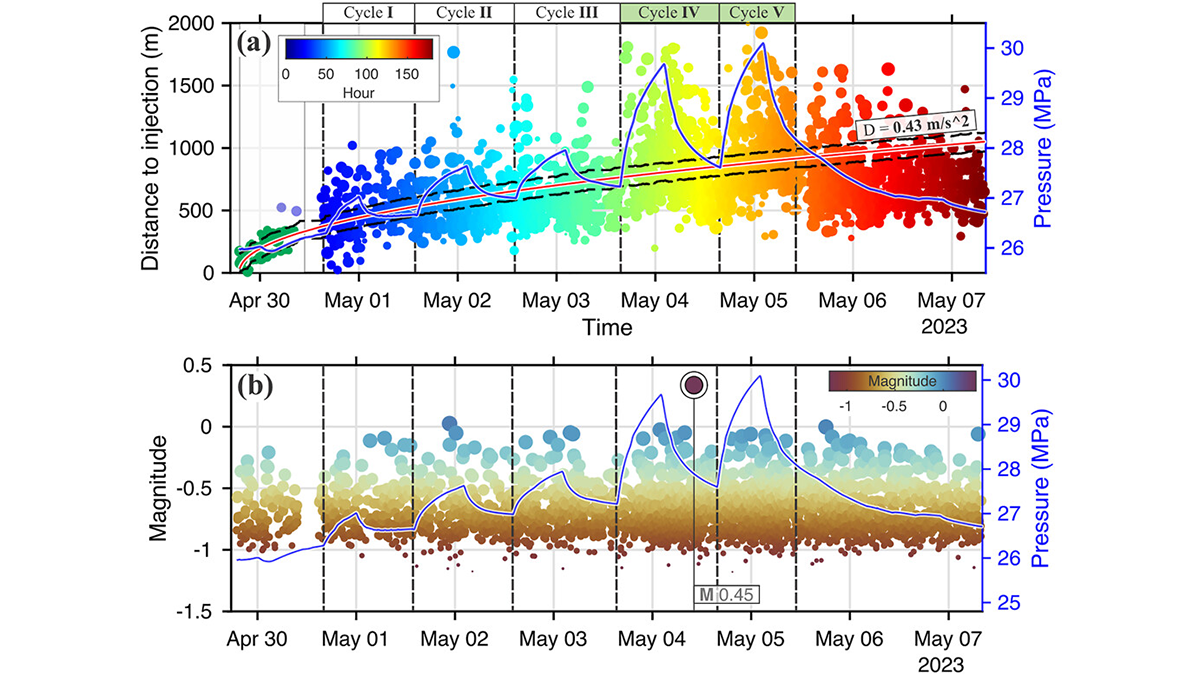
Posted inEditors' Highlights
How Flexible Enhanced Geothermal Systems Control Their Own Seismicity
A new study maps how microseismicity waxes and wanes with pressure in enhanced geothermal systems, offering a template for managing quakes in future heat-mining projects.

Posted inFeatures
Susanne Maciel: Marrying Mathematics and Geology
A geophysicist brings math down to Earth and reaches a rural audience.