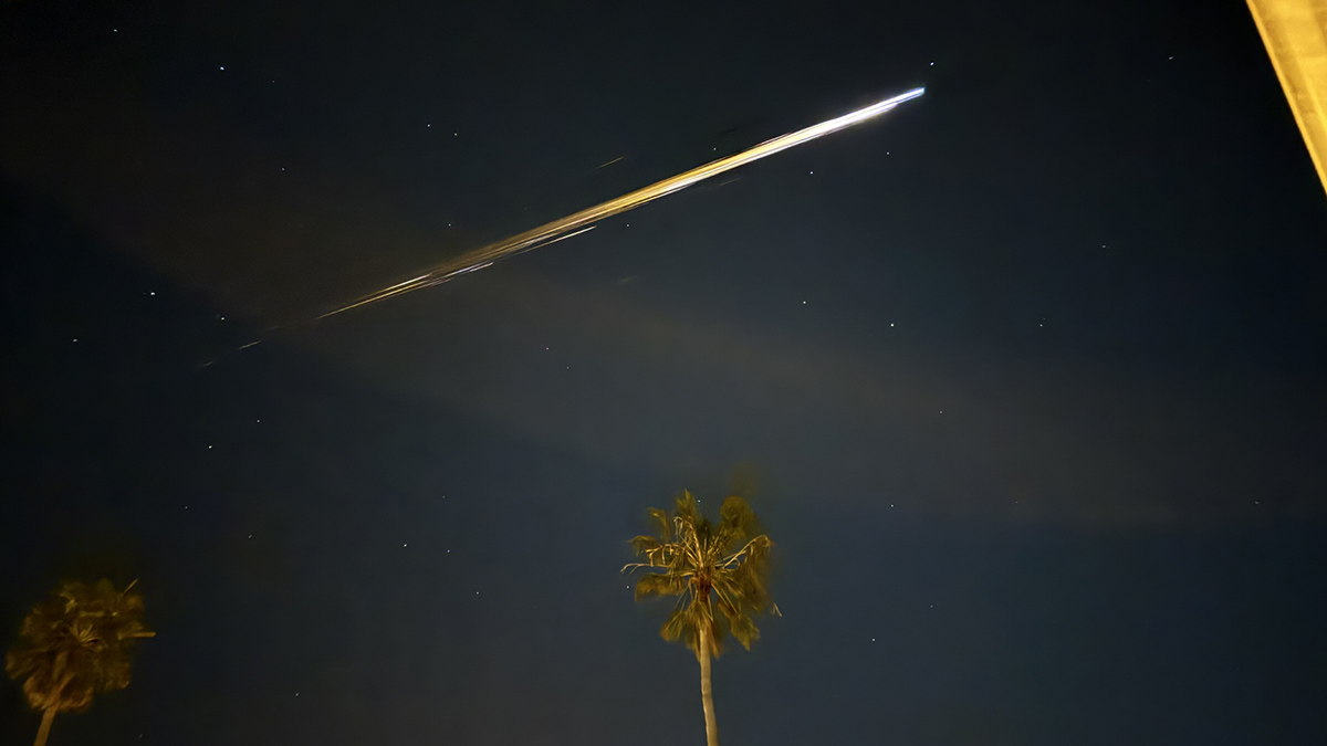
A Chinese spacecraft that burned up high over Los Angeles created a sonic trail detected by ground-based sensors.
seismology

Posted inEditors' Highlights
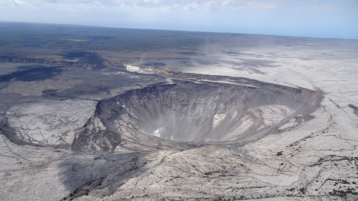
120 Years of Geodetic Data on Kīlauea’s Décollement
A new study explores the deformation and stress changes of Kīlauea’s décollement from 1898 to 2018 by collating an unprecedented 120 years of geodetic data.
Posted inResearch Spotlights
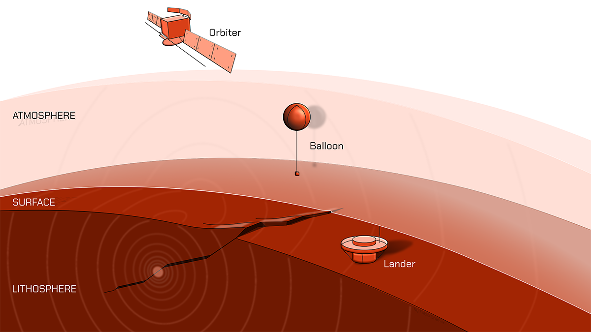
Three Ways to Track Venusquakes, from Balloons to Satellites
The planet’s harsh conditions make studying seismicity challenging, but it is likely possible.
Posted inEditors' Highlights
Compositional Anomalies Complicate Our Model of Mantle Convection
A new study expands on recent research which suggests that oceanic crust accumulates in the mid-mantle. The new seismological constraints advance our understanding of thermo-chemical planetary evolution.
Posted inNews
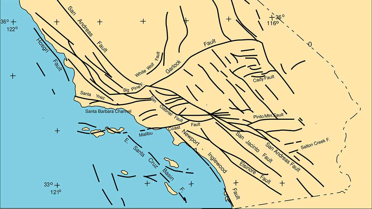
Creeping Faults May Have Simpler Geometries
A recent study offers an alternative perspective on why some fault segments slide smoothly, whereas others get stuck and produce earthquakes.
Posted inNews
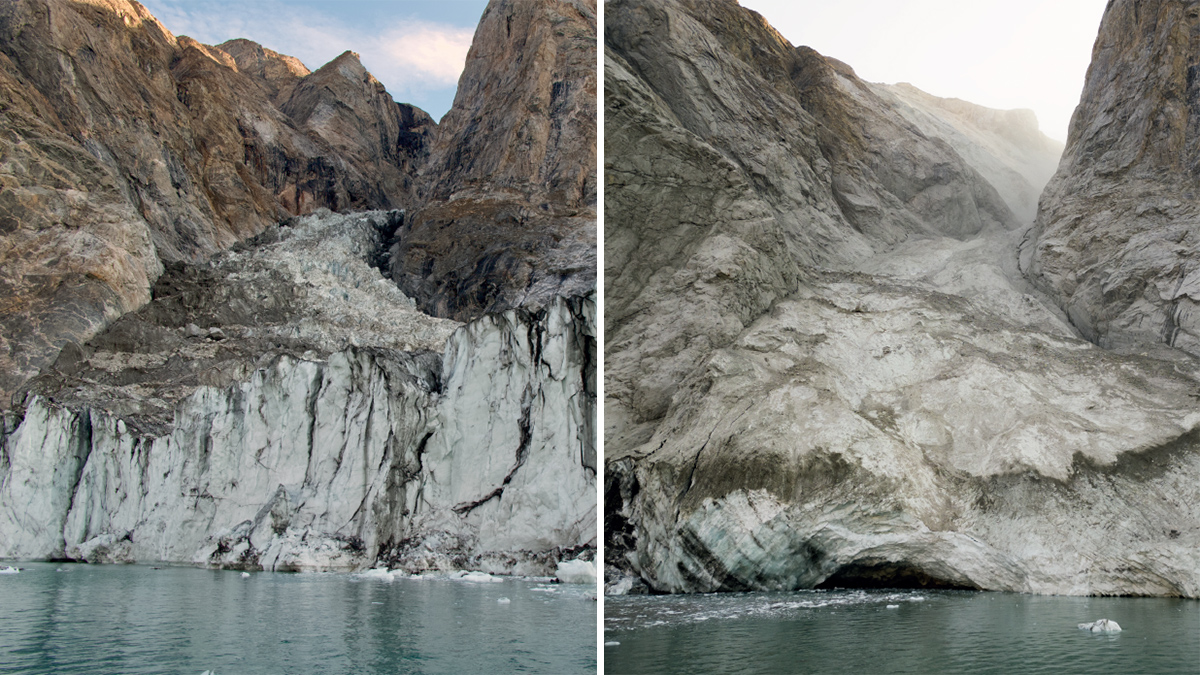
Finding the Frequency of a Fjord
A massive tsunami churned up a mysterious 9-day noise in East Greenland. As the climate warms, more fjords may start singing.
Posted inScience Updates
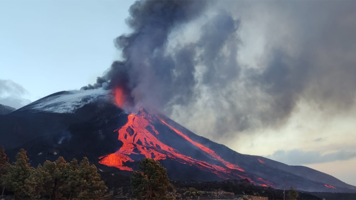
Volcanic Anatomy, Mapped as It Erupts
Testing during the 2021 Tajogaite eruption on La Palma demonstrated the value of near-real-time petrological analyses as a supplement to seismic and geochemical data for eruption monitoring.
Posted inEditors' Highlights
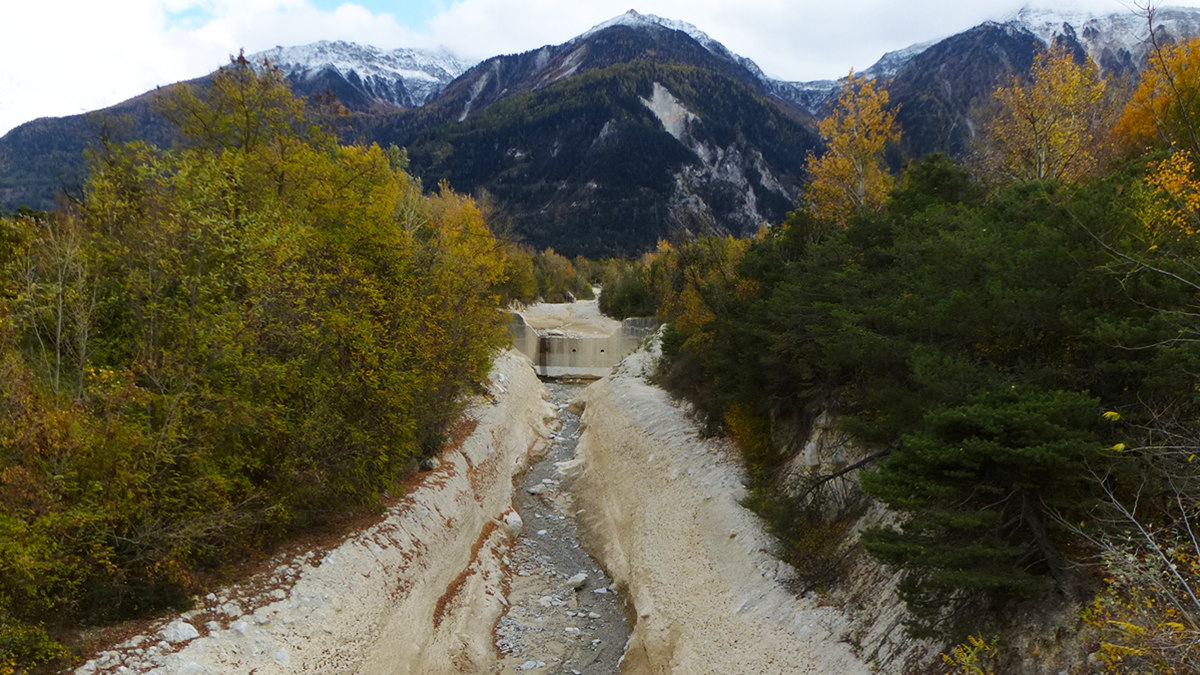
Counting from One to Nine to Detect Debris Flows
A groundbreaking method using Benford’s law allows the detection of debris flows from seismic signals.
Posted inEditors' Highlights
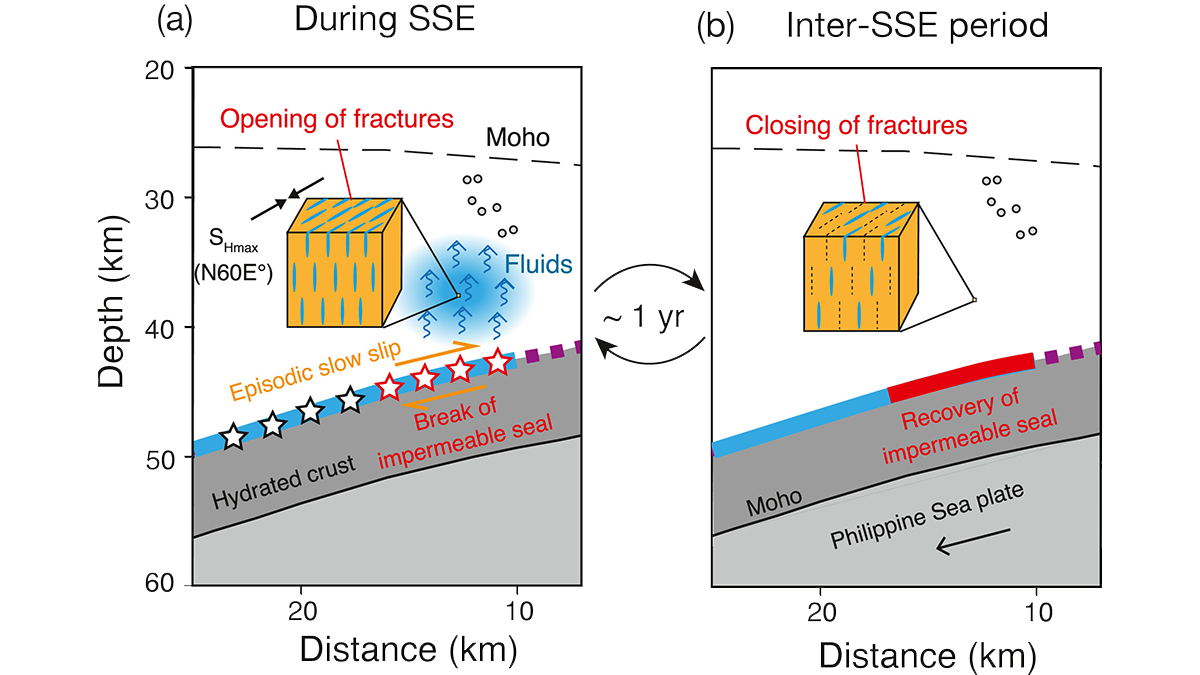
Cyclic Opening of Deep Fractures Regulates Plate Boundary Slip
Seismic anisotropy changes through time suggest that cyclical opening of fluid-filled fractures is synchronized with subduction zone slow slip events.
Posted inEditors' Highlights
Forecasting Caldera Collapse Using Deep Learning
A deep learning model trained with geophysical data recorded during the well-documented 2018 Kilauea volcano eruption, Hawaii, predicts recurrent caldera collapse events.