
To celebrate the Year of Open Science, we highlight our efforts to make AGU journals and books more open, accessible, and inclusive.
United Nations
Posted inNews
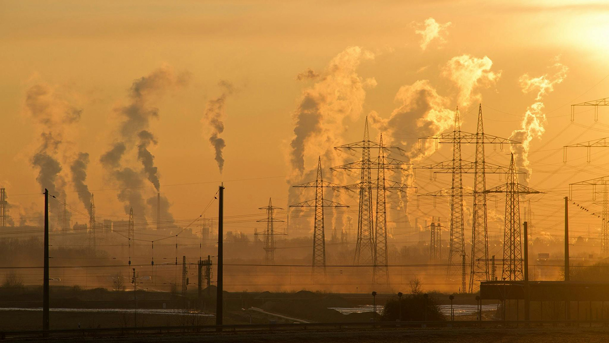
Current Efforts Not Enough to Keep Warming Under 1.5°C
A canyon between current efforts and necessary action means global temperatures are on track to rise far beyond Paris Agreement goals.

Posted inEditors' Vox
How Publishers Can Support the UN SDGs: Examples from AGU
AGU Publications is committed to supporting the UN Sustainable Development Goals through publishing and drawing attention to scientific research that addresses issues of global and societal concern.

Posted inEditors' Vox
Earth’s Critical Zone Remains a Mystery Without its People
Achieving the UN Sustainable Development Goals may only be possible if human activities are central to critical zone science.

Posted inNews
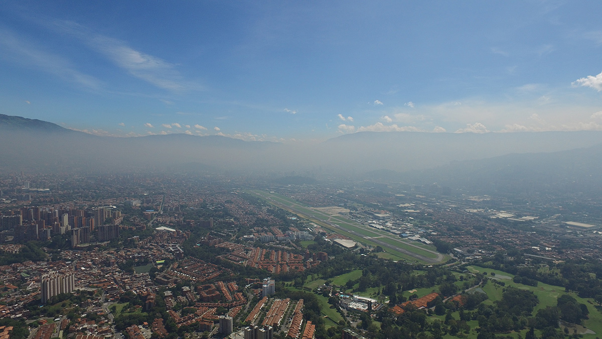
La ciudad colombiana que está abriendo el camino para las “Alertas Tempranas para Todos”
Medellín alerta a sus habitantes sobre inundaciones, deslizamientos, incendios, rayos y mala calidad del aire.
Posted inNews
Colombian City Pioneers Path to “Early Warnings for All”
Medellín alerts citizens to floods, landslides, fires, lightning, and poor air quality.
Posted inEditors' Vox
Geoscientists Make a Difference
A new special report demonstrates that geoscientists’ knowledge, skills, and competencies can be used to advance every one of the United Nations Sustainable Development Goals.
Posted inFeatures
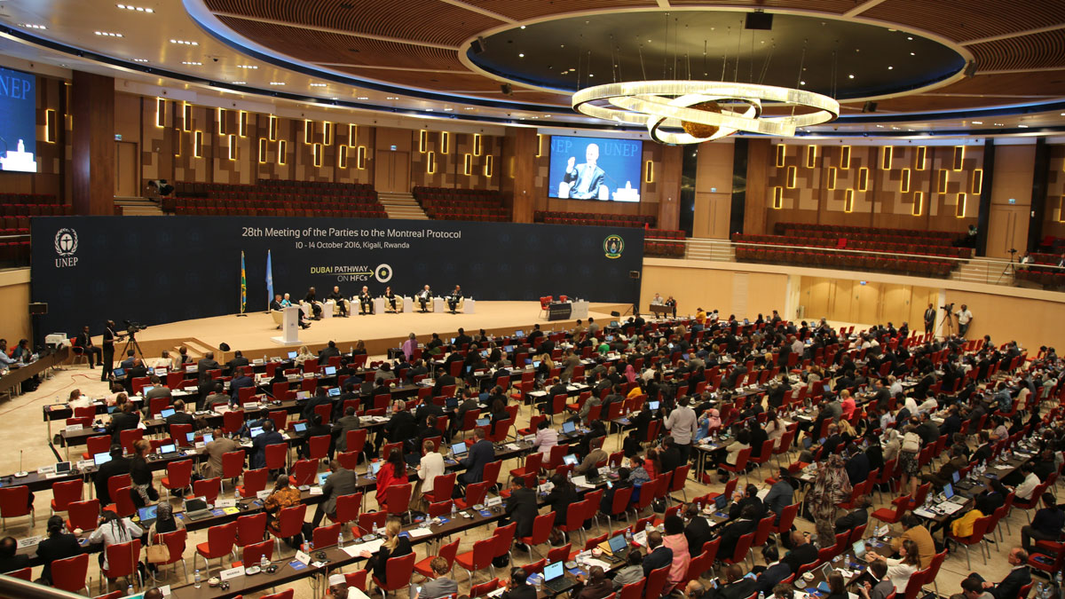
Estableciendo el marco para la acción climática bajo el Protocolo de Montreal
Doce artículos fueron la base científica para la rápida acción que reforzó el tratado, el cual ya estaba salvaguardando el ozono estratosférico, para que también protegiera el clima al reducir los super contaminantes.

Posted inFeatures
Setting the Stage for Climate Action Under the Montreal Protocol
Twelve papers formed the scientific basis for fast action to strengthen the treaty, which was already safeguarding stratospheric ozone, so it also protects the climate by reducing super pollutants.
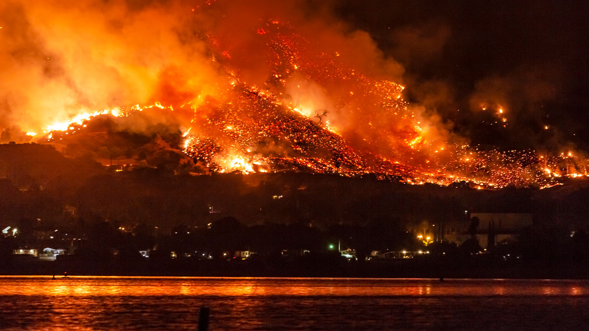
Posted inNews
Los incendios forestales empeorarán, advierte informe de la ONU
Desde el ecuador hasta el Ártico, es probable que aumenten los incendios forestales y que el cambio climático los empeore, según un nuevo informe de las Naciones Unidas. La acción todavía es posible, dicen los autores.