
The Landslide Blog is written by Dave Petley, who is widely recognized as a world leader in the study and management of landslides.

A low key announcement made in Indonesia yesterday caught y attention this morning. It was made by PT Archi Indonesia Tbk (ARCI), a listed mining company, about two gold mine areas run by subsidiary companies. The announcement says the following:-
“PT Archi Indonesia Tbk (ARCI), a mineral mining holding company, has terminated mining activities in two mining pits operated by its subsidiaries in North Minahasa and Bitung, North Sulawesi.
“Hidayat Dwiputro Sulaksono, Corporate Secretary of ARCI, said that the activity termination in both mining pits had to be done following heavy rain on April 6-7, 2024, which let to flood and landslide in several sites.”
So I thought I would take a quick look at the Planet Labs imagery of these areas to see if I could identify any problems.
One of the sites operated by these companies is the Toka Tindung Gold Mine project, which is located at [1.596, 125.095]. The site is clearly identified on Google Maps. And one of the pits in this area is mapped on Google Earth as Araren, which is listed as a pit elsewhere on the internet:-
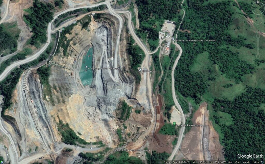
This image shows a large landslide in the southeast corner of the mine. This landslide is about 350 m from the crown to the toe and about 300 m wide. Indonesia Miner has a news report about this landslide, which severely impacted production in 2022:-
“Earlier this year, on [2 January 2022], a natural disaster occurred which affected one of the pits belonging to a subsidiary of PT Archi Indonesia Tbk ( ARCI ), PT Tambang Tondano Nusajaya. ARCI management said that one of the natural disasters caused damage to the working walls of the mine. With the occurrence of this disaster, Corporate Secretary of PT Archi Indonesia Tbk Harry Margatan said after the natural disaster that affected one of the Company’s pits, management had adjusted the capital expenditure requirement.”
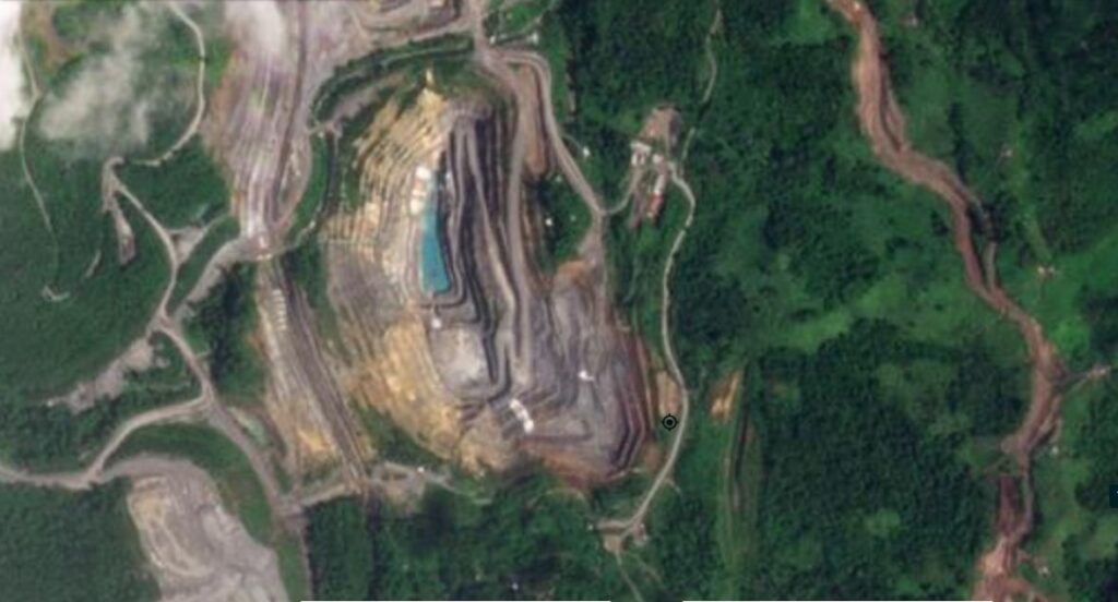
There is a clear Planet Labs image from 4 February 2024 of this site, which shows that very extensive works had been undertaken to remediate this landslide:-
This is the same site, captured this morning (17 April 2024):-

And below should be a slider that allows the two images to be compared:-

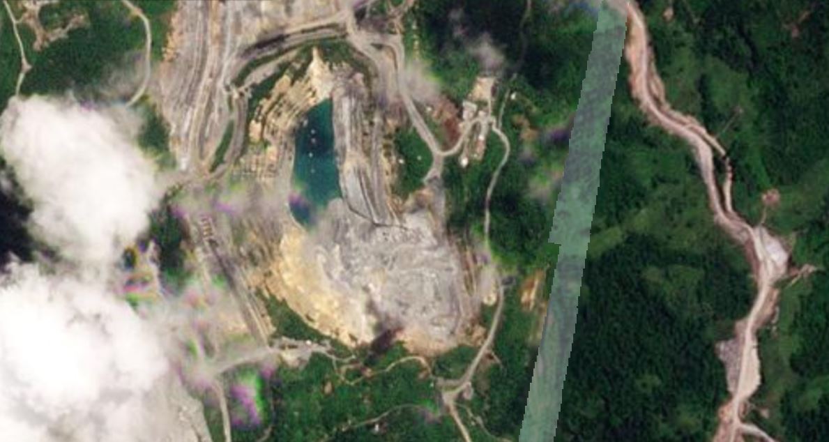
The most recent image would appear to show that a large landslide has once again occurred in the southeast corner of the mine, in the same areas as the 2022 failure. The landslide appears to be substantially larger than the 2022 event, a rough measurement is that it is at least 500 m from crown to toe and about 300 m wide, It is notable that the pit has filled with water since the failure, possibly indicating that drainage is impaired.
I cannot find any other information about events at this site earlier this month, but the satellite images suggest that they were quite significant. Interestingly, the original filing indicates that there is a problem in another pit in the area, but there is too much cloud in the images to identify that at present.
Reference
Planet Team (2024). Planet Application Program Interface: In Space for Life on Earth. San Francisco, CA. https://www.planet.com/