The Landslide Blog is written by Dave Petley, who is widely recognized as a world leader in the study and management of landslides.

On 1 January 2025, a major embankment failure occurred on the Bridgewater Canal close Dunham Massey in NW England.
The local newspaper, Altrincham Today, has a nice article about this event and has posted drone footage to Youtube:-
The collapse occurred during heavy rainfall that induced flooding across the region. As the drone footage shows, this embankment collapse has contributed to the problems.
The location of the failure is [53.3814, -2.4108]. There is a good archive of Google Earth imagery – this view (from 2010) shows the site well:-
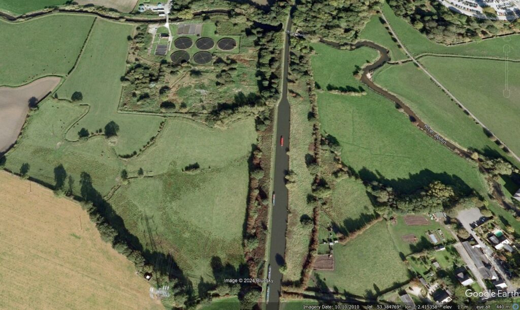
This section of the canal is constructed above the level of the surrounding land, and so is supported on both sides by a manmade embankment. It is this structure that has failed.
The Bridgewater Canal is a 66 km long artificial waterway that links Runcorn, Manchester and Leigh in northwest England. It was built to transport coal – the section that failed was, I believe, constructed in the 1760s. Thus, the earthworks that failed are over 250 years old. The canal is “owned and operated by The Bridgewater Canal Company Limited, part of Peel L&P [a large property developer in the UK] in conjunction with the Bridgewater Canal Trust”. The canal is now predominantly used for leisure activities.
The image below, from the Youtube footage, shows the site of the failure:-
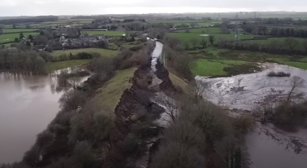
This causes of this failure are not yet clear. In general, possible explanations include a slope failure of the embankment, seepage through the structure leading to piping failure or overtopping (perhaps because the structures controlling the water level were not effective). It is going to be important to understand what happened at this site as it could have implications for other sections of the canal.
It is also interesting to note that the sides of the canal around the breach also failed. There’s a nice tweet showing footage from Peter White that captures this:-
These smaller landslides are mainly rotational failures of the inner faces of the embankment, driven by rapid drawdown of the water level (they can also be seen in the drone footage). These failures will make the remediation of the main embankment failure more challenging.
The repair of this section of the canal is going to be long and expensive.