The Landslide Blog is written by Dave Petley, who is widely recognized as a world leader in the study and management of landslides.
Back in 2022, I wrote (on the old site) about a landslide that occurred on 1 September that year, a failure that is now known as the Huzhu landslide, in Qinghai Province, China. This landslide is the subject of a paper (Chen et al. 2025) in the journal Engineering Geology, which examines the failure mechanisms in loess that may have contributed to the event.
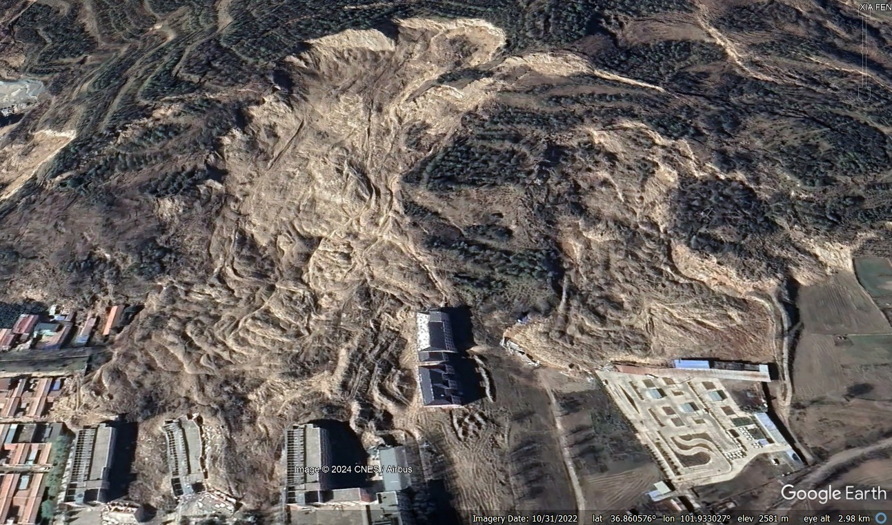
There is also now fantastic Google Earth imagery of the site, which is located at [36.8607, 101.9312]. This is a view of the landslide:-
This is a fascinating, huge and immensely complex landslide that is intriguing in many, many ways. There are in effect four different slope failures across the slope, all of which occurred on 1 September 2022. Chen et al. (2025) conclude, entirely reasonably, that the underlying cause is high pore water pressure that led to fluidisation of the loess. The landslide appears to have been associated with prolonged rainfall, rather than a short duration event.
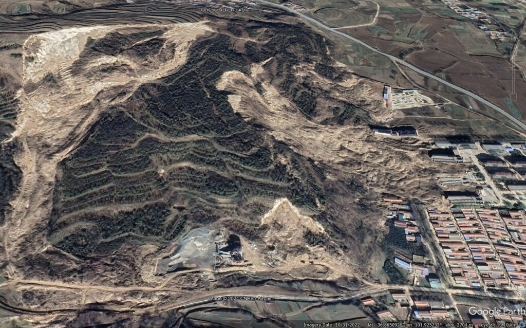
The major landslide here is a deep seated failure that has affected the whole slope. This is best illustrated with a slider that compares before and after images from Google Earth:-


The large rear scarp is clear near the top of the image – the whole slope below this has failed and deformed in a very large-scale, deep-seated translational failure. This can best be seen in the deformation of the road at the toe of the slope on the left of the image above, but clearer in the one below:-
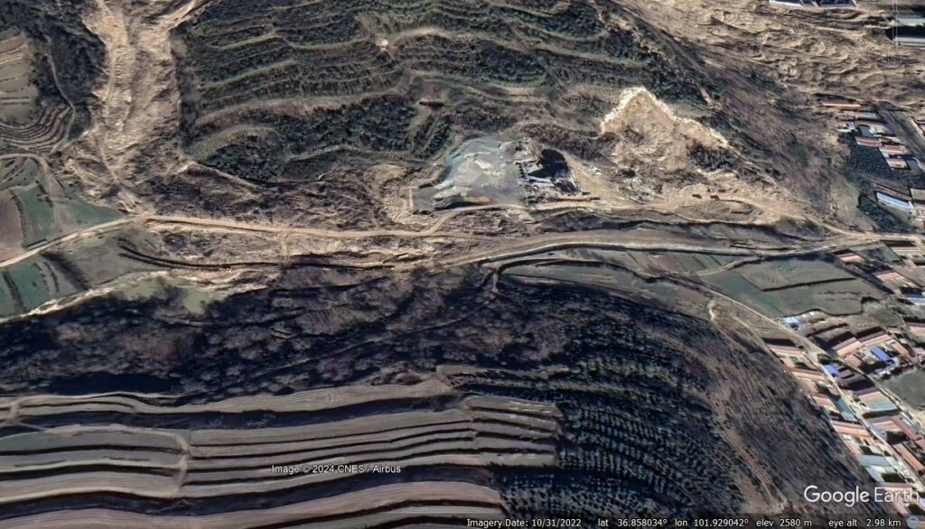
A temporary road has been built along the alignment of the original road to provide access to the facilities on the right side of the image. The original road has moved about 40 metres.
And then there are three other, much more mobile failures. One, the largest, originates from the area of the rear scarp and has flowed down the flank of the deep-seated landslide.
The second, which has caused far more damage, has flowed from the main landslide mass. This can be seen on the left side of the image below:
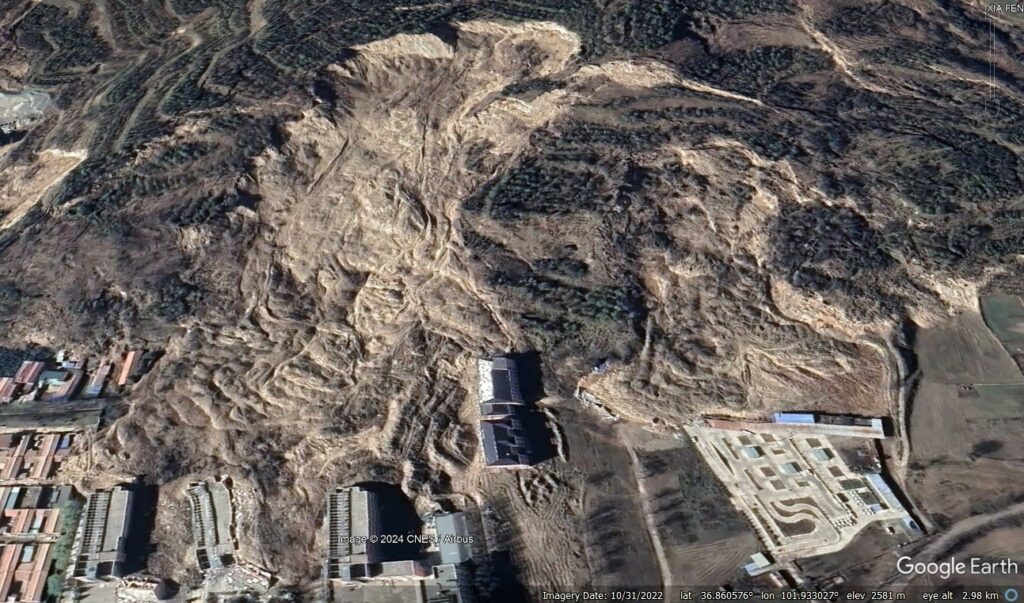
This is a classic fluidised loess landslide. Four people died in their houses on 1 September 2022 – this is the most likely culprit.
The final landslide occurred on the right side of the image above, a smaller but still very mobile, fluidised loess landslide. This occurred in an area that had previously been both quarried and had suffered slope failures. Imagery from 2017 shows significant distress in this part of the slope:-
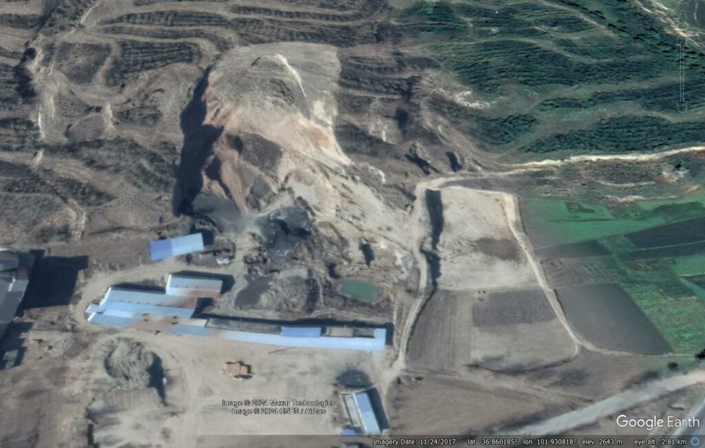
Chen et al. (2025) suggest that these fluidised slides occurred because local pore water pressures became extremely high. This is fair, of course. I would also contend that deformation during the initial, deep-seated failure was highly unevenly distributed, which may have created areas in which the structure of the loess was under additional loads. This is likely to have been the case in the rear scarp area, for example, or where there had been a previous failure.
The Google Earth image above shows that managing this slope in the long term is extremely difficult. Large-scale engineering works are unavoidable if the houses and infrastructure at the toe of the slope is to be protected in the long term.
Reference
Chen, Y., Wang, F. et al. 2025. Localised fluidisation in a giant loess landslide,
Engineering Geology, 344, 107854. https://doi.org/10.1016/j.enggeo.2024.107854.

