
The Landslide Blog is written by Dave Petley, who is widely recognized as a world leader in the study and management of landslides.

In recent days, the dedicated group of landslide scientists that tries to understand large events has been focused on the dreadful Glacial Lake Outburst Flood (GLOF) that caused such high levels of loss in Sikkim on 4 October 2023. The hypothesis has been that the breach of the moraine dam was triggered by instability in the banks of South Lhonak lake, with failure initiating a displacement wave that overtopped the dam.
This has been greatly assisted by the collection of high resolution satellite imagery of the site. Loyal reader Bretwood Higman (Hig) has looked at epochs of Planet Labs imagery leading up to the events of 4 October, and has compiled this animation of precursory deformation of the moraine to the north of South Lhonak lake:-
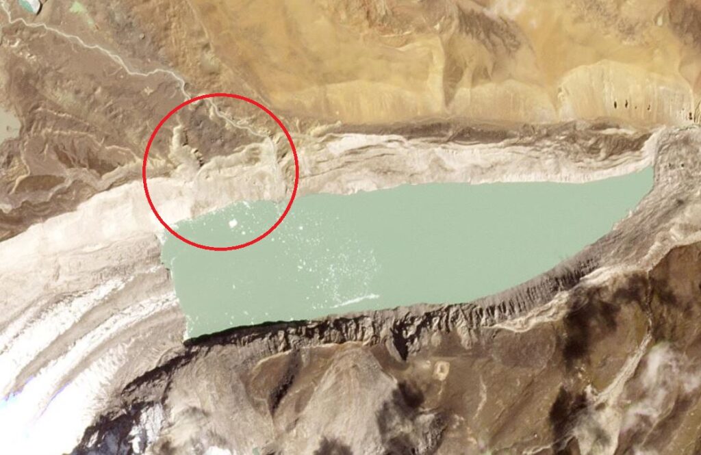
The area of interest is in the northwest of the image, close to the Planet logo. The extension of active deformation is apparent. I have highlighted this on the Planet Labs image below, captured on 26 September 2023:-
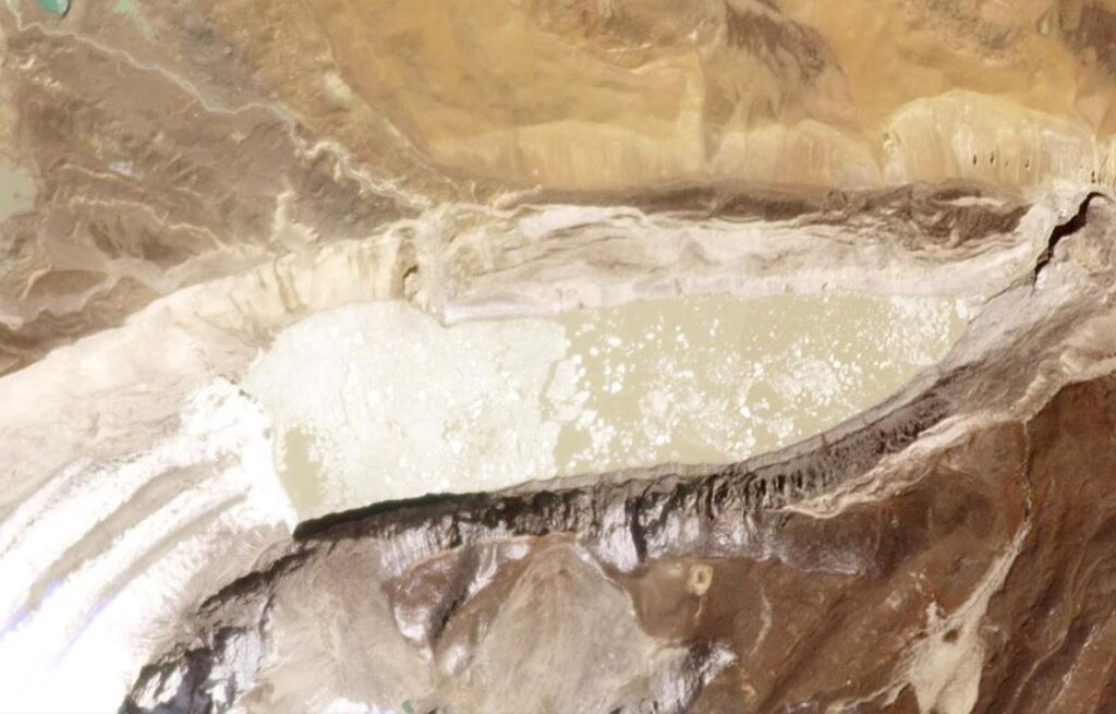
The image below, from 9 October 2023, shows how much material has been lost to landslides in this area:-
The ever impressive Dan Shugar has been looking at this area in detail, and has posted a thread on Twitter that is very interesting:-
Dan also has a Twitter thread about the trail of destruction that the flood induced, and the way in which it induced further landslides downstream due to undercutting of the river banks:-
It is worth reading the full set of posts in the thread.
Reference
Planet Lab PB 2023. Planet Application Program Interface: In Space for Life on Earth. San Francisco, CA. https://www.planet.com/