The Landslide Blog is written by Dave Petley, who is widely recognized as a world leader in the study and management of landslides.

Yesterday, I posted about the landslide disaster that struck Malalak in Sumatra at the end of November 2025. Unfortunately, that is just a tiny component of the catastrophe that has occurred in this part of Indonesia.
The BGS has used imagery released under the Disaster Charter to map landslides triggered by this event in Sumatra – their map shows a lower estimate of 4,326 landslides, but this is a massive underestimate:-
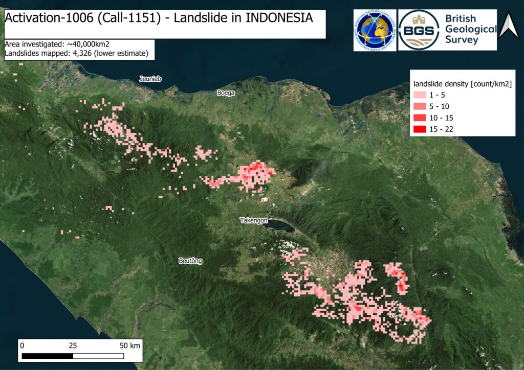
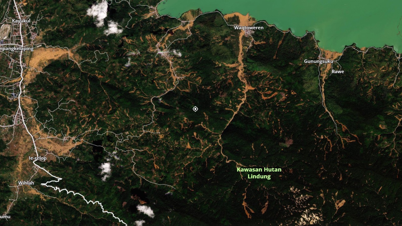
This is a dramatic image, and the BGS have done a great job to compile this map, but it covers just a small part of the affected area (Malalak is not in this part of Sumatra), and the mapping does not capture all of the landslides. For example, the southern banks of Takengon Lake, in the centre of the image, has no mapped landslides. However, this is how that area looked on the 30 November 2025 Planet Labs PlanetScope satellite image (the centre marker is at [4.57347, 96.87513]:-

This is a classic situation that I have described repeatedly in recent years – intense rainfall triggering hundreds of thousands of shallow landslides, which then form channelised debris flows. Take a look at the area on the immediate banks of the lake. This is this area as of 28 October 2025 and on 29 November 2025:-


Note the devastation that the channelised flows have inflicted on the communities. This pattern is replicated over a massive area of Sumatra. I wonder if this is the largest landslide event on record in terms of the number of individual failures, surpassing even Cyclone Gabrielle in New Zealand.
Loyal reader Alasdair MacKenzie kindly highlighted that there is some footage of the debris flows at Malalak on social media:-
Acknowledgement
Thanks as always to Planet Labs (2025) for their amazing imagery.