
The Landslide Blog is written by Dave Petley, who is widely recognized as a world leader in the study and management of landslides.

Whilst I was skiing in the French Alps last week, there were a couple of significant landslides. The highest profile event was the vast and intriguing landslide at Niscemi in Sicily (located at [37.14176, 14.38524]), which is a failure on a very large scale. The rear scarp is about 1.2 km long, for example.
In terms of loss of life, the more consequential event occurred at the Rubaya coltan mine complex in the Democratic Republic of Congo on 28 January 2026 (approximate location is [-1.55938, 28.88349]). Reuters has a good report about this event – obtaining good information is very challenging as the area is not controlled by the government. The mining news site Discovery Alert reports that at least 227 people were killed and 20 were injured, but further people were thought to be buried in the debris. It is likely that the final death toll will not be determined.
This is the second massive landslide at the Rubaya complex in less than a year – a landslide on 19 June 2025 is thought to have killed over 300 people.
APT has a video on Youtube that apparently shows the aftermath of the landslide at Rubaya:-
This is a still from that video:-
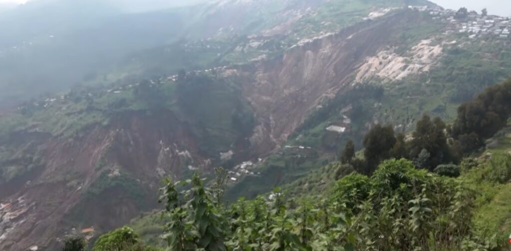
Assuming that the landslide is the large area on the centre right of the image, it is easy to see how mining on the lower slope can trigger instability. Note also the area on the left of the image, where there is a large tension crack across the slope.
As yet, satellite imagery of the Rubaya area is not available since the landslide, so it is not yet possible to identify the exact location of the failure. I will keep an eye on this over the coming days.