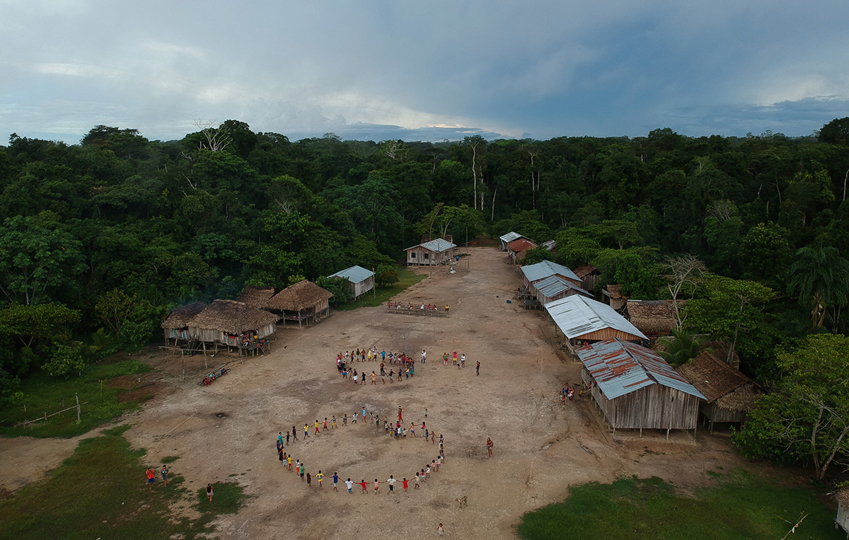

Located in the western portion of the Brazilian Amazon, Terra Indígena do Vale do Javari (Valea do Javari Indigenous Land) is one of the world’s largest continuous patches of pristine tropical rainforest and harbors the world’s highest concentration of noncontacted Indigenous peoples.
The region gained global attention in 2022 with the assassinations of Brazilian anthropologist Bruno Pereira and British journalist Dom Phillips. The murders revealed the increasing pressure locals face in preserving the environmental and cultural integrity of their way of life and staving off the organized crime that often accompanies illegal logging and poaching in the region.
Wildfires are contributing to this pressure, and researchers are using innovative mapping techniques to try to understand their dynamics within the territory and its surroundings. A team of biodiversity and remote sensing experts based in Brazil and the United States will present some of their findings on 16 December at AGU’s Annual Meeting 2025.
Mapping wildfires around the still-pristine region may help identify priority areas for conservation and inform policy planning in forest protection, said coauthor Gabriel de Oliveira, a remote sensing and vegetation dynamics researcher with the University of South Alabama.
“Our goal was to understand whether the forest’s natural resistance to fire has held firm over 4 decades and how pressures in the surrounding landscape might be changing that,” said de Oliveira.
“Vale do Javari is certainly a highly threatened region because it is far from everything and very much at the mercy of organized crime.”
The team used MapBiomas Fire Collection data, which record the annual and monthly mapping of burned areas in Brazil from 1985 to 2024. They supplemented these data with additional satellite-derived thermal information to map where fires have occurred since 1985 inside Vale do Javari and surrounding buffer zones extending 50, 100, and 200 kilometers outward.
Researchers who study fire in the Amazon see this ongoing study as a valuable brick in the growing wall of knowledge about fire in protected lands. “They’re using MapBiomas data to see what has burned and how often it burned,” said Ane Alencar, science director at the Amazon Environmental Research Institute (IPAM Amazônia).
“Vale do Javari is certainly a highly threatened region because it is far from everything and very much at the mercy of organized crime. Any tool or study that reveals the threats facing that Indigenous land is very valuable, so it looks quite interesting,” she added.
Ultimately, de Oliveira hopes the new research will help inform conservation strategies in the area. “If we could detect where fire is already recurring or creeping closer, we could begin to identify zones that deserve urgent attention from policymakers,” he said.
Finding Patterns
Fires have become a growing concern in isolated Indigenous lands across the Amazon.
According to a recent analysis by the Observatory of Isolated Indigenous Groups, the past 25 years of satellite data show that in 2024, more than 10,000 hot spots (burn scars) were detected in Brazil alone. The analysis was conducted between January and September across 67 Indigenous territories and protected areas with isolated groups and represents both a 221% increase above the long-term average and a roughly 50% increase from its previous peak in 2010.
The landscapes of Indigenous and protected areas are typically less disturbed compared with the rest of the Amazon, so an abrupt spike in hot spot activity signals processes that researchers say deserve close attention.
A similar pattern emerges when considering not just the number of hot spots but their scope, the total area burned within Indigenous lands across Brazil. For most of the past decade, that figure remained around 1.5 million hectares per year. But in 2024, during one of the most severe droughts on record, total burned area inside Indigenous territories jumped to about 3 million hectares, an increase of 81%, according to IPAM Amazônia. Nearly a quarter of all area burned in the Amazon in 2024 occurred within Indigenous territories.
For researchers who study territories such as Vale do Javari, these trends are troubling not only because they indicate rising fire pressure but because Indigenous lands play critical roles in ecology and public health. A 2023 study showed that Indigenous territories act as major buffers against wildfire smoke, for instance, preventing large amounts of particulate pollution from reaching more densely populated areas nearby. A 2025 analysis identified Vale do Javari as one of Brazil’s most significant hot spots for future species discovery, meaning that habitat loss there could extinguish biodiversity that scientists have not even documented yet.
Those broader patterns align with what de Oliveira and his collaborators are observing on the ground and in satellite records. Their analysis showed that the forest interior of Vale do Javari remains relatively resistant to burning, but the surrounding landscape has changed markedly. In the 200-kilometer buffer zone, annual burned area has risen sharply in recent decades, with some of the highest values on record appearing in the past 2 years. “The signals are strongest at the edges,” de Oliveira said. “You see repeated fire in certain locations, and those are the places where degradation begins.”
To detect degradation that might not yet appear in traditional deforestation maps, the team also examined thermal anomalies from Landsat and Sentinel data. Deviations in surface temperature, de Oliveira said, can indicate canopy opening or drying under the trees. “A healthy, closed canopy regulates energy very efficiently,” he explained. “But when the canopy thins or fire has passed through multiple times, the ground heats up more. That thermal signature tells us something is happening below the leaves, even before clear-cutting takes place.”
The group validated some of these signals with fieldwork in regions just outside the Indigenous territory. They have not yet worked inside Vale do Javari itself.
The researchers found that small paths, recurring burn scars, and subtle canopy disruptions appear to align with known routes used for illegal logging, poaching, and other forms of encroachment. “It’s not the classic pattern of a large clear-cut,” said de Oliveira. “It’s a much slower, quieter process—fire escaping from pasture or burning the same patch of forest two or three times until it loses its resilience.”
Research as a Conservation Tool
“Repeated fire—especially combined with extreme drought—moves the system toward collapse.”
The gradual erosion of forest health is one of the team’s main concerns. “If a forest burns once, it can recover,” de Oliveira said. “But repeated fire—especially combined with extreme drought—moves the system toward collapse. You may not see deforestation immediately, but the structure and function of the forest are already changing.”
De Oliveira and his fellow researchers hope their maps will serve as a tool for early intervention, particularly in the buffer zones with the highest fire risk. The next step, de Oliveira said, is to work with local and federal agencies to establish targeted conservation strategies that extend beyond Indigenous land boundaries.
“Protection cannot stop at the line on a map,” he added. “We need buffer zone policies and monitoring systems that recognize how these landscapes are connected. Vale do Javari is still a stronghold, but the data show that what happens around it will determine its future.”
—Meghie Rodrigues (@meghier.bsky.social), Science Writer