Starting this week, the National Oceanic and Atmospheric Administration has incorporated its highest-resolution model of this country’s waterways into its flow forecasting efforts to improve predictions of potentially devastating floods.
“For the first time on a continental scale, we’re modeling the entire nation’s stream network.”
“For the first time on a continental scale, we’re modeling the entire nation’s stream network,” Thomas Graziano, director of NOAA’s new Office of Water Prediction at the National Weather Service (NWS), told Eos.
Previously, NWS was in the dark about many of the nation’s water catchments, Graziano continued, because the agency only issued forecasts for locations associated with 4000 of the 8000 stream gauges operated by the U.S. Geological Survey (USGS) to monitor water flow. With a powerful new supercomputer—the administration’s first foray into high-performance computing—the new model can issue forecasts on 2.7 million more locations across the contiguous United States, using data from all 8000 of USGS’s stream gauges.
Flood Hazard
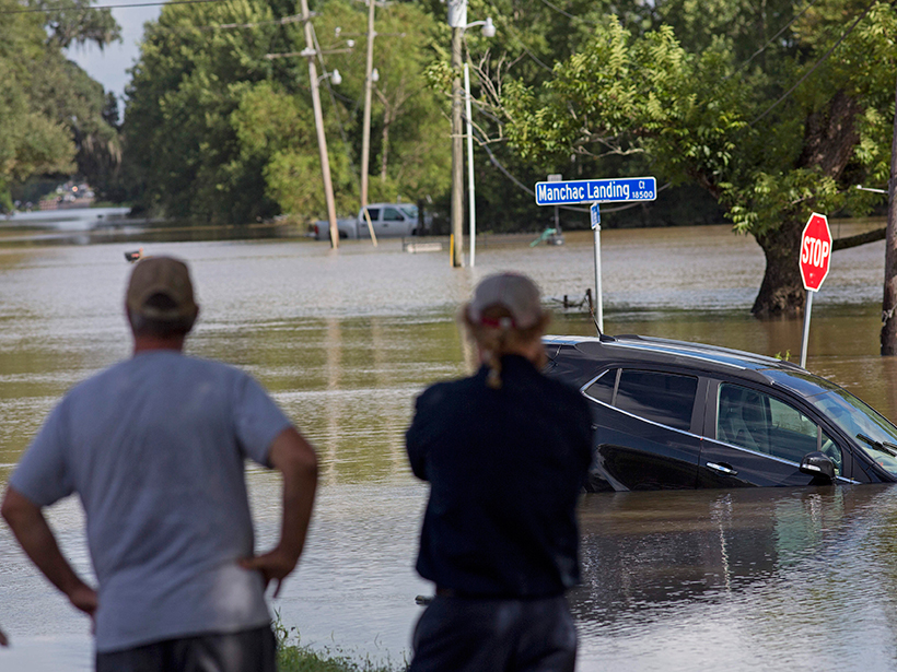
Floods killed 176 people in the United States in 2015. As of 26 June, 58 people have died in floods this year, and an additional 11 deaths have been confirmed this week from severe floods in Louisiana.
“With a changing climate, we’re experiencing more prolonged droughts and a greater frequency of record-breaking floods across the country, underscoring the nation’s need for expanded water information,” said Louis Uccellini, director of NWS. “The National Water Model will improve resiliency to water extremes in American communities. And as our forecasts get better, so will our planning and protection of life and property when there’s either too much water, too little, or poor water quality.”
Local Forecasts
The new model offers “insight into the streamflow at all these locations down to the smallest neighborhood-scale streams,” Brian Cosgrove, the National Water Model’s project leader, told Eos.
The new model takes “river forecasts all the way to the coasts.”
The water model automatically ingests data from NWS weather models, which take into account local weather forecasts and precipitation data. The model’s short-range forecast configuration runs on an hourly basis. It spits out water flow predictions in hourly “snapshots” covering the entire continental United States, extending as far as 15 hours into the future. The medium- and long-range forecast configurations run less frequently but provide forecasts extending as far as 30 days in advance. This will help local NWS offices to provide the best possible forecasts to surrounding neighborhoods, Graziano said.
To a layperson, this means that “we’re going to provide water-predictive guidance at the street level,” Graziano said.
In addition, the new model takes “river forecasts all the way to the coasts,” Graziano added. More than 100 million people live along coastlines in the United States, he said, and now they’ll get river forecasts.
—JoAnna Wendel, Staff Writer
Citation:
Wendel, J. (2016), New flood model offers national streamflow coverage, Eos, 97, https://doi.org/10.1029/2016EO057853. Published on 19 August 2016.
Text © 2016. The authors. CC BY-NC-ND 3.0
Except where otherwise noted, images are subject to copyright. Any reuse without express permission from the copyright owner is prohibited.