Editors’ Highlights are summaries of recent papers by AGU’s journal editors.
Source: AGU Advances
Aerosols are tiny particles suspended in the air. They can cool the climate by making clouds brighter and longer-lasting. Scientists rely on satellite observations to measure the aerosol-cloud interaction, but distinguishing human impacts from natural weather patterns remains a challenge.
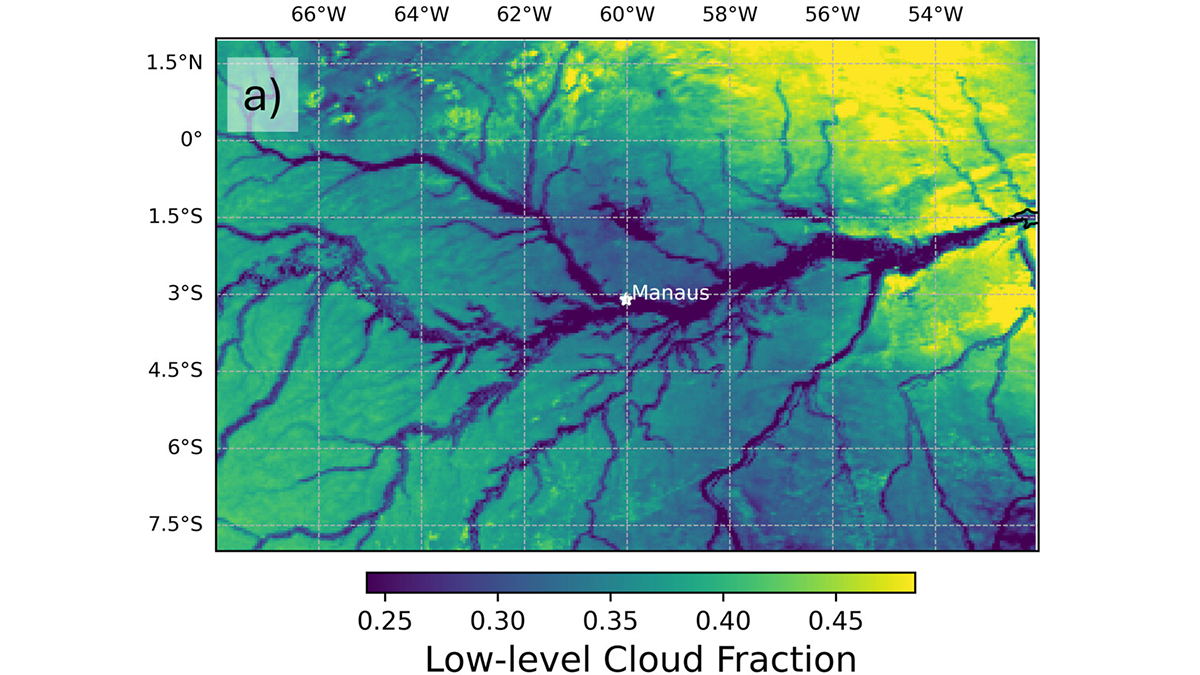
Christensen et al. [2026] reveal that the Amazon River itself creates cloud patterns that mimic the signatures of pollution. Using 15 years of satellite data, researchers found that the temperature difference between the cool river and the warm land drives a local “river breeze” circulation. This natural process creates clouds with smaller and more numerous water droplets, which exhibit very similar features that satellites look for to identify pollution. Consequently, clean clouds over the river can appear polluted in satellite datasets. These findings highlight the critical need to account for local geography and natural weather patterns to accurately assess how human activities are influencing Earth’s climate.
Citation: Christensen, M. W., Varble, A. C., Tai, S.-L., Wind, G., Meyer, K., Holz, R., et al. (2026). The Amazon River-breeze circulation limits detection of aerosol-cloud interactions in warm clouds. AGU Advances, 7, e2025AV002188. https://doi.org/10.1029/2025AV002188
—Xi Zhang, Editor, AGU Advances