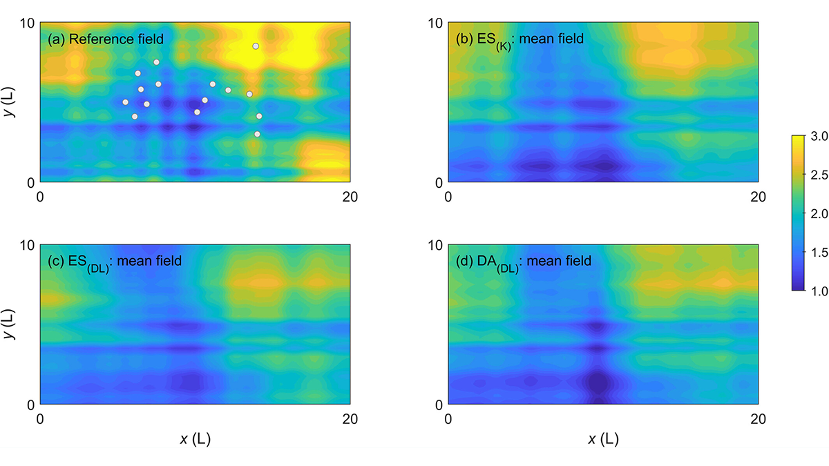
Major Earth system processes are non-linear and non-Gaussian, and so should be our data assimilation approaches.
Editors’ Highlights

Posted inEditors' Highlights
Barrier Islands Are at the Forefront of Climate Change Adaptation
Coastal evolution modeling sheds light on the impacts of coastal development and adaptation decisions on barrier islands in the era of sea-level rise.

Posted inEditors' Highlights
When It Rains, It Pours!
Water that falls on a forest canopy during rainfall events reaches the ground at focused locations called “pour points”. This insight has a major impact on how we view hydrologic processes on the ground.
Posted inEditors' Highlights
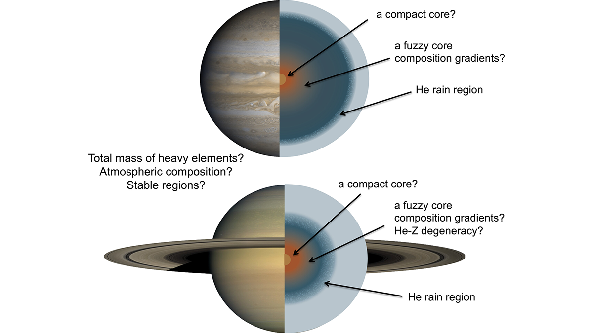
Gas Giants with Fuzzy Cores
New measurements of Jupiter and Saturn show that both planets have dense cores that are gradational (fuzzy) and large, rather than small and compact.

Posted inEditors' Highlights
When You’re a Wet(land), You’re A Wet(land) All the Way
Wetlands and their methane emissions require careful consideration for incorporation in Earth system models with many advances made over the past 30 years.

Posted inEditors' Highlights
Salty Soil May Release Methane on Mars
Through roving and drilling, Mars Curiosity Rover may be breaking up the ground’s salty, hardened soils that seal methane, possibly causing a temporal, local methane spike.

Posted inEditors' Highlights
Tuning Improves High-Resolution Climate Simulations
Tuning parameterizations of turbulent mixing and of the fall velocity of precipitation and cloud ice alleviates long-standing biases in climate simulations.
Posted inEditors' Highlights
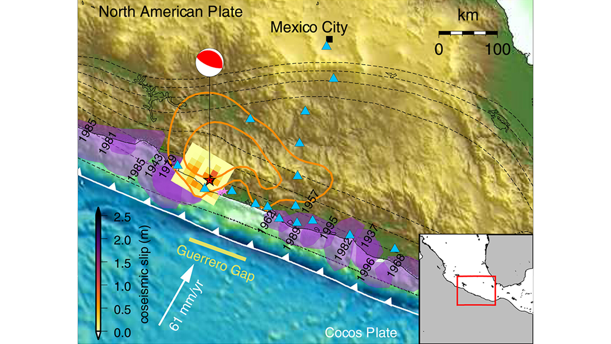
Forecasting Earthquake Ruptures from Slow Slip Evolution
A new generation of physics-based models that integrate temporal slip evolution over decades to seconds opens new possibilities for understanding how large subduction zone earthquakes occur.
Posted inEditors' Highlights
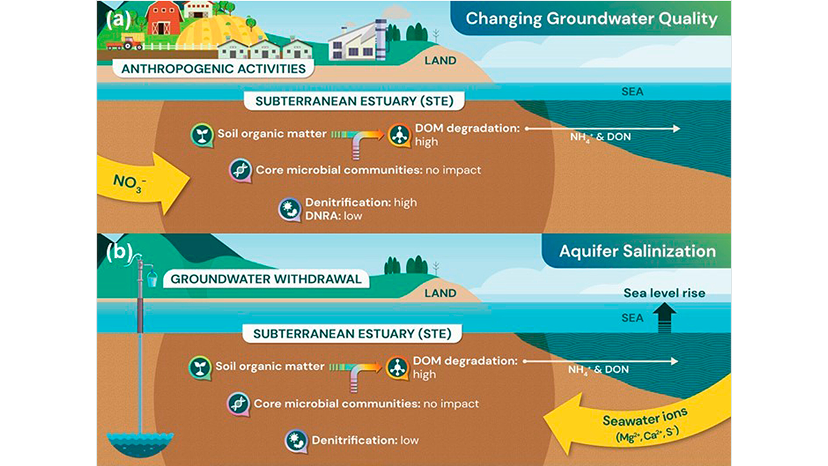
The Unexplored Microbial Life in Subterranean Estuaries
A new study reveals that microbial life in subterranean estuaries is threatened by anthropogenic activities.

Posted inEditors' Highlights
How Earthquakes Grow from a Tiny Fracture to a Catastrophic Event
State-of-art numerical simulations illustrate how a small-scale shear instability can become a giant earthquake in a manner that is consistent with seismological observation.