In the next in our series of Editors’ Vox that discovers what interesting things AGU journal editors do when they’re not reviewing manuscripts, Thanos Papanicolaou, an Associate Editor for Water Resources Research, describes his field experiments to measure soil health.

The infamous “Dust Bowl” of the 1930s on the Great Plains of the United States is a good example of how human activity in tandem with climate can threaten the sustainability of our ecosystems. Intrusive farming activities—stemming from poor understanding of ecosystem processes occurring above and below the ground—led to severe dust storms, which were exacerbated by droughts. Tens of thousands of farmers and their families were displaced.
Based on visual evidence, new farming techniques seemingly led to an end of the Dust Bowl era. However, hidden within the soil is a story of what both past and present land management practices, in conjunction with the climate, have done and continue to do to the health of our soils and water bodies.
My research seeks to unravel how past human activities and climate have led to the current state of soils used for agriculture, how current activities continue to affect the soils, and how future climate is likely to interact with human activities to affect future soil states.
Typical methods for measuring soil health—such as extracting and analyzing soil cores—may not be as effective as believed because they do not account for variations in landscape properties (such as soil type and landscape slope) or for changes in land management. My team and I, along with collaborators from the NSF’s Critical Zone Observatory for Intensively Managed Landscapes, decided on a novel approach to merge field observations with coupled watershed erosion and organic matter cycling models to trace fluxes of water, sediment, and nutrients across heterogeneous landscapes and into stream networks.
The approach allows us to incorporate previously neglected or poorly understood processes such as the transport of soils enriched in nutrients along a landscape, where the enrichment level is dependent on the management, topography, soil texture and climatic forcing. By capturing these missing processes, we are better able to predict the net fluxes across space and time, and therefore get a better idea of how soil nutrient concentrations are changing across the landscape.
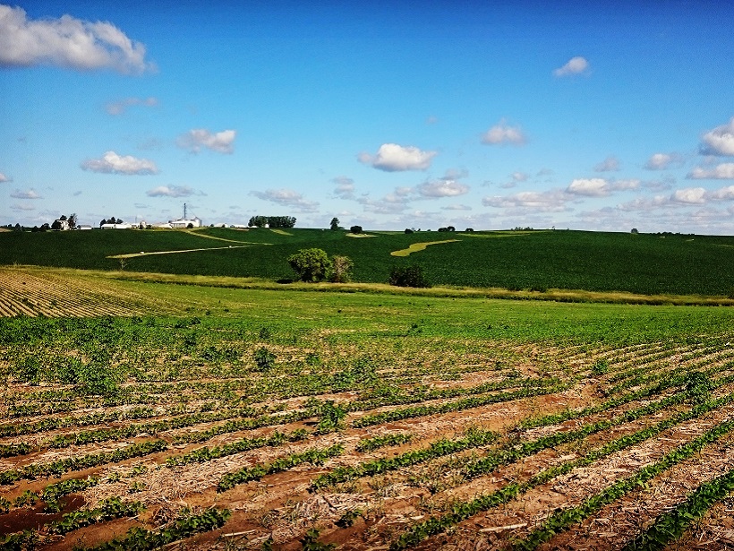
Our field observations have been carried out at sites in the U.S. Midwest known for intensive agriculture and high crop production including in Iowa, Illinois, Minnesota and North Carolina. They involve state-of-the-art rainfall experiments designed specifically to mimic natural rainfall effects on landscapes with different soil types, management, and topographic properties. A typical experiment is shown in this video at Clear Creek in Iowa.

In each set of experiments, we simulate storms of different rainfall intensities on field plots approximately 7.5 meters long by 2 meters wide. The simulators are set at a height of 2.5 meters to allow the raindrops to reach terminal velocity before impacting the soil, just as natural raindrops would. The simulators are also calibrated to mimic the natural rain drop size distributions. Each plot has a collection point at the outlet, which consists of a weir with a v-shaped notch where flow and sediment are measured.
We have also used tracer measurements to determine the travel speeds of the water flow and soil particles moving around the plot, for example using radio-frequency identification of tagged particles and dye tracing.
At the same time, we monitor changes in the soil surface during an experiment using digital laser-scan measurements and photogrammetry. Most measurements are made continually in time to capture the temporal changes in fluxes as the experiments progress.
We also take samples from the experiment sites back to the laboratory to determine soil size distributions, soil flux rates, nutrient concentrations, and enrichment of transported material. The processed soil surface scans also provide measures of erosion and depositional patterns on the plots.
Using all this information obtained from field experiments, we have been able to improve our models to better mimic the natural processes occurring across the landscape. In turn, we can use the models to better understand the history of what we are now observing on the landscape and forecast how different practices are likely going to affect the state of the soils under future climate conditions.
Our findings so far indicate that nutrient fluxes and storage levels can vary greatly from accepted norms when variations in soil type, topography, and management are considered. The investigations revealed that upslope areas continued to be depleted in nutrients long after the end of the Dust Bowl era because of enhanced erosion stemming from agricultural practices from 1935 to 1987. However, these practices, and the erosion they caused, led to downslope areas having better soil health because they received nutrients washed from higher ground. Although past land management practices have taken their toll, current practices have led to an improvement in soil health with organic matter levels recovered to about half the levels in the 1930s.
Like humans, landscapes have memory, which is not easily forgotten. Past activities set the stage for the trajectory of ecosystems, and present activities continue to dictate where they are headed. Uncovering both the visible and hidden stories of the landscape will hopefully contribute towards a more sustainable future for these critical landscapes.
—Thanos Papanicolaou, Associate Editor for Water Resources Research and Department of Civil and Environmental Engineering, The University of Tennessee at Knoxville; email: [email protected]
Citation:
Papanicolaou, T. (2017), Stories in the soil, Eos, 98, https://doi.org/10.1029/2018EO084055. Published on 17 October 2017.
Text © 2017. The authors. CC BY-NC-ND 3.0
Except where otherwise noted, images are subject to copyright. Any reuse without express permission from the copyright owner is prohibited.