Source: Geophysical Research Letters
In remote and tectonically complex regions like the Arctic, geologic and paleomagnetic data are often too limited to reconstruct the tectonic evolution of the continents and adjacent ocean basins. For example, scientists disagree on the history of the modern Amerasia Basin, which stretches from Ellesmere Island to the East Siberian Sea. Previous studies have proposed the existence of an earlier basin, called the South Anuyi-Angayucham Ocean, in that region, but too few data have been collected to adequately reconstruct its history.
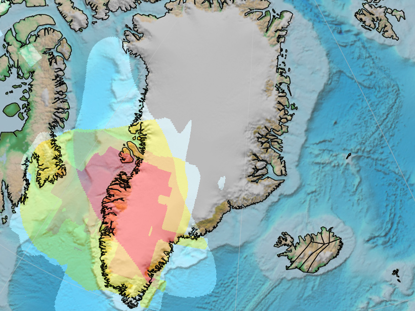
Now Shephard et al. have found evidence of this extinct ocean basin far below Greenland. Using independent tomography models and data derived from the European Space Agency’s Gravity Field and Steady-State Ocean Circulation Explorer (GOCE) satellite, the authors identified a seismic and gravity anomaly in the middle mantle between 1000 and 1600 kilometers depth, which they interpret as the remnants of ancient oceanic slabs subducted during the Mesozoic.
The presence of ancient slab material at this depth and in this location, the authors argue, is consistent with the presence of the South Anuyi-Angayucham Ocean during the Mesozoic. Using a method to calculate slab sinking rates—which they found to be in agreement with global studies of 1.2 ± 0.3 centimeters per year—and the mantle anomaly’s location, the authors traced back the anomaly to to the closure of this basin. This calculation narrows the timing of subduction to the Late Jurassic to Early Cretaceous—a period of extensive Arctic plate reorganizations as well as extensive magmatism.
The origins of this magmatism are poorly understood, but the authors say that their new findings could shed some light. A region known as the High Arctic Large Igneous Province reveals signals that may be related to the interaction of the ancient slab material and a rising mantle plume. In particular, the authors note that rocks that erupted close to the presumed location of the ancient paleo-Arctic subduction zone have geochemical signatures indicative of arc-mantle sources. This suggests that the igneous rocks incorporated significant amounts of slab-related mantle from the downgoing slab—a finding that could finally explain the origins of mysterious and variable High Arctic magmatism signatures. (Geophysical Research Letters, doi:10.1002/2016GL068424, 2016)
—Terri Cook, Freelance Writer
Citation:
Cook, T. (2016), Evidence of an extinct ocean basin detected beneath Greenland, Eos, 97, https://doi.org/10.1029/2016EO052969. Published on 25 May 2016.
Text © 2016. The authors. CC BY-NC-ND 3.0
Except where otherwise noted, images are subject to copyright. Any reuse without express permission from the copyright owner is prohibited.