Source: Water Resources Research
When wind blows across a lake’s surface, it pushes the water downwind, inducing periodic currents below the surface (called “internal waves”), which are characterized by vertical movements on the order of 5–10 meters every day. This motion is fundamental to redistributing oxygen, heat, and nutrients that support living organisms, but its quantification is difficult when lakes are surrounded by mountains or other topographical features that make wind patterns more complex.
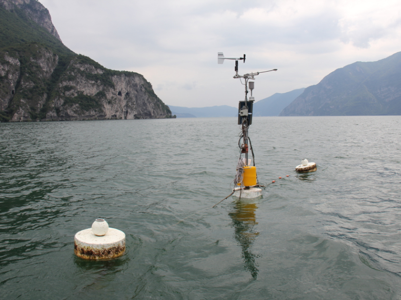
Typically, researchers use just one or a handful of wind-monitoring stations to estimate how wind speed affects the currents of a given lake, an approach fraught with error when wind patterns are highly variable due to local topography. Previous studies have used computer models to simulate the wind-water dynamics of very large lakes surrounded by relatively flat terrain, but none have yet tackled smaller lakes in more mountainous regions. Now Valerio et al. present an improved method for filling that gap by creating a high-powered computer simulation of the movement of air over mountains and across a lake’s surface.
The model is based on Lake Iseo, a 256-meter-deep, 61-square-kilometer lake near Milan, Italy, with an island at its center. To simulate the atmospheric conditions typical of many pre-Alpine regions, the team collected exceptionally detailed meteorological and water temperature data from six monitoring stations at the lake in July 2010. Then they fed those data into a topographic and hydrodynamic simulation of the wind and water flow, noting how wind channeled through the 1800-meter-high mountains bordering the glacial valley and how it affected the lake’s currents.
The simulation of 1 day took 4 days of processing by a supercomputer—far too much computing power to make the technique feasible for long-term studies, the authors note. But the analysis of the wind distribution allowed the authors to suggest general criteria that may help scientists to check the accuracy of simpler measurements and decide where wind-monitoring stations should be located. (Water Resources Research, https://doi.org/10.1002/2016WR020335, 2017)
—Emily Underwood, Freelance Writer
Citation:
Underwood, E. (2017), How does wind push water?, Eos, 98, https://doi.org/10.1029/2017EO076185. Published on 22 June 2017.
Text © 2017. The authors. CC BY-NC-ND 3.0
Except where otherwise noted, images are subject to copyright. Any reuse without express permission from the copyright owner is prohibited.