Seasonal snow cover extends over 46,000,000 square kilometers, or about 31% of Earth’s land area each year. This snow is a critical source of water, and it has major positive and negative economic effects: Not only does it support agriculture, recreation, and other aspects of local economies, but as a natural hazard it can also cause great harm.
More accurate measurement of the volume of water contained in the world’s snowpacks is at the top of the “wish list.”
Satellite remote sensing, with its potential for global coverage and frequent measurements, is highly suited to studying Earth’s dynamic seasonal snow cover. Although many remote techniques for mapping snow cover extent are well established (e.g., efforts led by NASA and the U.S. National Ice Center), more accurate measurement of global snow-water equivalent (SWE), which is the volume of water contained in the world’s snowpacks, is at the top of the “wish list.” Current global SWE products are challenged, for example, by areas with forests or complex terrain.
Snow remote sensing experts agree that no single remote sensing technique can accurately measure SWE under the wide variety of conditions found across the globe. However, multiple techniques, using sensors that detect radiation in different parts of the electromagnetic spectrum, from the visible to the microwave, are sensitive to SWE. Thus, a combination of sensing techniques coupled with in situ measurements and modeling is a promising approach to monitor SWE globally.
The campaign was designed to quantify when and why each technique reached its limit.
NASA has embarked on a multiyear project called SnowEx to inform the design of a space mission to improve global measurement of SWE.
As much as half of global snow-covered areas are forested, and forests have confounded our measurement attempts of SWE for decades. Thus, the focus of SnowEx in year 1 (2016–2017) was the collection of airborne and ground-based observations in forested areas. We used these observations to challenge the accuracy of various sensing techniques to measure snow in the presence of forest cover. The campaign was designed to quantify when and why each technique reached its limit.
Motivation and Strategy
The societal impacts of seasonal snow cover are immense. In California, for example, snowmelt supports an agricultural industry worth billions of dollars each year. In the western United States, snow-related recreation is also a multibillion dollar per year business. The climatological significance of snow cover is truly far reaching: Because of its highly reflective nature, snow cover modulates the land surface energy balance on local to planetary scales and is also an indicator of climate change.
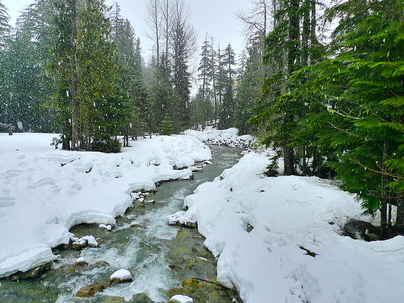
To assess existing capabilities for measuring SWE in forested areas, researchers selected two forested areas in Colorado to examine thoroughly during the first year of the SnowEx project. The primary study site, Grand Mesa in western Colorado (Figure 1), offered excellent conditions for the year 1 forest challenge: The site offers a variety of forested and open terrain, and the forest density and the SWE follow natural gradients. The secondary site, Senator Beck Basin in southwestern Colorado, was added to obtain data from a well-defined watershed to help address energy balance questions. As a bonus, it also featured complex terrain.

Snowy Fieldwork
Nearly 100 people, including students and senior scientists, participated in data collection in situ at the two selected sites during a February 2017 field campaign. U.S. government researchers from NASA, the National Oceanic and Atmospheric Administration (NOAA), the U.S. Forest Service, and the U.S. Army Cold Regions Research and Engineering Laboratory were joined by researchers from 25 different universities, some of whom hailed from outside the United States.
After a day of safety training and to learn consistent measurement techniques, study personnel made rigorously controlled measurements during each week of fieldwork. About 40 individuals took coordinated ground measurements each week in a variety of weather conditions during an intensive 3-week observation period that extended from 6 February through 26 February.

In conjunction with the SnowEx deployment, NASA, NOAA, and university researchers conducted the Great Lakes Winter Experiment 2017 (GLAWEX’17) in Wisconsin and the Upper Peninsula of Michigan from 26 February through 2 March.
GLAWEX’17 researchers made detailed lake ice measurements in small lakes in Michigan and on Lake Michigan in Green Bay, Wis., to investigate remote sensing signatures of snow on land versus snow on lakes. The measurements were designed to help validate and support lake ice classification algorithms dependent on satellite synthetic aperture radar (SAR) data.
Aircraft Remote Sensing
Five instrumented aircraft flew over the Colorado study sites during the intensive observation period, with nine different sensors operating in different parts of the electromagnetic spectrum, from the visible/near infrared and thermal infrared to the microwave regions. Instruments included SARs, lidar, multispectral and hyperspectral imagers, and infrared and video cameras.
Lidar and SAR were used to measure snow depth and SWE for comparison with ground measurements acquired before and after snowfall. The thermal infrared camera provided snow and forest canopy surface temperature. The visible/near-infrared sensors measured bidirectional reflectance and albedo needed for accurate energy balance modeling.
In Situ Measurements and Modeling
Overall, more than 30 instruments were deployed on the ground, including radars, microwave radiometers, spectrometers, lidar systems, GPS interferometric reflection systems, time-lapse cameras, and devices to characterize precipitation.
Approximately 100 ground measurement sites were distributed across the Grand Mesa and Senator Beck Basin study areas to capture a range of snow characteristics in varying canopies and snow depths/SWE across varying gradients.
Seven specialized weather stations provided surface weather, radiation, soil moisture, snow depth, and snow/soil temperatures. Snow pit measurements included full profiles of snow density, wetness, temperature, grain characteristics, specific surface area, and stratigraphy.
To support model development, SnowEx also included distributed observations of the snowpack energy balance, snowpack temperature profiles, and airborne and space-based observations of albedo and snow surface temperature.
Next Steps
The year 1 campaign kicked off NASA’s SnowEx project by collecting a new and unique multisensor data set that will be used, along with models, to guide the formulation of a future space mission targeting remote SWE measurement.
These efforts are all essential for designing a global system to assimilate remotely sensed snow data from multiple sensors.
The airborne and ground-based observations made in the first year of the SnowEx project will be used to develop algorithms for measuring SWE and also to test and evaluate multiple snow modeling and data assimilation frameworks for the estimation of global snow volume.
Researchers will use SnowEx data to benchmark current model performance, provide information to improve future model design, and assess error structures of various remotely sensed snow characteristics. These efforts are all essential for designing a global system to assimilate remotely sensed snow data from multiple sensors.
In year 2, the community is focused on analysis of the voluminous data from the year 1 campaign. The knowledge gaps identified by these analyses will be used to design SnowEx campaigns that are in the planning stages for the 2019 Northern Hemisphere winter and beyond.
A Unique Data Set
SnowEx is the most comprehensive snow remote sensing study of its kind to date. Its unique data set collected in 2017 will be mined for years to come.
All of the remote sensing and in situ data from SnowEx will be archived by and freely available through the NASA Distributed Active Archive Center at the National Snow and Ice Data Center.
Acknowledgments
We offer a giant thank-you to the dedicated team that made SnowEx possible and for support from NASA’s Terrestrial Hydrology Program.
Author Information
Edward Kim (email: [email protected]), NASA Goddard Space Flight Center, Greenbelt, Md.
Citation:
Kim, E. (2018), How can we find out how much snow is in the world?, Eos, 99, https://doi.org/10.1029/2018EO099939. Published on 01 June 2018.
Text © 2018. The authors. CC BY-NC-ND 3.0
Except where otherwise noted, images are subject to copyright. Any reuse without express permission from the copyright owner is prohibited.