
A National Academies report highlights challenges and opportunities in volcano science.
Science Updates
Posted inScience Updates
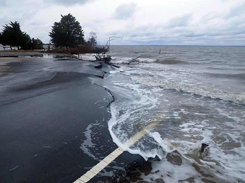
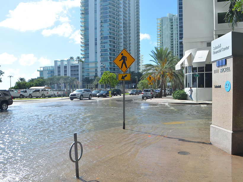
Sea Level 2017 Conference Looks to Coastal Sea Level Rise Impact
International World Climate Research Programme/Intergovernmental Oceanographic Commission (WCRP/IOC) Open Science Conference on Regional Sea Level Rise and Its Impacts; New York, New York, 10–14 July 2017
Posted inScience Updates
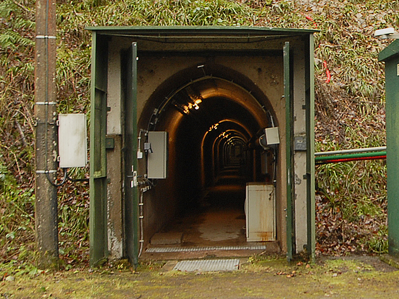
Recording Belgium’s Gravitational History
Instruments at Belgium’s Membach geophysical station set a new record for monitoring gravitational fluctuations caused by storm surges, groundwater fluctuations, and the Moon’s tidal pull.
Posted inScience Updates
Vetting New Models of Climate Responses to Geoengineering
The Seventh Meeting of the Geoengineering Model Intercomparison Project; Newry, Maine, 26 July 2017
Posted inScience Updates
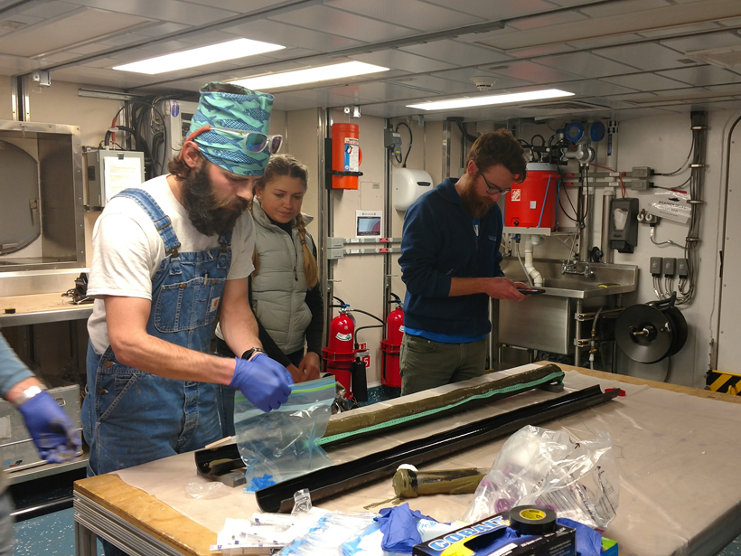
Exploring Methane Gas Seepage in the California Borderlands
Early-career scientists aboard the 2016 UNOLS Chief Scientist Training Cruise explored recently reactivated underwater methane seeps in the San Diego Trough.
Posted inScience Updates
Integrating Water Science and Culture for Urban Sustainability
Workshop on Water and Environmental Global Challenges: International Water Infrastructures and Security; Miami, Florida, 23–25 May 2017

Posted inScience Updates
Incorporating Observatory Data into Oceanography Courses
OOI Teaching with Data Workshops; New Brunswick, New Jersey, 19–21 May 2017 (chemistry) and 2–4 June 2017 (geology)

Posted inScience Updates
Exploring the Restless Floor of Yellowstone Lake
Yellowstone Lake, far from any ocean, hosts underwater hot springs similar to those on mid-ocean ridges. A research team is investigating the processes that drive the lake’s hydrothermal systems.
Posted inScience Updates
Ocean Circulation, Carbon Cycling During the Last Deglaciation
Past Global Changes (PAGES) OC3 Working Group second workshop on Ocean Circulation and Carbon Cycling during Last Deglaciation: Regional Synthesis of Carbon Isotopes Data; Corvallis, Oregon, 27–29 June 2017
Posted inScience Updates
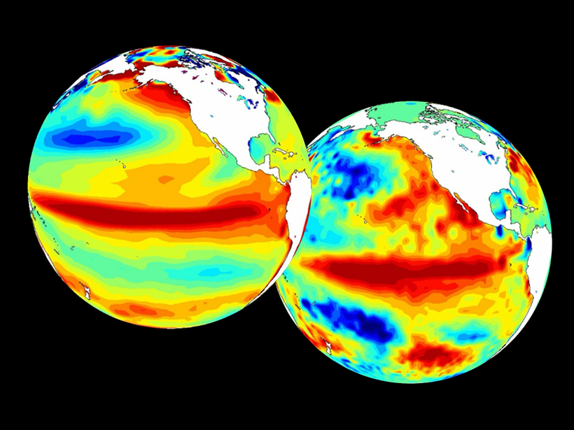
Advancing Climate Forecasting
Better forecasts, new products: The World Climate Research Programme coordinates research aimed at improving and extending global climate forecasting capabilities.