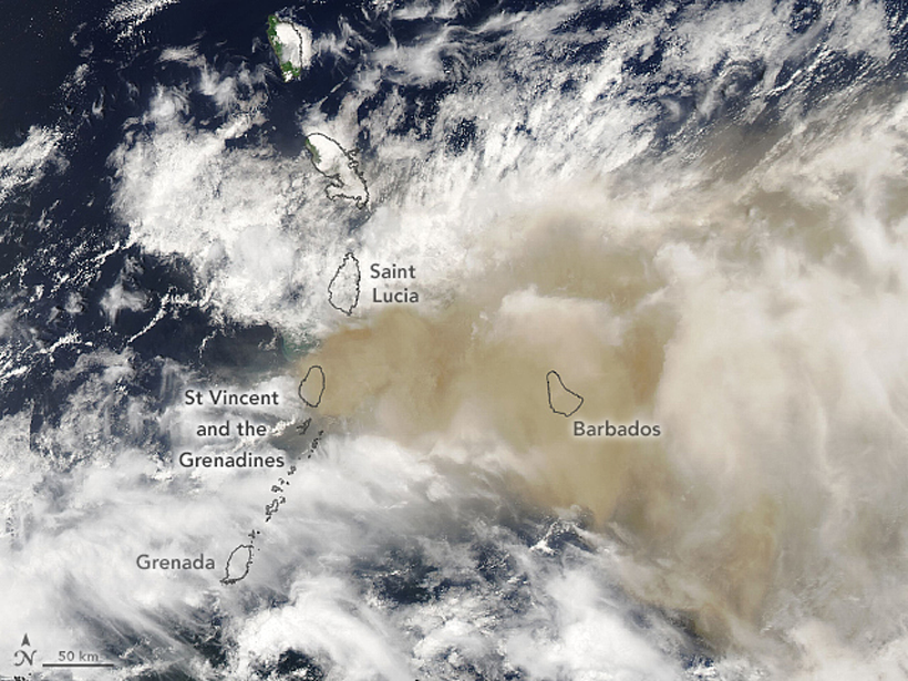
Satellites in the sky combined with computers on the ground detect and track volcanic ash clouds, like those produced by Soufrière St. Vincent in April, in near-real time.
remote sensing

Posted inNews
A Reminder of a Desert’s Past, Before Dingo Removal
A fence spans Australia’s Strzelecki Desert, keeping dingoes out of the southern side. Drone and satellite technology have illustrated how removing this top predator changes vegetation growth.

Posted inEditors' Vox
Tropical Carbon and Water Observed from Above
Satellite observations show how tropical forest carbon fluxes respond to changes in water from climate variability.
Posted inNews
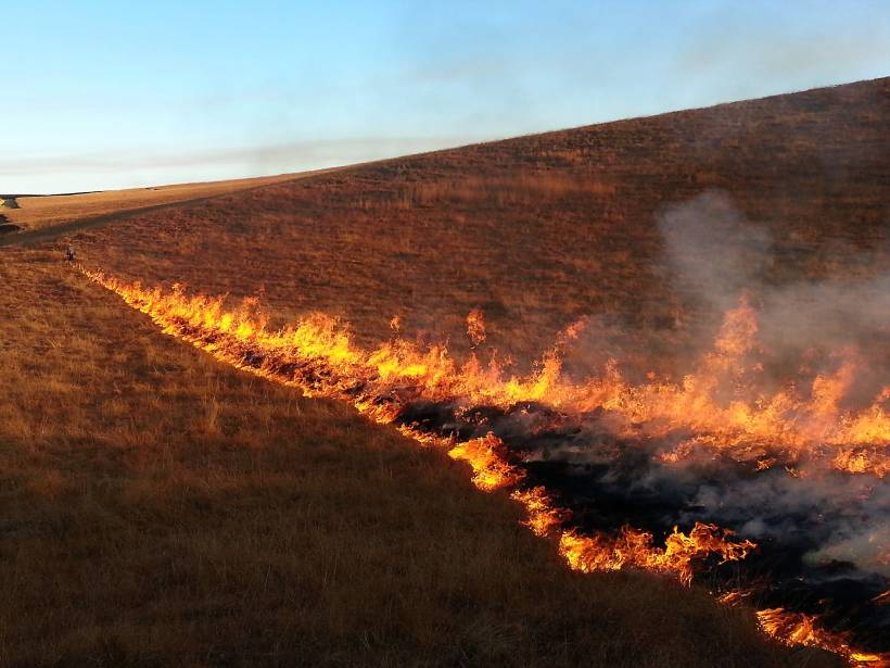
Zooming In on Small Fires in Africa
By analyzing high-resolution satellite images, researchers found that fires burning in Africa were undercounted by as much as 80%.
Posted inEditors' Highlights
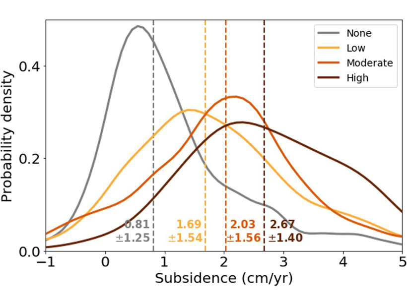
SE Asia Peatlands Subsidence Tied to Drainage Density
Human-made channelization significantly accelerates peat decomposition and drives ground-surface deformation in tropical wetlands.
Posted inScience Updates
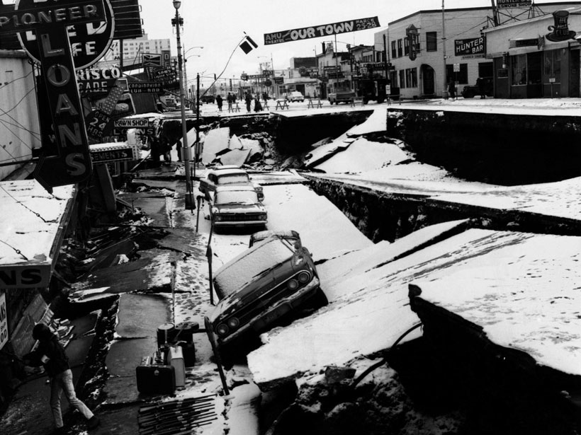
Slipping and Locking in Earth’s Earthquake Factories
Geodetic observations collected during back-to-back decadal research campaigns have revealed crucial new insights into the start–stop and slow-motion behavior of subduction zones.
Posted inNews
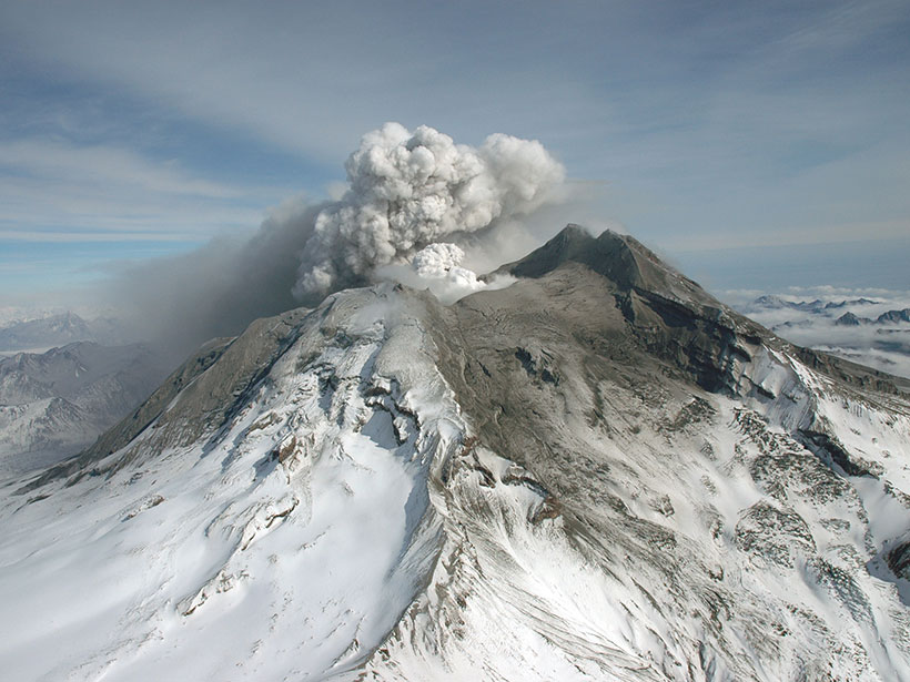
Volcanic Lands Warm Before Eruptions
Satellite data have revealed that ground radiant temperatures around volcanoes rose in the years leading up to eruptions. The observation may help in forecasting future volcanic activity.
Posted inResearch Spotlights
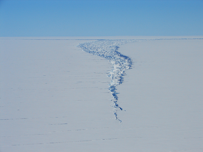
Satellite Captures Detaching Iceberg in Near-Real Time
NASA’s ICESat-2 satellite recorded the cleaving of a 315-billion-ton iceberg from Amery Ice Shelf in 2019, as well as years of subtle cracking and splitting prior to the calving event.
Posted inEditors' Highlights
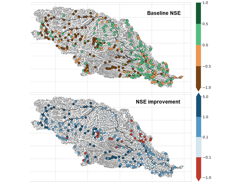
Gauging Ungauged River Basins with Smart Remote Sensing
A clever combination of hydrologic modelling and discharge estimates from the Landsat satellite provides good discharge estimates throughout the Missouri river basin.

Posted inOpinions
An Observational Gap at the Edge of Space
Ongoing climate change in Earth’s middle and upper atmosphere will affect the rapidly expanding space and telecommunications sectors. Maintaining observations of this region is more crucial than ever.