Hyperspectral Remote Sensing of Coastal and Inland Waters Webinar; 28 May 2019
remote sensing

Posted inScience Updates
Monitoring Volcanic Craters with Infrasound “Music”
Volcanic craters act as giant horns that emit intense low-frequency sounds. Changes in this infrasound may be used to track rising lava lakes and identify signals of future eruptions.
Posted inEditors' Highlights
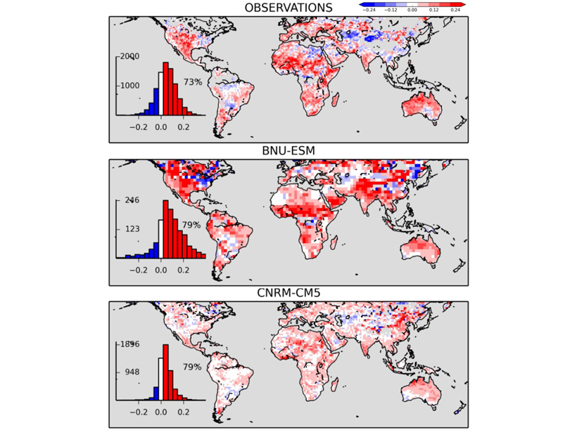
Diagnosing Soil Moisture Impacts on Model Energy Fluxes
Do climate models truthfully mimic how drying soil affects land-surface budget partition?
Posted inResearch Spotlights
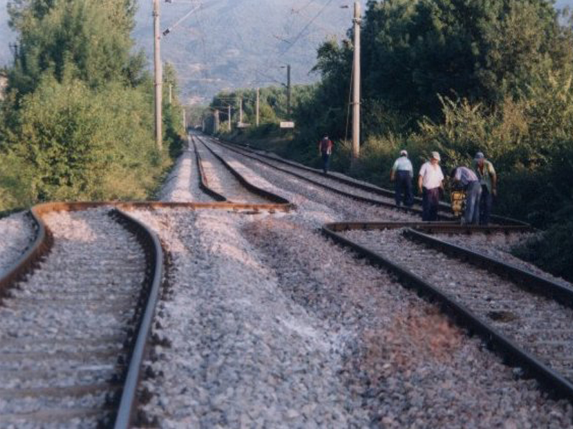
Variations in Creep Along One of Earth’s Most Active Faults
Satellite-based radar images of motion along Turkey’s North Anatolian Fault are helping scientists understand when, where, and how creep occurs and its implications for seismic hazard.

Posted inResearch Spotlights
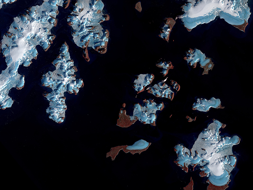
Missing Lakes Under Antarctic Ice Sheets
New radio sounding study finds little evidence of lakes under Antarctica’s Recovery Glacier.
Posted inNews
Seismic Clues to Surging Glaciers
Measuring seismic waves passing through a glacier suggests that not only is liquid water playing a role in periodic surging but the water is channeled into cracks from across the ice.
Posted inResearch Spotlights
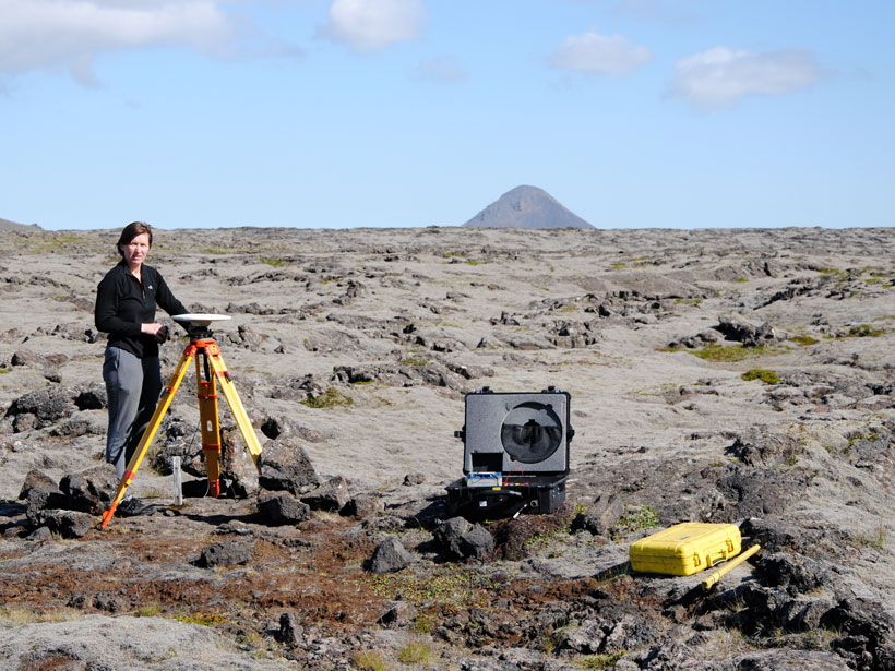
A New Way of Visualizing Iceland’s Crustal Deformation
A novel method of calculating strain rates from GPS data shows the South Iceland Seismic Zone is experiencing rapid deformation, including inflation near the island’s most active volcano.

Posted inResearch Spotlights
Mapping Ice Algal Blooms from Space
Satellite data reveal how colorful algae are melting the Greenland ice sheet.
Posted inNews
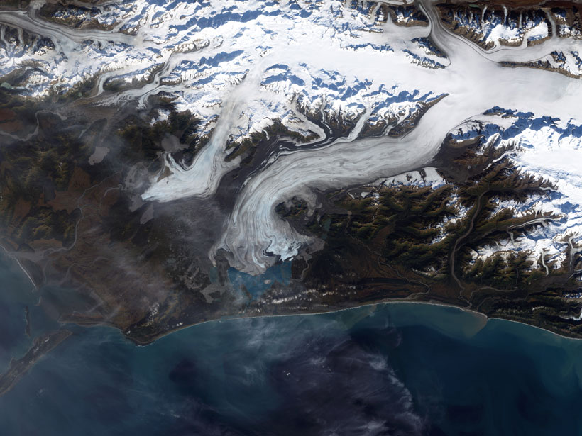
Fast-Melting Mountain Glaciers Speed Up Sea Level Rise
Satellites spy on remote alpine glaciers, producing more accurate—and higher—estimates of ice loss over time.
Posted inEditors' Vox
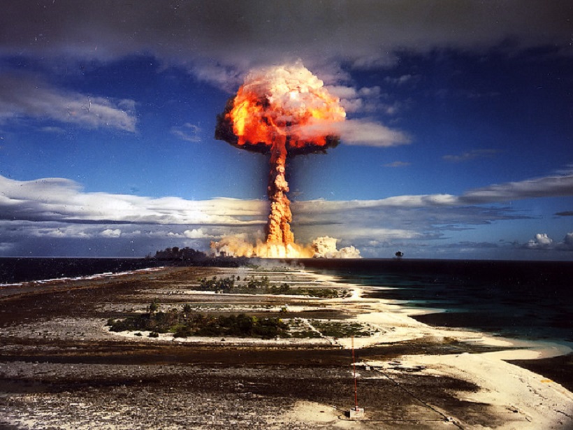
Measuring Explosive Events on Earth from the Ionosphere
Natural and manmade explosive events occurring on or below the Earth’s surface can be measured remotely in different ways and different places from the ionosphere.