
A new measurement capability can detect the polarization of the radio frequency wave of lightning sources, which reveals different forms of lightning breakdown processes.
remote sensing
Posted inEditors' Highlights
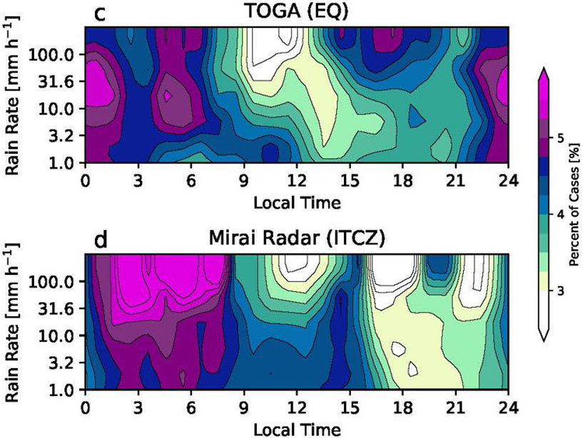
Diurnal Variation of Rainfall over the Equator Revisited
Radar data show an afternoon precipitation maximum in the equatorial Indian Ocean in addition to the nocturnal maximum; this occurs under light surface winds and suppressed large-scale convection.

Posted inResearch Spotlights
A More Detailed Look at Earth’s Most Poorly Understood Crust
The second-generation Antarctic Digital Magnetic Anomaly Project offers a powerful new tool for probing the structure and evolution of the southernmost continent’s lithosphere.
Posted inScience Updates
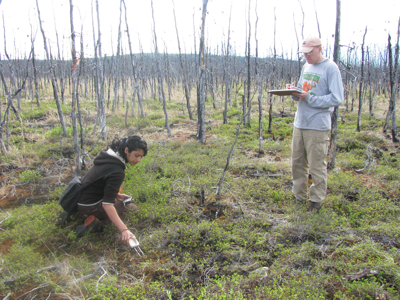
Mapping and Monitoring Soil Moisture in Forested Landscapes
Monitoring Forest Soil Moisture for a Changing World; Ann Arbor, Michigan, 15–17 May 2018

Posted inEditors' Highlights
New Lidar Comparisons of Temperatures Near the Mesopause
For the first time, simultaneous measurements of upper atmosphere temperatures over altitudes 80 to 110 kilometers have been made by two complementary lidar techniques.

Posted inResearch Spotlights
A Closer Look at the Sustainability of Our Groundwater Aquifers
Researchers use a new approach to assessing the world’s largest aquifers in hopes of improving groundwater management during drought periods.

Posted inOpinions
Wireless Frequency Sharing May Impede Weather Satellite Signals
The delivery of weather satellite imagery is reliable today, but will it stay that way in the future?

Posted inScience Updates
New Achievements in Coastal Altimetry
11th Coastal Altimetry Workshop; Frascati, Italy, 12–15 June 2018

Posted inNews
Illegal Seafood Supply Chains Can Now Be Tracked by Satellite
Researchers pinpoint more than 10,000 likely transfers of catches between fishing vessels and cargo ships at sea. Knowing where these transfers occur can help officials crack down on illegal activity.
Posted inNews
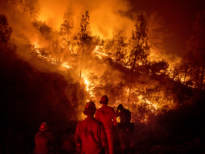
How Forecasting Models Are Changing the Way We Fight Fires
Eos speaks with Andy Edman, western region chief of the Science and Technology Infusion Division at the National Weather Service, about how the agency is helping wildfire crews fight fires from space.