
新的月球重力测量结果支持了这样一种观点,即部分熔融的地幔层夹在月球地幔的其余部分和月球内核之间。
AGU Advances

Posted inResearch Spotlights
Jupiter’s Moon Callisto Is Very Likely an Ocean World
A closer look at previously disregarded observations reveals stronger evidence that a deep ocean lies beneath Callisto’s icy surface.

Posted inEditors' Highlights
Using Satellite Data for More Effective Disaster Response
Satellite data play a crucial role in disaster assessment and response. Meeting expanding demand requires not only accelerated data processing but increased collaboration with responders.

Posted inResearch Spotlights
Trees Can Cool Cities, But Only with a Little Help
To get the benefits of trees, city managers must give greenery what it needs to thrive, says new research.

Posted inEditors' Vox
Editorial Handover at AGU Advances
The outgoing and incoming Editors-in-Chief of AGU Advances reflect on recent years of growth and expansion in the journal while they plan for the challenges ahead.
Posted inResearch Spotlights
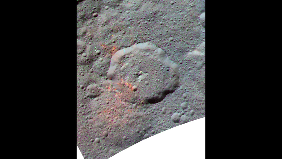
Ceres’s Organics Might Not Be Homegrown After All
Scientists have been unable to determine whether the dwarf planet’s organics were produced by its own chemical processes or delivered by asteroids. New evidence implicates asteroids.

Posted inEditors' Highlights
Characterizing the Space Between Clouds and Clear Sky
The area near clouds is often classified as ‘clear sky’, but a new study demonstrates the potential biases of misclassifying these transition zones and their significance for Earth’s energy budget.

Posted inResearch Spotlights
Ancient Climate Reconstruction Links Past and Future
A new map of climate conditions during the Pliocene epoch—the last time Earth’s carbon dioxide concentrations hit 400 parts per million—could offer clues about possible climatic changes in store for the 21st century.

Posted inEditors' Highlights
How Southern Ocean Currents Modulate Global Biogeochemical Cycles
Swirling currents called mesoscale eddies occupy about 22% of the ice-free Southern Ocean. Using data from drifting floats and satellites, scientists report the impact these eddies have on biogeochemical cycles.

Posted inEditors' Highlights
Mars and Earth: A Tale of Two Energy Budgets
The first view of Mars’ latitudinal radiant energy budget reveals stark contrast with Earth’s energy distribution, offering new insights into each planet’s unique energy dynamics.