Editors’ Highlights are summaries of recent papers by AGU’s journal editors.
Source: AGU Advances
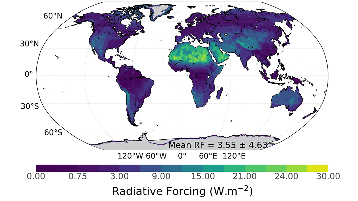
Earth System Models (ESMs) must include many complex and interacting biophysical processes to simulate present and future climates. One of those processes is soil albedo, defined as the proportion of the incident light or radiation that is reflected by the soil surface. ESMs typically represent land surface soil albedo using only two broadband values obtained from satellite reflectance data. In contrast, hyperspectral analysis can take advantage of the rich spectral detail of the albedo.
Braghiere et al. [2023] show that differences in soil albedo between hyperspectral and broadband representations over desert areas can reach 20%, resulting in spectrally integrated radiative forcing divergences of up to 30 W m−2. Such differences in radiative forcing can affect how ESMs simulate current and future surface temperatures and the hydrological cycle. New remote sensing missions to collect hyperspectral data globally may improve the ability of ESMs to simulate the effects of soil albedo on climate.
Citation: Braghiere, R. K., Wang, Y., Gagné-Landmann, A., Brodrick, P. G., Bloom, A. A., Norton, A. J., et al. (2023). The importance of hyperspectral soil albedo information for improving Earth system model projections. AGU Advances, 4, e2023AV000910. https://doi.org/10.1029/2023AV000910
—Eric Davidson, Editor, AGU Advances