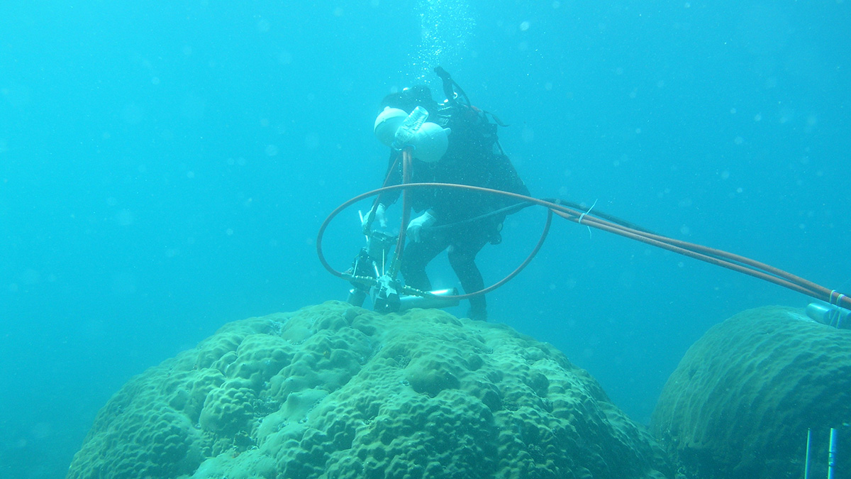
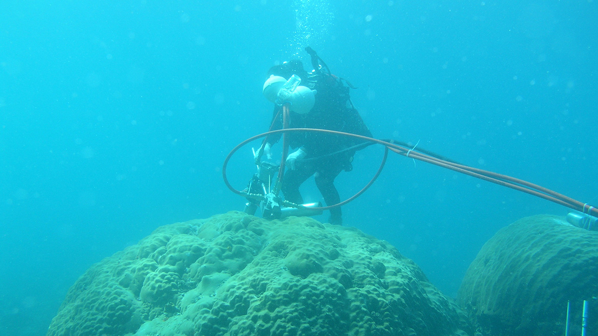
La erosión del suelo derivada del desarrollo económico mueve sedimentos hacia el mar del sur de China y también hacia los esqueletos de los corales.
Asia

Posted inResearch Spotlights
Coral Chemistry Reflects Southeast Asia’s Economic Expansion
Soil erosion from economic development sent sediments into the South China Sea—and into coral skeletons.


Posted inResearch Spotlights
When the Aral Sea Dried Up, Central Asia Became Dustier
Winds kick up large amounts of dust from the desert that has formed as the world’s fourth largest lake has disappeared, spreading it around the region and raising concerns about public health.

Posted inNews
Monitoring Moisture from Afar
Undisturbed tropical rain forests are experiencing more frequent droughts, but the ecosystems are isolated and difficult to assess. Scientists are using remote sensing to expand the depth and scope of monitoring efforts.
Posted inEditors' Highlights
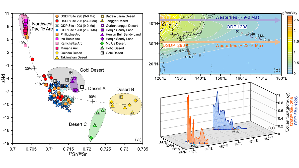
Asian Dust Flux into Philippine Sea Increased During Miocene
A new deep sea dust record from the Philippine Sea, when added to evidence from the NW Pacific, suggests how dust may record a change in dustiness or the position of wind transport.

Posted inEditors' Highlights
中新世输入菲律宾海的亚洲风尘增加
一项来自菲律宾海的新的深海风尘记录,结合西北太平洋已有记录的对比,展示了海洋风尘沉积如何记录大气粉尘通量或风力传输路径的变化。

Posted inEditors' Highlights
An Unstable Magnetic Field in Central Asia 2500-1500 Years Ago
The geomagnetic field intensity – poorly described – varies spatially and temporally on centennial time scales. A recent study fills an important gap in Central Asia and discusses global implications.

Posted inResearch Spotlights
Researchers Home in on the Age of the Yangtze River
Findings on the river’s age also have implications for past landscape change in Asia.