A significant increasing trend of turbulence in upper atmosphere over northern Eurasia is attributed to intense anthropogenic activities.
Asia

Posted inResearch Spotlights
An Innovative Approach for Investigating Subduction Slip Budgets
A new 3D model offers a state-of-the-art look at the full spectrum of slip behaviors in the Nankai subduction zone off Japan.
Posted inEditors' Highlights
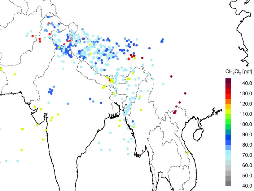
Measurements of Ozone-Depleting Chemicals in the Asian Monsoon
New high-altitude aircraft observations identify unexpected high levels of halogen-containing species entering the stratosphere above the summertime Asian monsoon.
Posted inNews
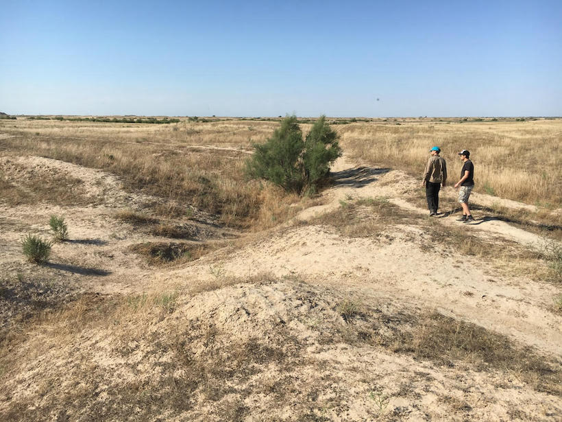
Drought, Not War, Felled Some Ancient Asian Civilizations
Radiocarbon dating, luminescent sand grains, and climate records point to drought as the reason for the civilizations’ demise.

Posted inNews
Overturning in the Pacific May Have Enabled a “Standstill” in Beringia
During the last glacial period, a vanished ocean current may have made the land bridge between Asia and the Americas into a place where humans could wait out the ice.

Posted inNews
Kabuki Actor’s Forgotten Manuscript Yields Clues About 1855 Quake in Japan
Researchers analyzed a survivor’s account of the disaster to better understand future temblors.
Posted inEditors' Highlights
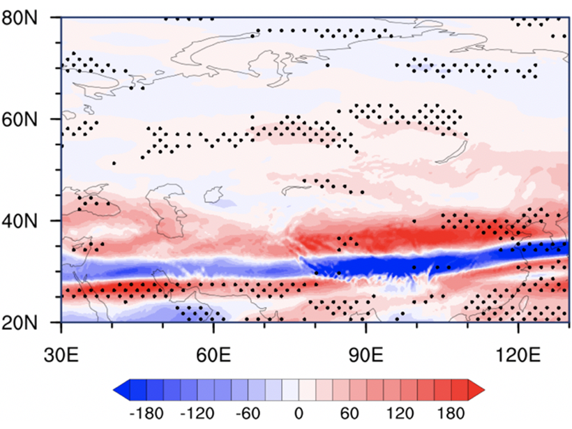
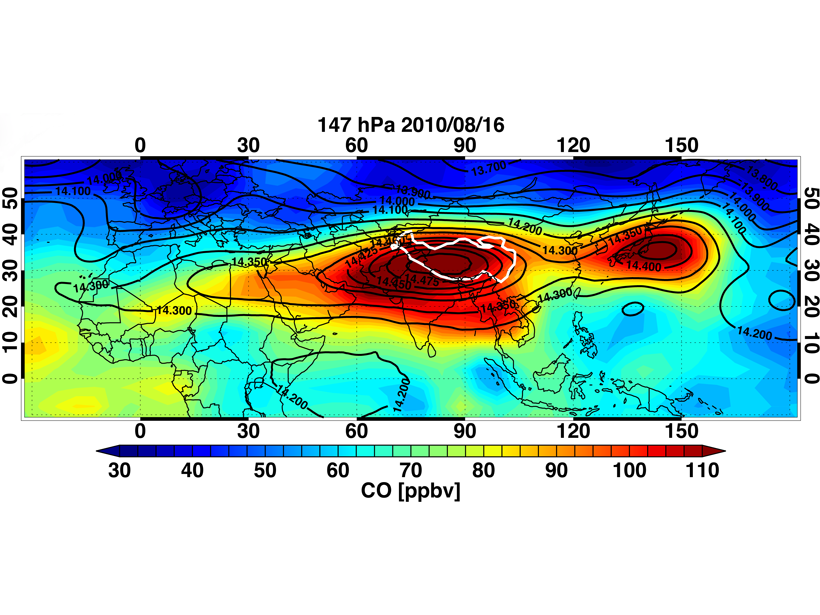
When Chemistry Lends a Hand to Dynamics
Chemical signature and chemical transport analyses help understand the dynamics of the Asian Summer Monsoon.

Posted inNews
The First Undeniable Climate Change Deaths
In 2018 in Japan, more than 1,000 people died during an unprecedented heat wave. In 2019, scientists proved it would have been impossible without global warming.
Posted inNews
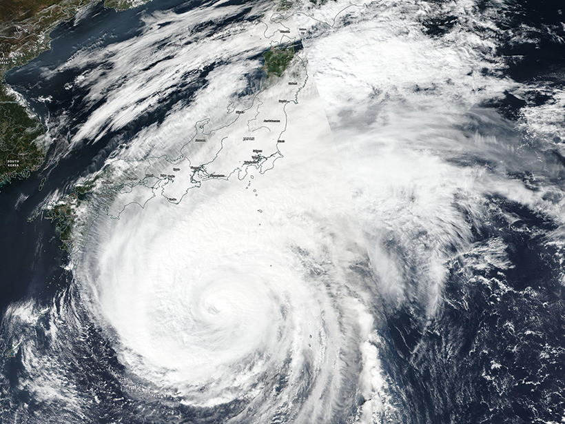
Typhoons Getting Stronger, Making Landfall More Often
New research shows a growing threat from Pacific storms amid climate change.
Posted inEditors' Highlights
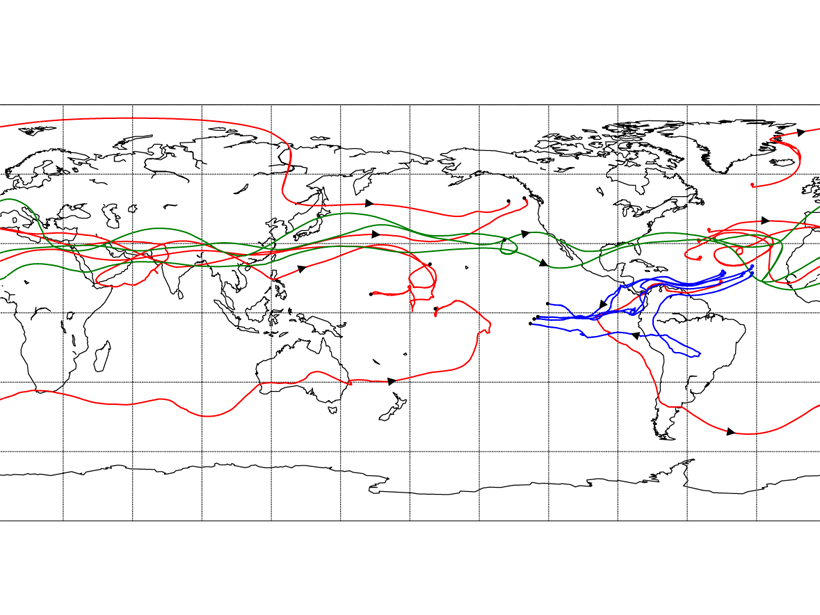
A New Perspective on a Classic Climate Conundrum
The Lagrangian method applied to tracking water transport between the Atlantic and Pacific basins reveals a larger contribution by mid-latitude westerly winds across Eurasia than previously thought.