
A novel antenna design promises to improve bandwidth and allow for better communication between Earth stations and satellites.
cool tools

Posted inScience Updates
A Digital Mayfly Swarm Is Emerging
Low-cost, open-source data collectors and a suite of collaborative online tools are making big leaps in the field of watershed monitoring.

Posted inFeatures
The Unsolved Mystery of the Earth Blobs
Researchers peering into Earth’s interior found two continent-sized structures that upend our picture of the mantle. What could their existence mean for us back on Earth’s surface?
Posted inNews
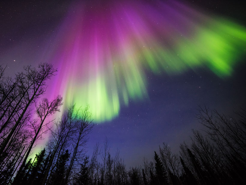
Deaf Students Feel the Universe’s Vibrations in New Workshop
Students experienced the vibrations of Earth’s auroras, the Sun’s flares, Jupiter’s bow shock, and Saturn’s rings in an outreach activity designed specifically for their community.
Posted inNews
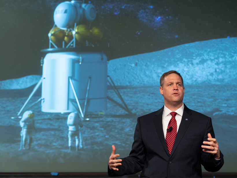
NASA Wants to Get Back to the Moon, and Fast
The space agency has plans for a sustainable return to the Moon.

Posted inScience Updates
Training a New Generation of Data-Savvy Atmospheric Researchers
Pacific Northwest National Laboratory and the University of Washington team up to teach students about state-of-the-art research instrumentation.
Posted inNews
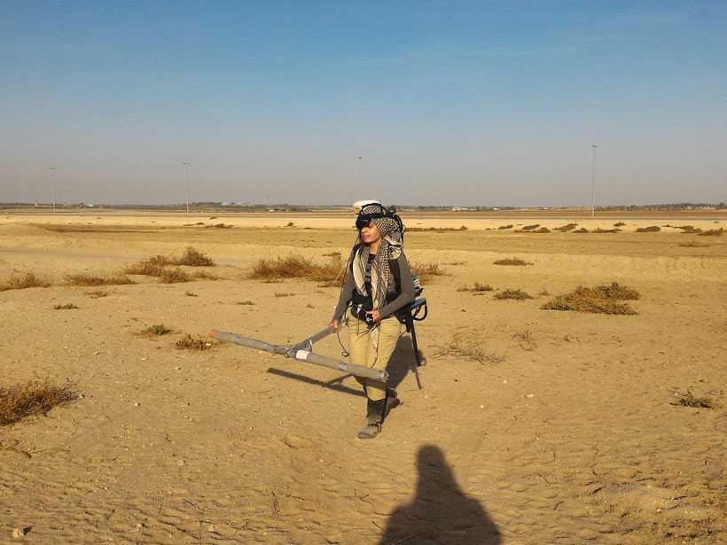
Magnetic Surveying Reveals Hidden Ancient Buildings and Streets
Buried buildings subtly distort natural magnetic fields, providing a magnetic surveying team with clues that helped archaeologists map an ancient city.
Posted inNews
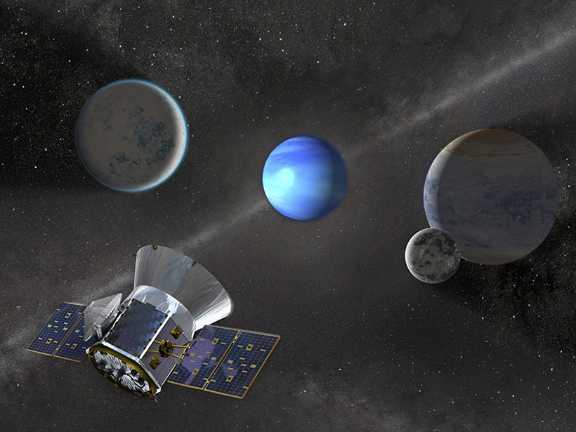
NASA Space Telescope Spots Its Third Planet
A planet 3 times as large as the Earth was detected by the Transiting Exoplanet Survey Satellite in a relatively leisurely orbit—the longest yet detected by this telescope—of 36 days.
Posted inResearch Spotlights
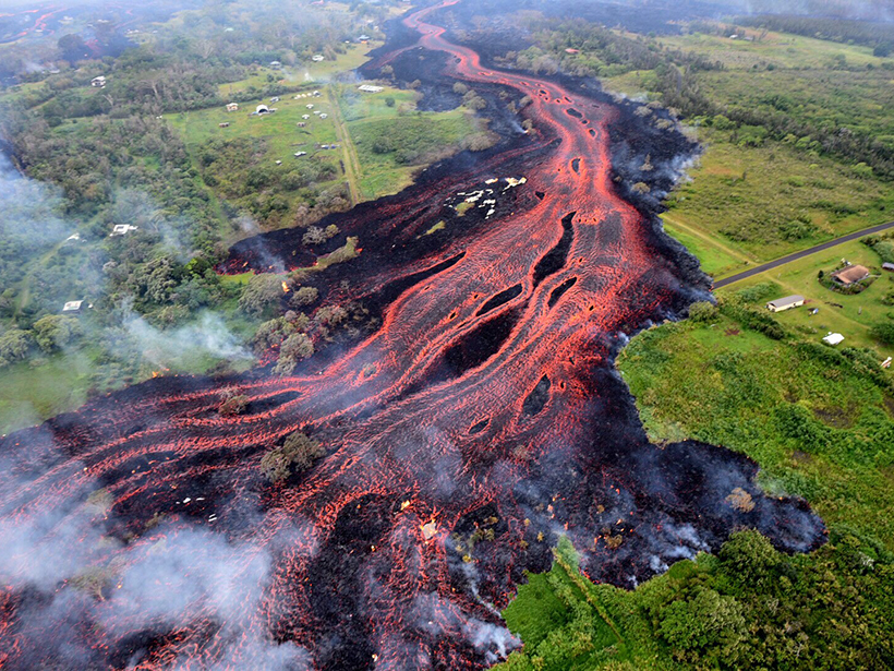
A New Tool for Studying Volcanic Eruptions Like Kīlauea
A new study sheds light on how magma erodes the conduit it flows through.
Posted inNews
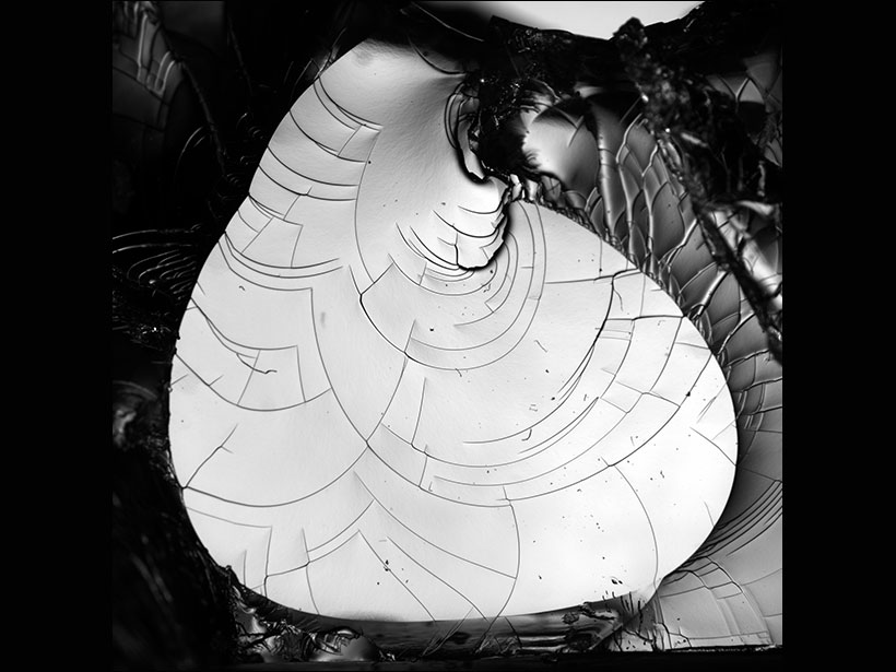
Watch Tiny Cracks Travel in 3-D
Scientists used a transparent gel and high-speed photography to figure out how cracks form and spread. What they found could help explain earthquakes and fracturing glaciers.