
Data from the 2015 eruption of Chile’s Calbuco volcano suggest the international network built to monitor nuclear explosions may also be used to detect and characterize volcanic activity.
cool tools

Posted inEditors' Highlights
Getting Littoral with Lake Carbon Efflux
Next generation forced diffusion chambers reveal dynamic environment for lake carbon exchange with distance from shoreline.
Posted inEditors' Highlights
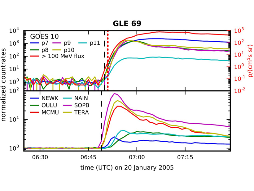
Catching the Oncoming Radiation Storm
Improved processing enables satellite-based radiation sensors to match ground-based sensors in providing prompt warnings of the onset of atmospheric radiation storms that can endanger civil aviation.
Posted inFeatures
Five Weird Archives That Scientists Use to Study Past Climates
When tree rings, ice cores, and cave formations can’t cut it, try your luck with whale earwax or bat poop.

Posted inAGU News
Virtual Mentoring Rewards Scientists at All Career Stages
Five geoscience organizations recently established an online global mentoring service for their disciplines.
Posted inGeoFIZZ
Ten Everyday Objects That Can Be Used for Science
Need a way to store sediment cores or grind up soil? These scientists have your answer.
Posted inEditors' Highlights
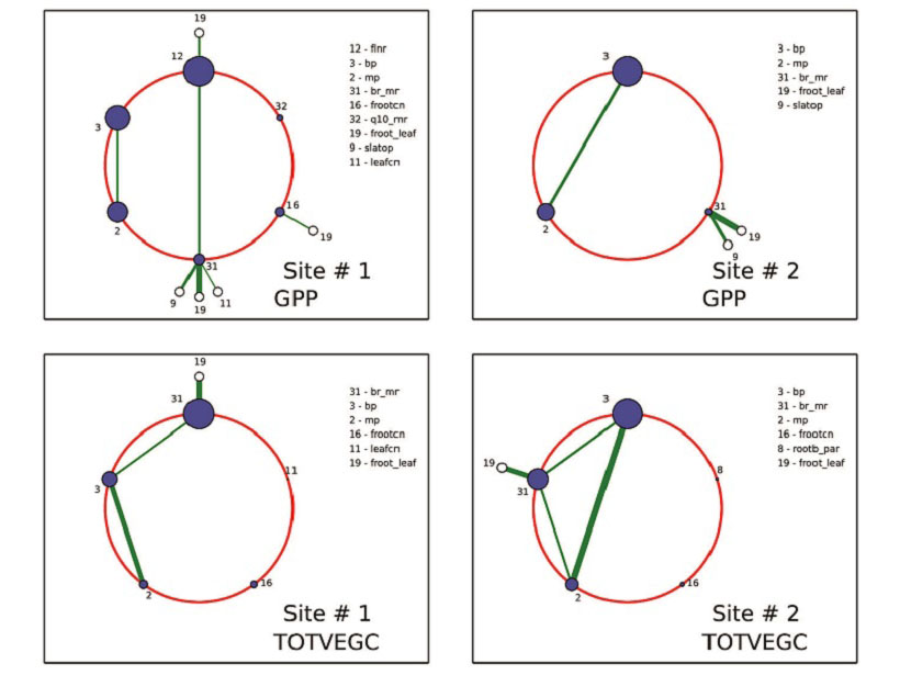
A Powerful New Tool to Analyze and Calibrate Earth System Models
Polynomial chaos and Bayesian compressive sensing are applied to a land surface model to understand how large numbers of tunable parameters interact and may be optimized.

Posted inAGU News
Virtual Poster Showcase Experienced Steady Growth in 2017
A pilot project for high schools and a geographic information system map, as well as other embellishments, have enhanced a program that enables students to present research electronically.
Posted inScience Updates
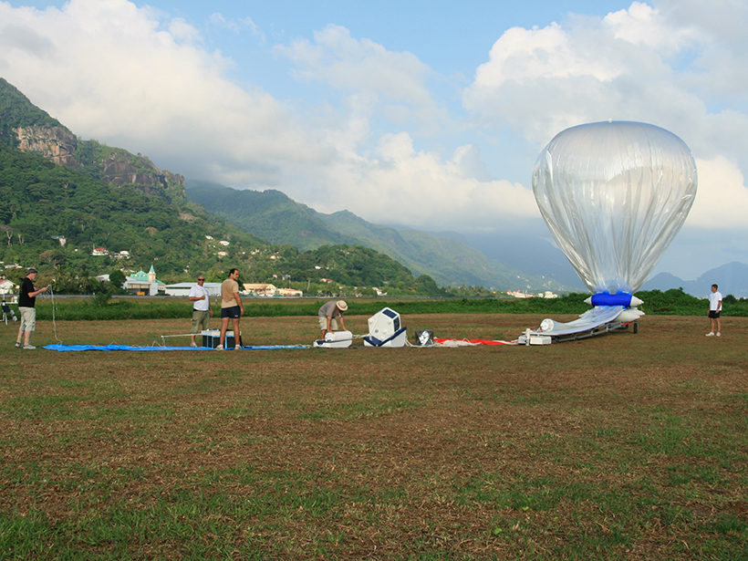
Around the World in 84 Days
In the Stratéole 2 program, set to launch in November 2018, instruments will ride balloons into the stratosphere and circle the world, observing properties of the air and winds in fine detail.
Posted inResearch Spotlights
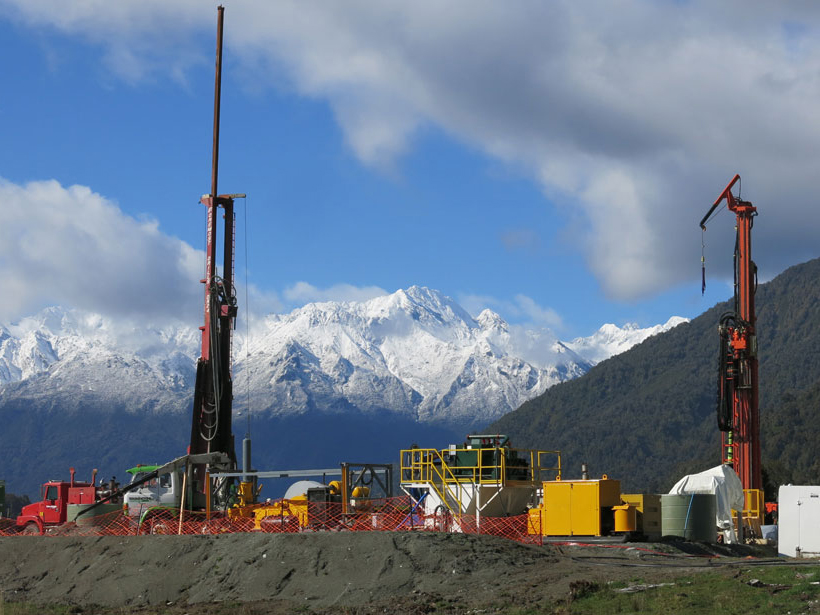
Drilling into a Future Earthquake
Researchers drill into a fault that is anticipated to rupture in coming decades to study fault structure and earthquake physics.