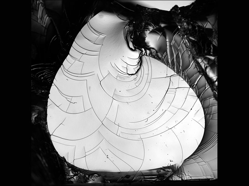
Scientists used a transparent gel and high-speed photography to figure out how cracks form and spread. What they found could help explain earthquakes and fracturing glaciers.
cool tools

Posted inNews
Meet IceWorm: NASA’s New Ice-Climbing Robot
A robot that can inch up icy surfaces may help scientists reach new heights in some of Earth’s most dangerous and remote landscapes.

Posted inScience Updates
Universal Units Reflect Their Earthly Origins
On Friday, the kilogram will join its fellow metric units with a definition based on fundamental physical constants, but these units maintain links to their roots in the geosciences.
Posted inScience Updates
Deep Floats Reveal Complex Ocean Circulation Patterns
Acoustically tracked floats drift far below the ocean’s surface, providing fresh discoveries about deep-sea currents. A new archive gathers decades’ worth of float data into a central repository.
Posted inEditors' Highlights
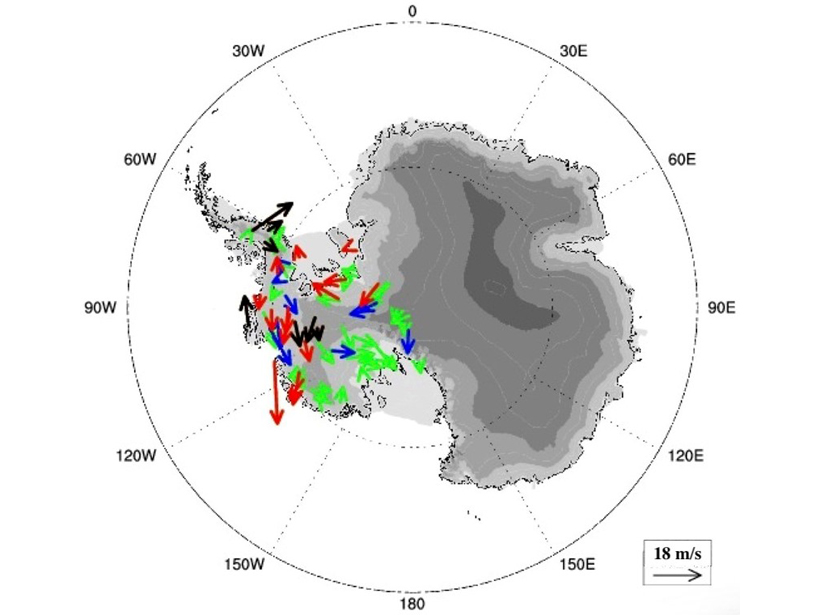
Dropsondes Reveal Atmospheric Boundary Layers Over Antarctic
636 high-resolution dropsondes reveal four types of atmospheric boundary layer over the Antarctic, including well-mixed and convective types.

Posted inScience Updates
Digging Deep into Geosciences with Minecraft
Building volcanoes, caves, and other features in an “open-world” computer game is an engaging way to teach the next generation about Earth.

Posted inFeatures
Lessons from Mexico’s Earthquake Early Warning System
The devastating 2017 Puebla quake provides an opportunity to assess how citizens perceive and use the Mexico City earthquake early warning system.
Posted inEditors' Highlights
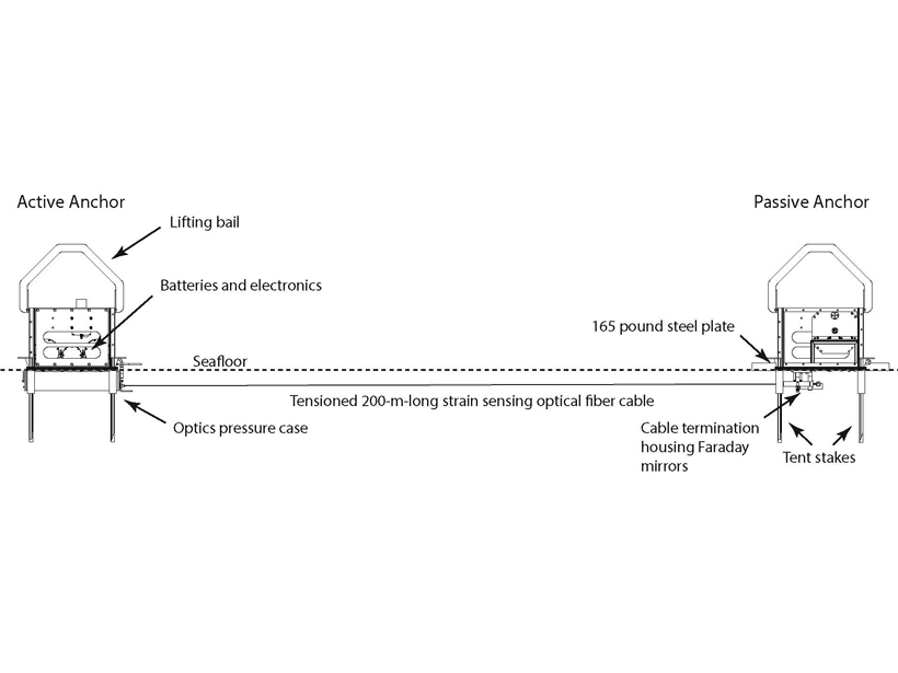
Successful Testing of Technique to Measure Seafloor Strain
A new optical fiber interferometry strain sensor tested off the Oregon coast holds promising prospects for seafloor geodesy.
Posted inResearch Spotlights
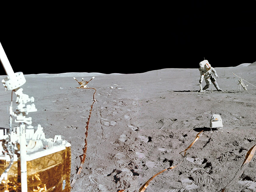
The Case of the Missing Lunar Heat Flow Data Is Finally Solved
Decades-old data analyzed for the first time suggest that astronauts’ disturbance of the Moon surface increased solar heat intake, warming the ground below.

Posted inResearch Spotlights
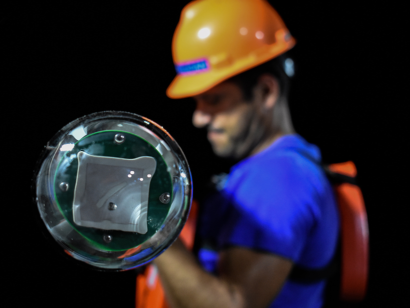
A Near-Real-Time Tool to Characterize Global Landslide Hazards
By fusing susceptibility information with precipitation data, a new model generates “nowcasts” to predict the potential for rainfall-triggered landslides in steep terrain between 50°N and 50°S.