
Forecasts of carbonate chemistry in coastal ecosystems determined from seasonal robotic measurements can improve fisheries management and help mitigate short-term ocean acidification events.
drones & ROVs
Posted inResearch Spotlights
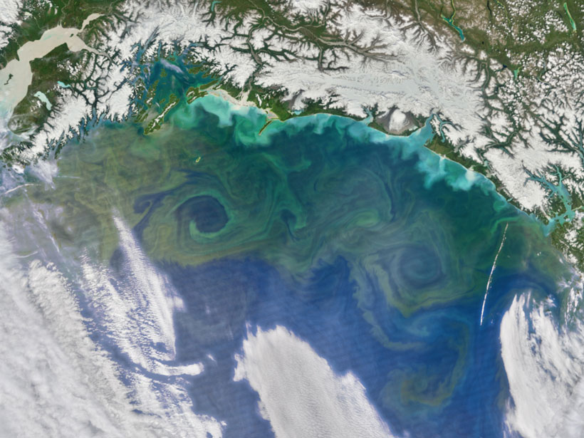
A Promising Development for Detecting Ocean Productivity
A comparison of primary productivity measurements across the North Pacific Ocean demonstrates the potential for using autonomous instruments to discern effects of climate change on the marine food web.
Posted inNews
Taking an Aerial View Underground
Wisconsin geologists are testing using drones equipped with thermal cameras to measure shallow soil depths in areas prone to groundwater contamination.
Posted inNews
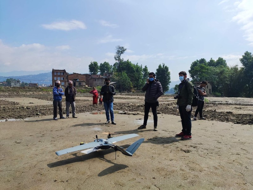
COVID Clears the Skies for Earth-Observing Drones in Nepal
When the pandemic hit Nepal and the country’s main airport drastically cut flights, a group of drone experts, local governments, and scientists saw a once-in-a-lifetime opportunity to gather geodata.

Posted inNews
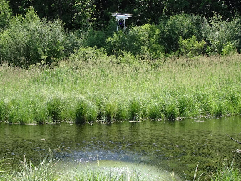
Drones Help Bridge the Gaps in Assessing Global Change
New instruments in the research tool kit bolster scientific understanding of the ecology of a greening Arctic.
Posted inNews
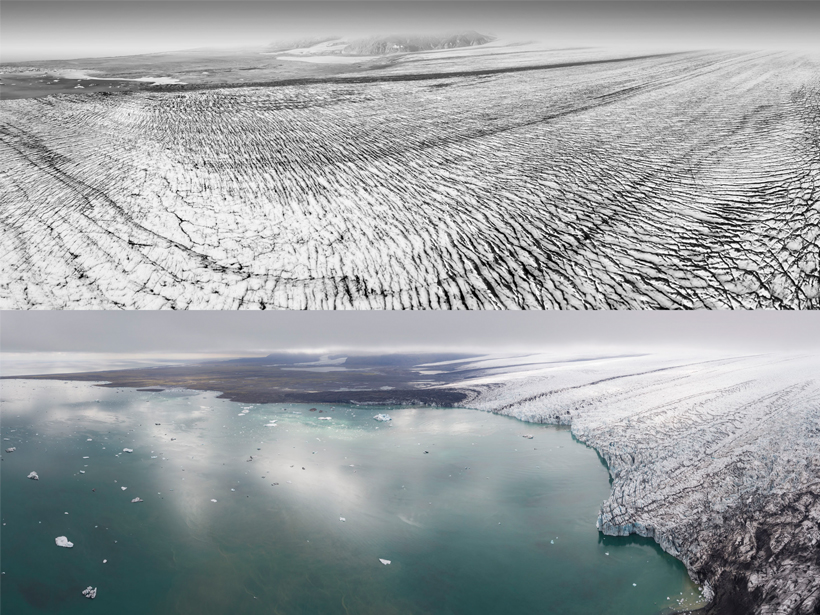
Drones Capture Iceland’s Shrinking Glaciers
Photographs of Iceland’s southern glaciers show pools of water where walls of ice once stood.
Posted inFeatures
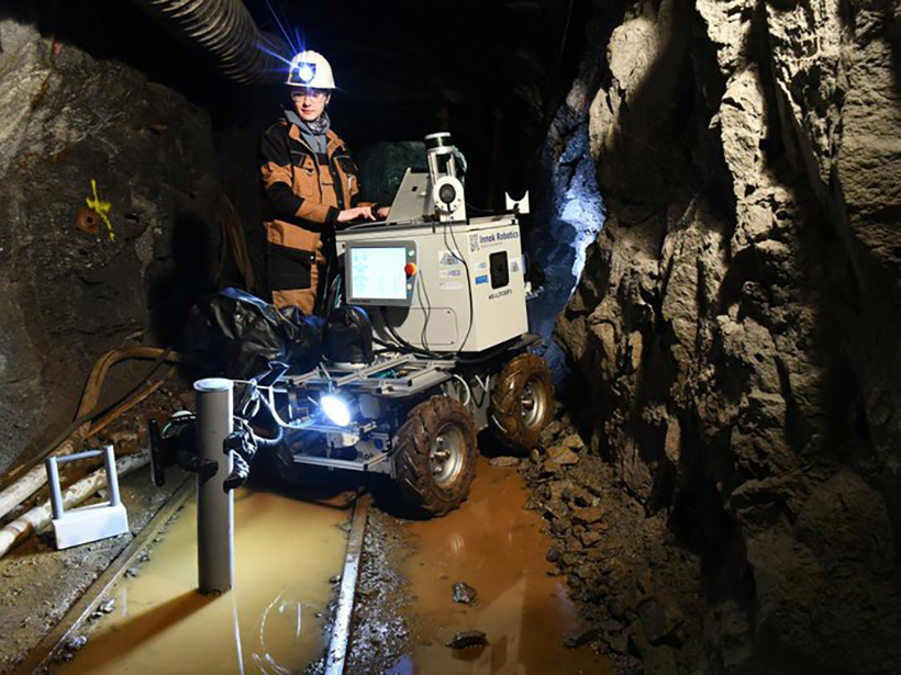
Underground Robots: How Robotics Is Changing the Mining Industry
From exploring flooded sites to providing alerts, use of robotics aims to “increase the arsenal of tools that can help miners work more safely and efficiently.”

Posted inResearch Spotlights
Oceanic “Pump” Sends Small Carbon Particles to Twilight Zone
Underwater gliders provide unprecedented, daily data that reveal new insights into how carbon gets from the atmosphere to the deep ocean.

Posted inNews
Meet IceWorm: NASA’s New Ice-Climbing Robot
A robot that can inch up icy surfaces may help scientists reach new heights in some of Earth’s most dangerous and remote landscapes.
Posted inScience Updates
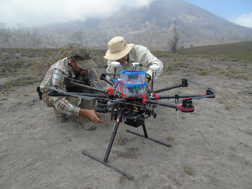
Drones Swoop in to Measure Gas Belched from Volcanoes
A team of volcanologists, chemists, physicists, and engineers from around the world test novel techniques at Central America’s two largest degassing volcanoes.