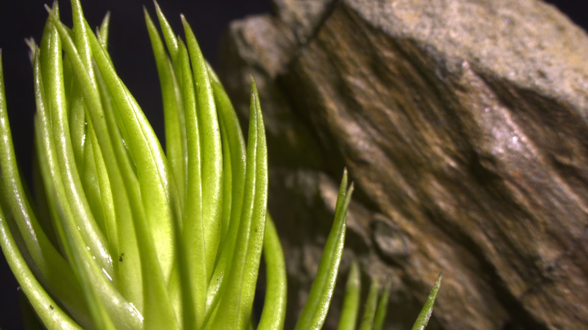
Vascular plants may have contributed to shaping Earth’s atmosphere long before trees evolved.
everything atmospheric
Posted inEditors' Highlights
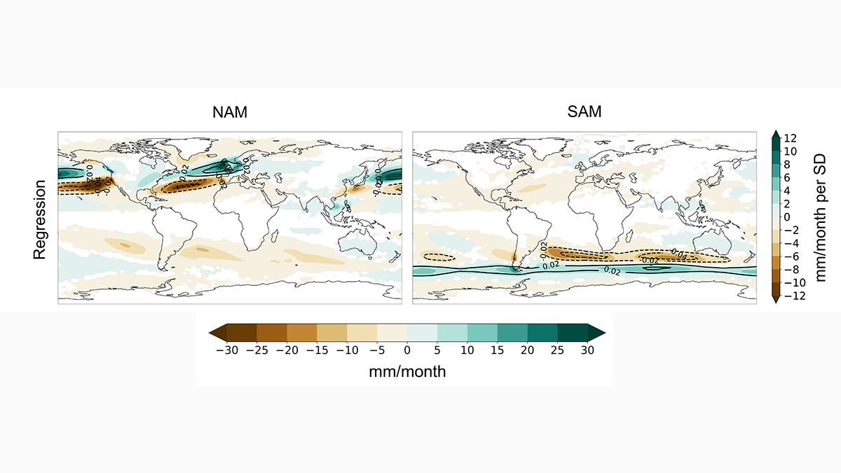
How Do Atmospheric Rivers Respond to Extratropical Variability?
Atmospheric river variability over the last millennium is primarily driven by north-south displacements in zonal winds induced by the annular modes.

Posted inNews
Even at the Bottom of the World, the Ocean Is Belching Plastic
Plastic fills the air above Auckland, New Zealand.
Posted inEditors' Highlights
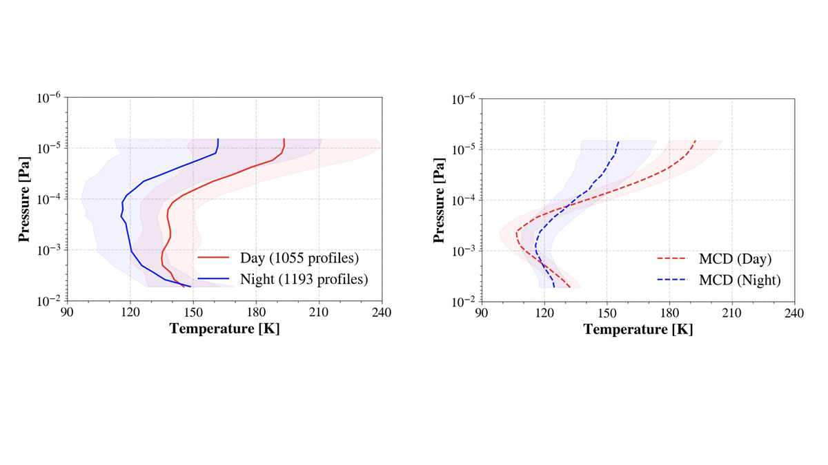
Unprecedented Constraint on the Martian Mesopause Temperature
The middle atmosphere of Mars is a critical region influenced by both waves from below and solar radiation from above, but until now there have been very few observational constraints on this region.
Posted inEditors' Highlights
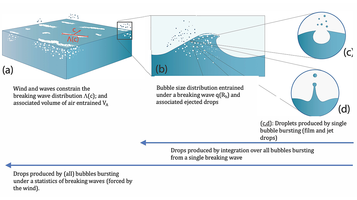
A New Approach to Sea Spray Aerosol Production and Prediction
Sea spray aerosols play a critical role in atmospheric processes. A new approach is in strong agreement with observations, paving the way for improved models of atmospheric aerosols of oceanic origin.

Posted inNews
Drones Make Weather Prediction Easier at the Poles
Researchers measured wind speed with a commercially available drone and a lightweight sensor. The approach could help scientists gather more data from remote environments.

Posted inResearch Spotlights
Far-Flung Forces Caused the 2021 Pacific Northwest Heat Wave
Air from thousands of kilometers away spiraled down to drape the Pacific Northwest in blistering heat.
Posted inResearch Spotlights
Mapeando estimaciones de la contaminación a nivel de calle para encontrar rutas más seguras
Un nuevo enfoque de alta resolución que combina múltiples tipos de datos detección remota de la contaminación permitió a investigadores desarrollar una aplicación que mapea las rutas más saludables para los transeúntes urbanos.
