• About
  • Special Reports
  • Topics
    • Climate
    • Earth Science
    • Oceans
    • Space & Planets
    • Health & Ecosystems
    • Culture & Policy
    • Education & Careers
    • Opinions
  • Projects
    • Postcards From the Field
    • ENGAGE
    • Editors’ Highlights
    • Editors’ Vox
    • Eos en Español
    • Eos 简体中文版
    • Print Archive: 2015–2025
  • Policy Tracker
  • Blogs
    • Research & Developments
    • The Landslide Blog
  • Newsletter
  • Submit to Eos
  • AGU.org
  • Career Center
  • Join AGU
  • Give to AGU
  • About
  • Special Reports
  • Topics
    • Climate
    • Earth Science
    • Oceans
    • Space & Planets
    • Health & Ecosystems
    • Culture & Policy
    • Education & Careers
    • Opinions
  • Projects
    • Postcards From the Field
    • ENGAGE
    • Editors’ Highlights
    • Editors’ Vox
    • Eos en Español
    • Eos 简体中文版
    • Print Archive: 2015–2025
  • Policy Tracker
  • Blogs
    • Research & Developments
    • The Landslide Blog
  • Newsletter
  • Submit to Eos
Skip to content
  • AGU.org
  • Career Center
  • Join AGU
  • Give to AGU
Eos

Eos

Science News by AGU

Support Eos
Sign Up for Newsletter
  • About
  • Special Reports
  • Topics
    • Climate
    • Earth Science
    • Oceans
    • Space & Planets
    • Health & Ecosystems
    • Culture & Policy
    • Education & Careers
    • Opinions
  • Projects
    • Postcards From the Field
    • ENGAGE
    • Editors’ Highlights
    • Editors’ Vox
    • Eos en Español
    • Eos 简体中文版
    • Print Archive: 2015–2025
  • Policy Tracker
  • Blogs
    • Research & Developments
    • The Landslide Blog
  • Newsletter
  • Submit to Eos

faults

Surface deformation imaged around the fault.
Posted inEditors' Highlights

Imaging an Earthquake Rupture in High Definition

by G. P. Hayes 4 April 201911 May 2022

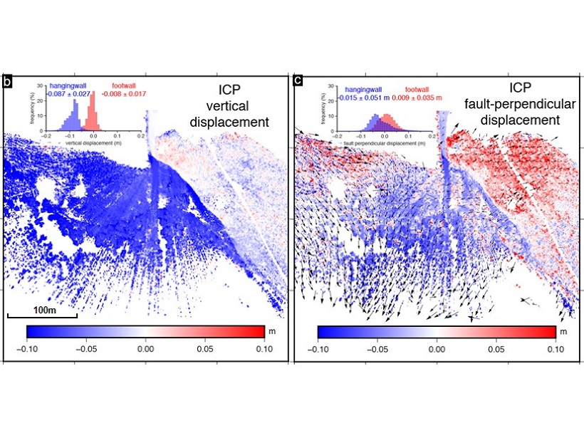
New field measurements using terrestrial laser scanning provide a detailed, centimeter-scale image of surface deformation patterns caused by the Magnitude 6.6 earthquake in Norcia, Italy.

An aerial view of the Mackenzie Mountains
Posted inResearch Spotlights

Resolving a Cordilleran Conundrum

by Terri Cook 15 March 201927 October 2021

A novel geophysical technique documents the existence of a “missing” fault, along which major displacement could have occurred during the Cretaceous on North America’s northwest margin.

Shale observed under strain
Posted inEditors' Highlights

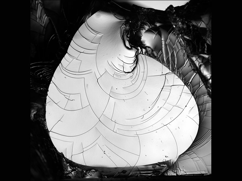
Real Time Probing of Shale Cracks in Double Torsion Experiments

by A. Revil 13 February 201910 March 2023

Imaging crack propagation in shales using twin optical cameras and fast X-ray radiograph acquisition.

A scientist installs GPS equipment to monitor earthquakes.
Posted inResearch Spotlights

Ancient Faults Amplify Intraplate Earthquakes

by Terri Cook 23 January 20194 October 2022

A comparison of deformation rates from Canada’s Saint Lawrence Valley offers compelling evidence that strain in the region is concentrated along ancient structures from previous tectonic cycles.

Block of clear hydrogel with few flaws into which pressurized fluid has been injected, causing long, continuous cracks
Posted inNews

Watch Tiny Cracks Travel in 3-D

by E. K. Carlson 26 December 20186 October 2021

Scientists used a transparent gel and high-speed photography to figure out how cracks form and spread. What they found could help explain earthquakes and fracturing glaciers.

Posted inEditors' Highlights

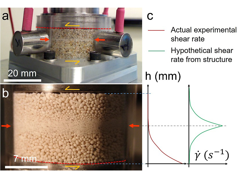
A New Spin on Grain Segregation in Fault Zones

by G. P. Hayes 14 September 20186 October 2021

Fine-grained layers in sheared fault gouge may be formed by shear-driven size-segregation in granular materials, rather than by shear localization.

Posted inEditors' Highlights

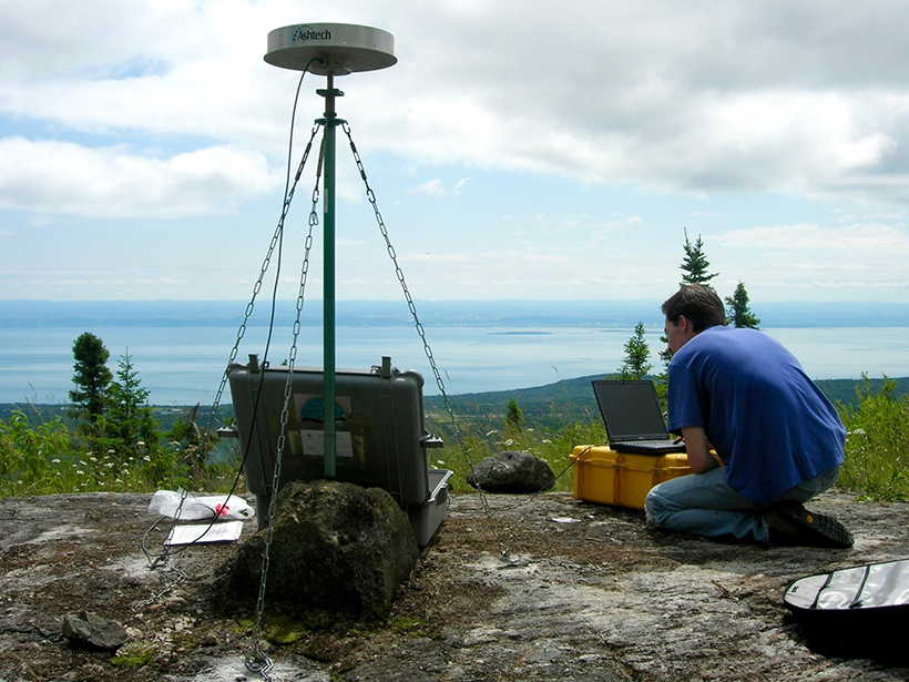
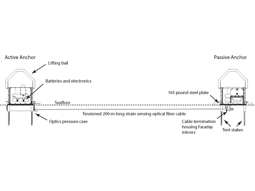
Successful Testing of Technique to Measure Seafloor Strain

by B. Pirenne 12 September 20186 October 2021

A new optical fiber interferometry strain sensor tested off the Oregon coast holds promising prospects for seafloor geodesy.

Researchers combine diverse data sets to analyze earthquake recurrence intervals in central Washington State.
Posted inResearch Spotlights

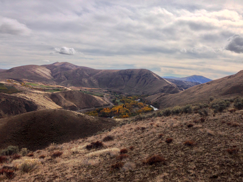
Constraining Central Washington’s Potential Seismic Hazard

by Terri Cook 19 June 20183 July 2023

Fault geometry and slip rate analyses show deformation in the Yakima Fold Province accelerated in the Pleistocene and has remained elevated, offering new insights into earthquake recurrence intervals.

Researchers map continental deformation in northwestern Tibet.
Posted inResearch Spotlights

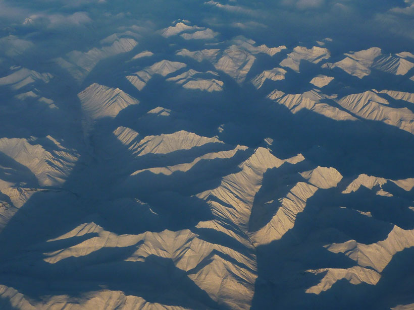
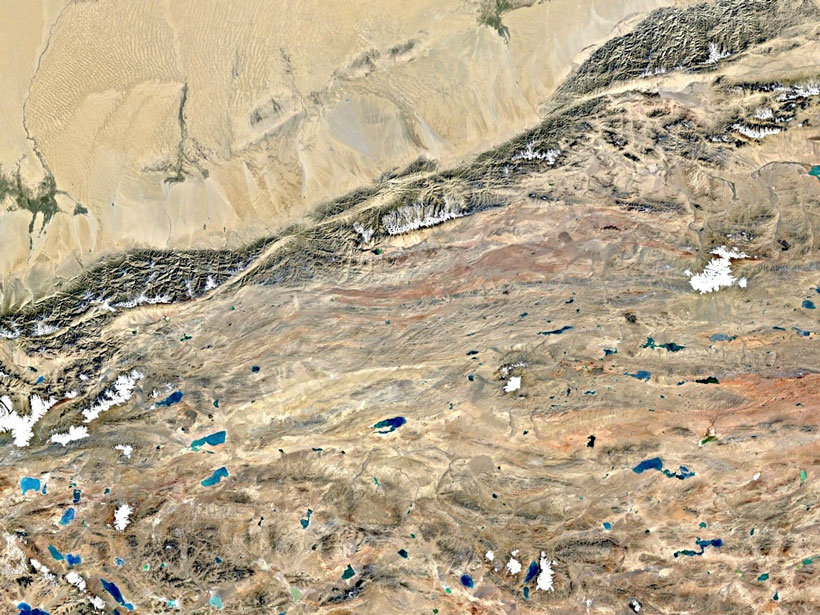
New Insights into Continental Deformation in Northwestern Tibet

by Terri Cook 9 May 201813 April 2022

A new surface velocity map shows strain localized along major strike-slip features, suggesting the central Tibetan Plateau is not deforming as a fluid in response to gravitational collapse.

Researchers use a new method to uncover evidence for gravity tectonics after the great Sumatra quake
Posted inResearch Spotlights

Evidence for Gravity Tectonics After the Great Sumatra Quake

by Terri Cook 27 March 201816 March 2022

A new method that applies structural geology principles to aftershock analyses suggests that gravity-driven motion may occur during part of the seismic cycle.

Posts pagination

Newer posts 1 … 12 13 14 15 16 … 19 Older posts
Over a dark blue-green square appear the words Special Report: The State of the Science 1 Year On.

Features from AGU Publications

Research Spotlights

As Wildfires Increase in the West, So Does Suppression Spending

10 June 202610 June 2026
Editors' Highlights

Multi-Scale Fault Roughness Encapsulated in a Friction Law

11 June 202611 June 2026
Editors' Vox

Small-Scale Indian Ocean Dynamics Underpin Marine Ecology and Climate

4 June 20263 June 2026
Eos logo at left; AGU logo at right

About Eos
ENGAGE
Awards
Contact

Advertise
Submit
Career Center
Sitemap

© 2026 American Geophysical Union. All rights reserved Powered by Newspack