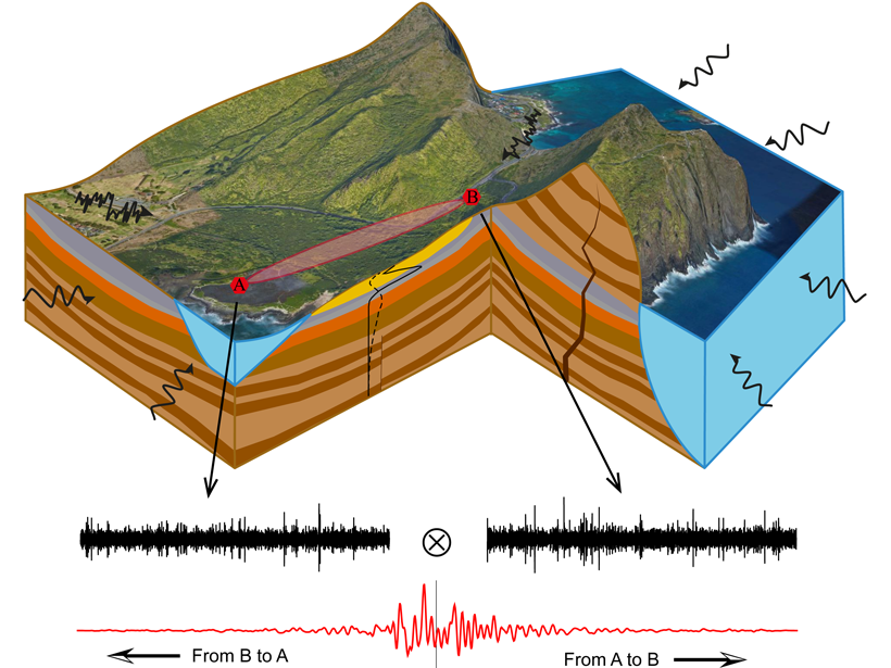
Seismic data reveal how water is accumulated and released by Himalayan groundwater reservoirs which are key for predicting future freshwater resources for a large part of South Asia.
groundwater
Posted inEditors' Highlights
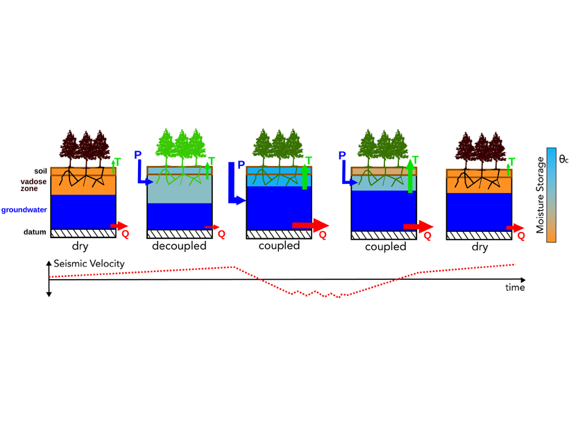
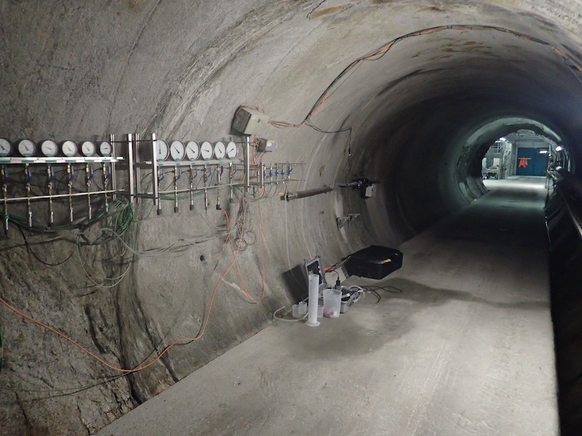
Revealing Complexity of Groundwater Flow with Hydrogeophysics
A combination of passive seismic and electrical measurements are used to unravel the complex hydrogeology structure and associated groundwater flow paths at a coastal site in O’ahu, Hawai`i.
Posted inEditors' Highlights
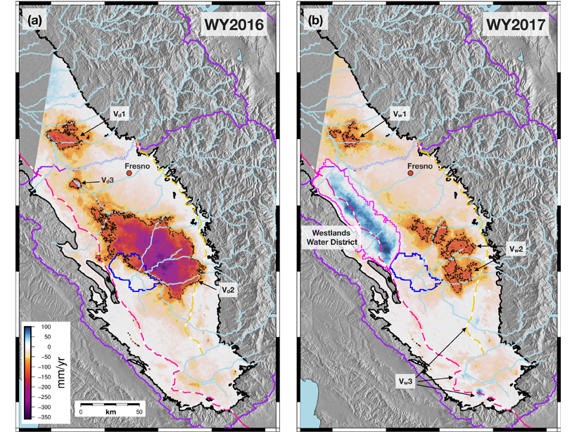
Satellites Detect Groundwater Recharge for San Joaquin Valley
A new study integrates spaceborne InSAR time series and GPS to resolve spatiotemporal patterns of deformation across the San Joaquin Valley indicating recharge areas and pathways for groundwater flow.
Posted inResearch Spotlights
Tracing Water from River to Aquifer
A new technique using dissolved noble gas tracers sheds light on how water moves through an aquifer, with implications for water resources and their vulnerability to climate change.

Posted inNews
Scientists Map Africa’s Groundwater Recharge for the First Time
The continent-wide survey provides an assessment of the resilience of groundwater resources.

Posted inEditors' Highlights
Thawing Permafrost May Cause Streams to Cool
Permafrost thawing associated with climate warming increases contributions to streamflow by deeper, cooler groundwater flow paths, which may result in lower summer stream temperatures.
Posted inResearch Spotlights
Earthquakes Can Acidify Groundwater
Fracturing during microearthquakes can cause groundwater pH drops. The change is temporary but can be equivalent to the difference between water and vinegar.
Posted inResearch Spotlights
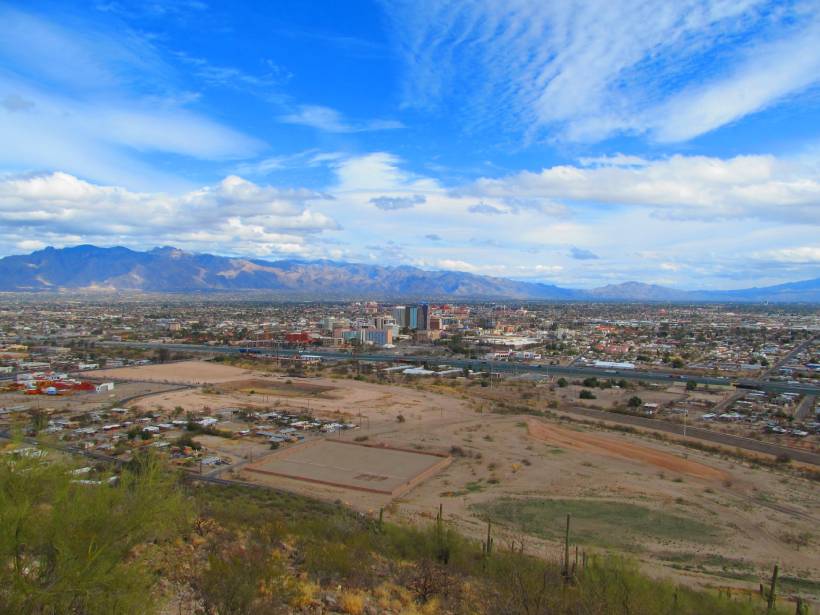
Parsing Routes to Aquifer Recharge Along Mountain Fronts
Research from the Tucson Basin indicates that tracers can be used to distinguish surface and subsurface recharge, providing crucial data to support sustainable water management in arid environments.
Posted inEditors' Vox
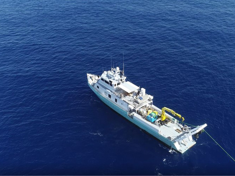
Freshened Groundwater in the Sub-seafloor
Scientists are using a variety of geochemical, geophysical, and numerical methods to study offshore freshened groundwater and better understand its role in the global water cycle.
Posted inEditors' Highlights
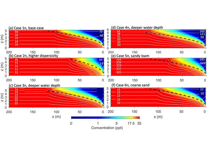
Evaporation Reverses Groundwater Flow and Forms Hyper-Salinity
A numerical model of groundwater-surface water systems shows how floodplain evaporation can reverse stream-groundwater flow and produce strong buoyancy changes associated with salinity.