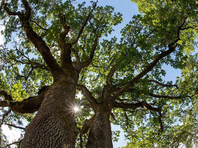
Oak trees in California seasonally tap moisture in unsaturated soil and weathered bedrock, even when the groundwater table is within reach of their roots.
groundwater

Posted inNews
Modeling Groundwater and Crop Production in the U.S. High Plains
Innovative new research by a team of international scholars borrows modeling methods from ecology and applies them to groundwater sustainability.

Posted inResearch Spotlights
¿Cómo Afecta el Reverdecimiento del Ártico al Agua Subterránea?
Nuevas investigaciones examinan cómo los cambios en la ecología de la superficie influyen en la hidrología subterránea en el Ártico.
Posted inNews
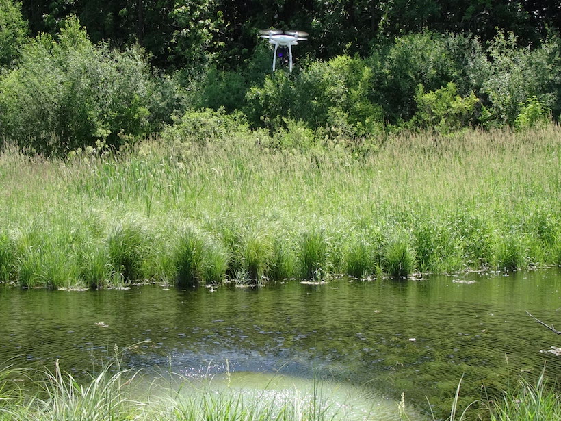
Taking an Aerial View Underground
Wisconsin geologists are testing using drones equipped with thermal cameras to measure shallow soil depths in areas prone to groundwater contamination.
Posted inNews
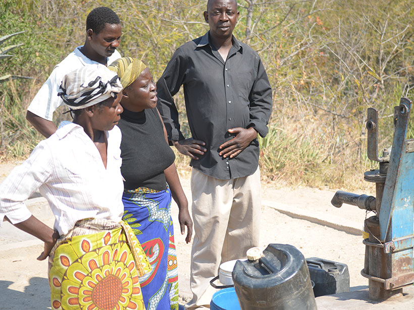
Groundwater Crisis in Zimbabwe Brought On by Droughts
Zimbabwe’s groundwater is disappearing fast, leaving rural communities without water for household and agricultural use.

Posted inEditors' Highlights
Machine Learning Predicts Subsidence from Groundwater Pumping
Machine learning and data on aquifer type, sediment thickness, and proxies for irrigation water use has been used to produce the most comprehensive map of land subsidence in the western U.S. to date.
Posted inEditors' Highlights
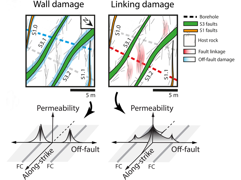
Fluctuating Fluid Flows in a Fractured Fault
Fault damage zones can focus fluid transport near faults.
Posted inEditors' Highlights
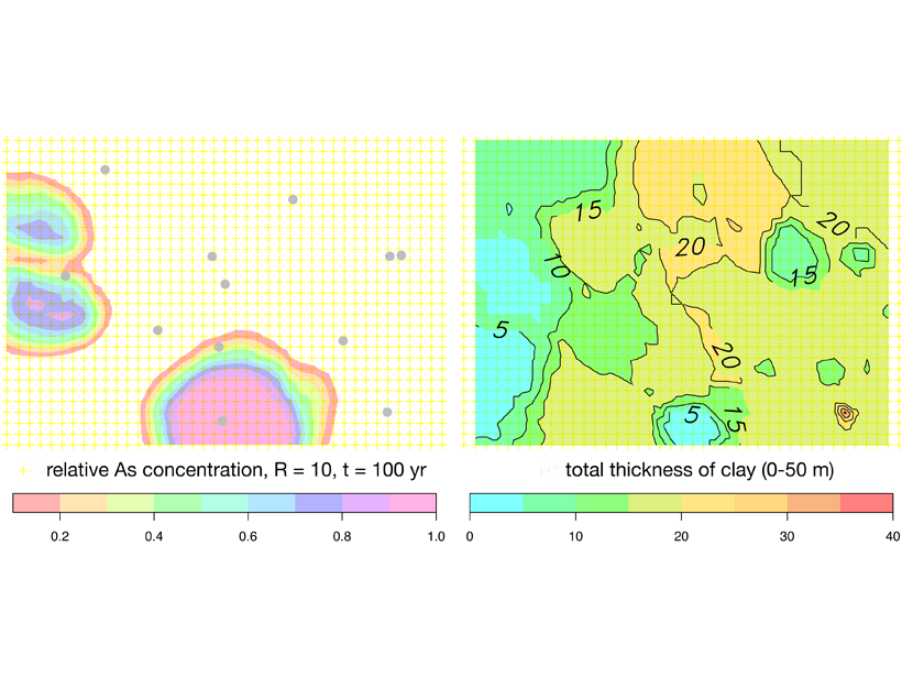
Arsenic Pollution in Bangladesh is Catching Up with Deeper Wells
Inhabitants of Bangladesh have deepened drinking water wells to avoid extracting arsenic-rich groundwater from shallow aquifers, but these may not be free from pollution either.

Posted inNews
El Agua Subterránea es la “Conexión Occulta” Entre la Tierra y el Océano
La importancia del agua subterránea dulce para los ecosistemas costeros es revelada utilizando el primer modelo numérico a escala global.

Posted inResearch Spotlights
How Does a Greening Arctic Affect Groundwater Recharge?
New research examines how shifts in aboveground ecology influence belowground hydrology in the Arctic.