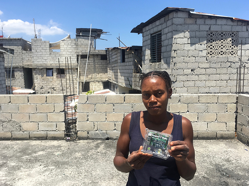
A network of “personal seismometers” is intended to complement Haiti’s national seismic network to engage and inform residents about earthquake hazards and preparation.
Hazards & Disasters
Posted inNews
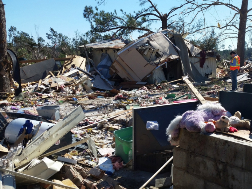
Tornado Warnings Don’t Adequately Prepare Mobile Home Residents
A survey of the southeastern United States shows that nearly half of mobile home residents don’t know where to shelter during a tornado, and many aren’t getting the resources they need to survive one.
Posted inResearch Spotlights
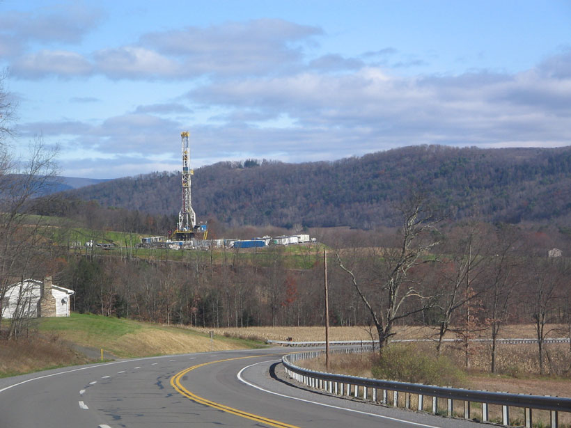
In Pennsylvania, Methane Emissions Higher Than EPA Estimates
Although methane emission estimates from underground coal production appear to be accurate, the calculated emissions from natural gas production are underreported.
Posted inNews
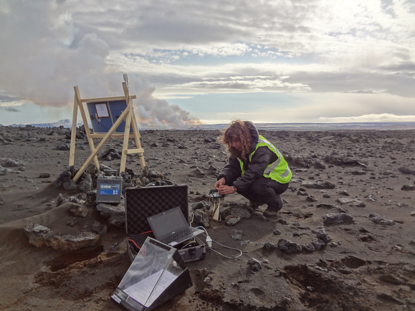
More Than 30,000 Earthquakes Trace the Movement of Magma
Seismometers near Iceland’s Bárðarbunga volcanic system pinpointed thousands of earthquakes in 2014–2015, revealing where molten rock was moving underground before any eruptions occurred.
Posted inNews
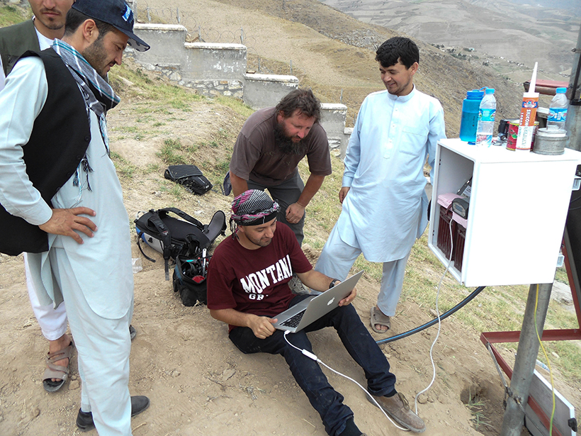
The Blob Causing Earthquakes
Geophysicists discover that a “blob” of rock sinking into the mantle is the force triggering earthquakes in the Hindu Kush.
Posted inResearch Spotlights
A New Look at Winter Air Quality in the Northeastern U.S.
Past studies underestimated a major pollution source, particularly in rural areas.
Posted inResearch Spotlights
A Look at How Long-Banned PCBs Persist in the Ocean
A new study tracks how climatic factors like sea ice cover and ocean circulation affect the life span and distribution of polychlorinated biphenyls in the world’s oceans.

Posted inEditors' Highlights
Enabling Dynamic, Regional-Scale Modelling of Outburst Floods
The GeoClaw model is used to simulate a landslide-dam outburst flood through rugged Himalayan topography.
Posted inResearch Spotlights
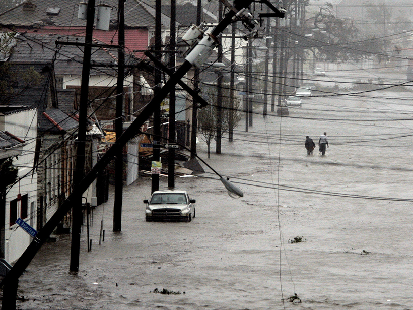
As Sea Levels Rise, Expect More Floods
A new study unveils the increasing exposure of coastal communities to minor and extreme floods as sea levels rise.
Posted inNews
Burning Fossil Fuels Worsens Drought
Tree rings help scientists trace the influence of greenhouse gas emissions on 20th-century drought conditions.