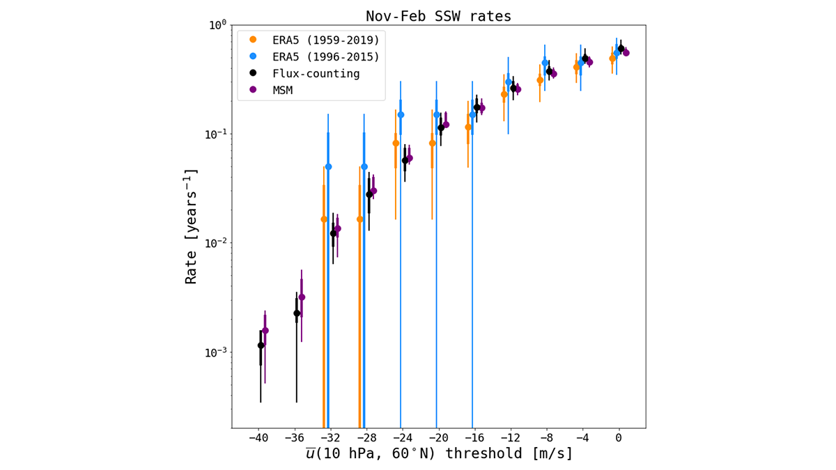
Subseasonal weather forecast ensembles are a useful tool for overcoming the inherent difficulty of quantifying extreme weather risk caused by data scarcity.
Hazards & Disasters
Posted inEditors' Highlights
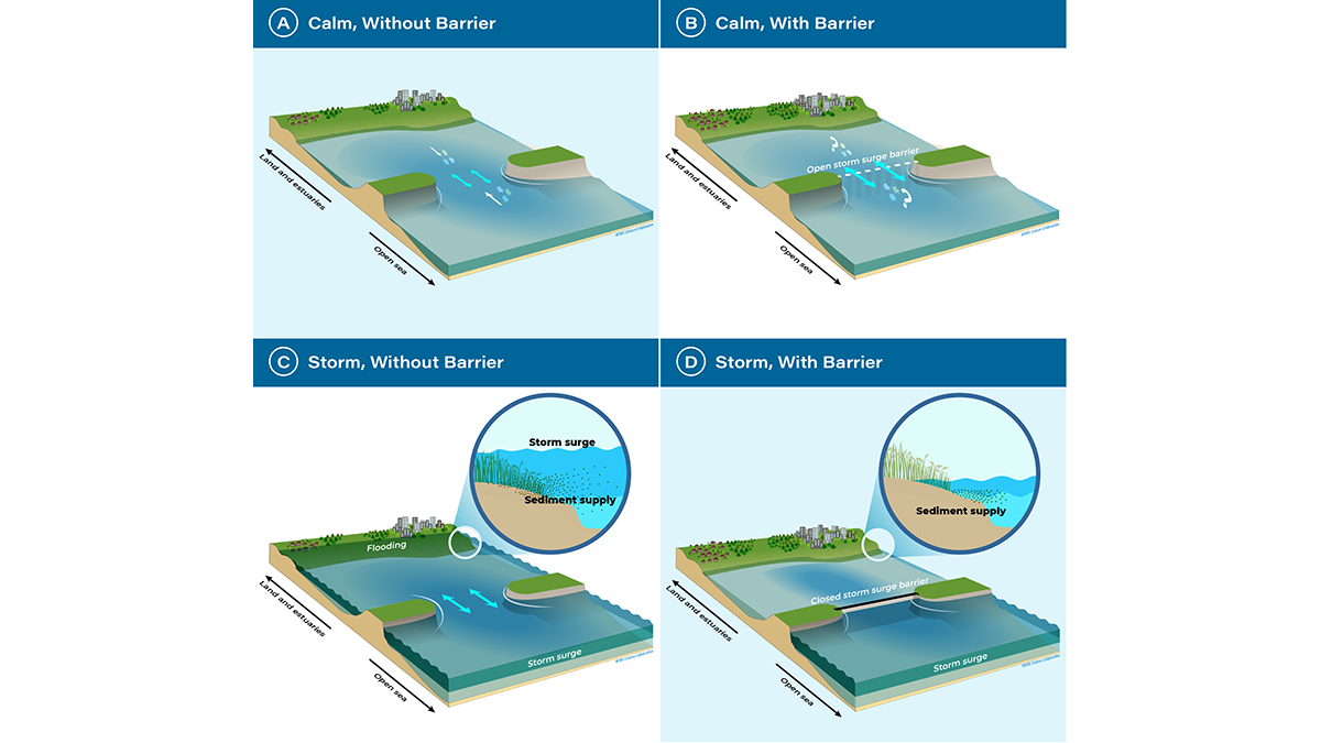
A Turning Point for Estuaries Worldwide
As estuarine barriers are built in response to sea level rise, flooding, and salinization, more research is needed to better understand their implications for human activities and ecosystems.

Posted inResearch Spotlights
How Space Storms Miscue Train Signals
Geomagnetic storms could significantly disrupt electrified train operations in the United Kingdom once every few decades, according to a new study.

Posted inNews
Back-to-Back Hurricanes Could Become Common by 2100
New research shows back-to-back hurricanes could strike the United States every few years by 2100.
Posted inEditors' Highlights
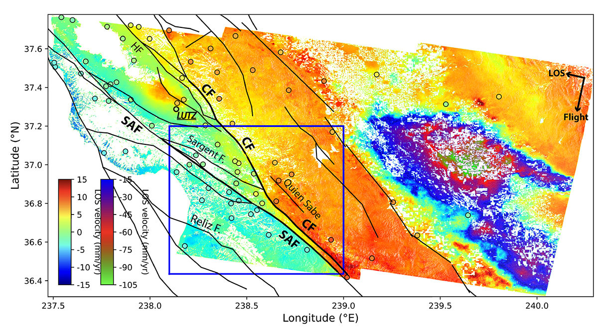
Radar Satellites Capture Subtle Slip Evolution on Faults
A five-year time series from radar satellite imagery tracks surface slip on major faults in the San Francisco Bay Area, capturing subtle velocity variations and controlling factors.

Posted inEditors' Vox
How Big Data is Helping Environmental and Climate Research
A new special collection invites papers focusing on the processing, modeling, and analysis of all types of big datasets in the Earth and space sciences, including the influence of solar forcing on Earth’s climate.

Posted inNews
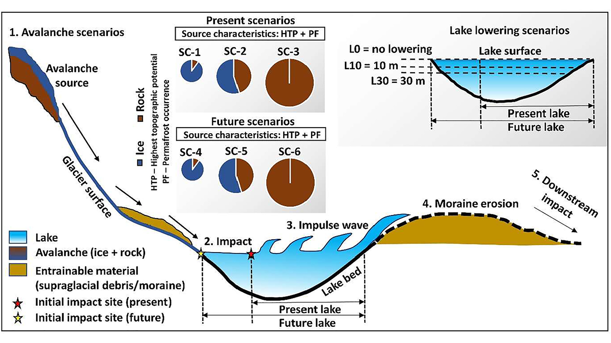
Glacial Lakes Can Unleash Deadly Deluges. How Risky Are They?
Breaches in glacial lake dams threaten millions around the world, and scientists are investigating how climate change might affect that risk.

Posted inResearch Spotlights
Scientists Just Measured a Debris Flow in Unprecedented Detail
This research team used a laser sensor originally designed for autonomous vehicles to track debris flow surges.
Posted inResearch Spotlights
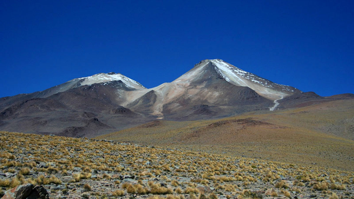
Mapping the Fizzy Brines and Fluid-Filled Fractures Below a Volcano
Seismic tools reveal where hydrothermal fluids lie beneath the Uturuncu volcano in Bolivia and hint at their composition.
Posted inEditors' Highlights
Artificial Lake-Level Lowering Alleviates Floods in the Himalayas
A new model combining future permafrost degradation and related avalanches demonstrates that artificial lake-lowering could significantly reduce the risk of glacial lake outburst floods.